Mount McKay, Sacred mountain summit in Thunder Bay, Canada
Mount McKay is a peak in Thunder Bay that rises distinctly above the surrounding landscape with sheer cliff faces on three sides. The summit is capped by a thick layer of dark igneous rock that protects the softer stone layers underneath, giving the mountain its characteristic blocky appearance.
Mount McKay is a mafic sill formed during magmatic activity linked to the Midcontinent Rift System about 1,100 million years ago. Its 60 m thick diabase cap, dated to 1115 ± 1 million years, protects the underlying shale and greywackes of the Rove Formation. Since 1933, a road has allowed access to a plateau on the mountain.
The Fort William First Nation calls the mountain Anemki Wajiw, or Thunder Mountain, and considers it sacred ground. Ojibwe tradition places the shrine of Nanabozho, the Great Spirit of the deep-sea waters, on the peak. A notice at the lookout asks visitors not to climb the mountain.
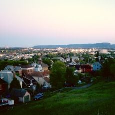
A road built in 1933 leads to a plateau on the lower eastern side, where a lookout at 300 m elevation faces Thunder Bay and its harbour. A billboard there asks visitors not to climb the mountain, which the Fort William First Nation considers sacred ground.
A second, 7.2 m thick sill of very hard diabase lies 96 m below the main cap, exposed on the north face. The lookout billboard asks visitors not to climb the mountain, as Anemki Wajiw is sacred ground for the Fort William First Nation.
The community of curious travelers
AroundUs brings together thousands of curated places, local tips, and hidden gems, enriched daily by 94,618 contributors worldwide.