Le Grammont, Mountain summit in Valais, Switzerland.
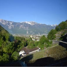
Le Grammont is a 2,172-metre pyramid-shaped summit in the Chablais Alps, in the Monthey district of Valais. Three ridges radiate from the top: one east-southeast past the Alamont (1,900 m), one east-northeast to the Croix de la Lé (1,872 m), and one west-southwest over Les Jumelles (2,215 m) and the Sé Villemod (2,030 m). Its limestone and siliceous ground supports Hieracium species and plants found nowhere else.
In 1306 the summit is recorded as "Grandis mons", suggesting it stood out as the great mountain of the massif. It is suspected to be the Tauredunum, the mountain whose collapse in 563 sent a tsunami across Lake Geneva. In 1906 a concession was filed for a 7,140 m rack railway from Saint-Gingolph to the summit, with 80 cm gauge and a 32% gradient; the project was abandoned after 1913.
The name derives from the 1306 form "Grandis mons", recorded when the peak stood out as the great mountain of the massif. Hikers today pass Lac de Taney on the southern approach from Miex, and the summit view takes in Lake Geneva, the Pennine Alps and the Vaud Alps.
The summit is reached on foot from the village of Miex via the Lac de Taney, a 7.8 km route taking about 4 hours. The path has no particular difficulty, though it is sometimes steep near the top.
On 13 July 1943 a British Royal Air Force aircraft crashed on the north-east slope above Le Bouveret at about 900 metres, killing seven; the Swiss army stated days later that its anti-aircraft defence had shot it down. The dead are buried in the English cemetery at Vevey. The English-language source names the pilot as Horace Badge and the aircraft as a Lancaster.
The community of curious travelers
AroundUs brings together thousands of curated places, local tips, and hidden gems, enriched daily by 94,132 contributors worldwide.