·

Enable Location

We need your location to show you interesting places around you

Discover nearby places

Find interesting locations and hidden gems around you

Precise directions

Get accurate directions and distances to places

Your location is never shared with other users. It's only used when you tap the location button.

Plattenberg

Log in to your account

Start exploring — it's free

Trusted by 62,724 travelers worldwide

Continue with Google
Continue with Apple
or

We will send you a code to connect

By continuing, you accept our Terms and Conditions and our Privacy Policy

Check your inbox

We've sent a pincode in your inbox. Please enter the code below.

Plattenberg

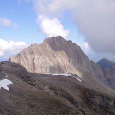
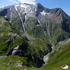
Plattenberg, Mountain summit in Lepontine Alps, Switzerland

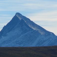
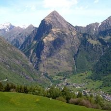
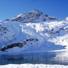
Plattenberg is a mountain summit in the Lepontine Alps that rises to 3,041 meters (9,977 feet) between Luzzone and Zervreila lakes. The peak marks the border between Ticino and Graubünden cantons and displays distinctive rock formations across its face.

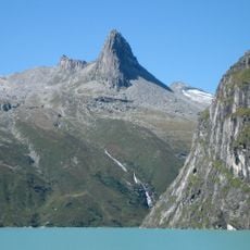
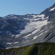
The mountain has drawn mountaineers since the early stages of Alpine exploration and has been climbed for generations. Its limestone formations have shaped its role in the history of Swiss climbing and alpine mountaineering.

Local climbing communities maintain detailed records of various ascent routes, contributing to the documentation of Swiss Alpine mountaineering practices.

Reaching this summit requires taking a Postbus to Innerthal near Wägitalersee and following established paths via Bockmattlipass and the east face of Schiberg. Proper mountaineering gear and alpine experience are essential for a safe ascent.

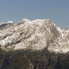
The large, south-facing rock slabs that give this peak its name stretch across the mountainside and offer climbing routes for different skill levels. These distinctive flat rocks make it a preferred destination for climbers seeking varied ascent options.

The community of curious travelers

AroundUs brings together thousands of curated places, local tips, and hidden gems, enriched daily by 60,000 contributors worldwide.

Start exploring
Location
Location
Elevation above the sea
3,041 m
GPS coordinates
46.55828,9.02326
Latest update
December 14, 2025 20:02
« Plattenberg - Mountain summit in Lepontine Alps, Switzerland » is provided by Around Us (aroundus.com). Images and texts are derived from Wikimedia project under a Creative Commons license. You are allowed to copy, distribute, and modify copies of this page, under the conditions set by the license, as long as this note is clearly visible.

Discover hidden gems everywhere you go!

From secret cafés to breathtaking viewpoints, skip the crowded tourist spots and find places that match your style. Our app makes it easy with voice search, smart filtering, route optimization, and insider tips from travelers worldwide. Download now for the complete mobile experience.

Around Us App Screenshot

A unique approach to discovering new places

Le Figaro

All the places worth exploring

France Info

A tailor-made excursion in just a few clicks

20 Minutes

Around Us
Travel Guide & Maps
Download

Send to your phone

QR Code
1

Open the camera app on your mobile.

2

Point at the QR code with your camera. A notification will appear.

3

Tap the notification to open the link.