·

Enable Location

We need your location to show you interesting places around you

Discover nearby places

Find interesting locations and hidden gems around you

Precise directions

Get accurate directions and distances to places

Your location is never shared with other users. It's only used when you tap the location button.

Zervreilasee

Log in to your account

Start exploring — it's free

Trusted by 62,726 travelers worldwide

Continue with Google
Continue with Apple
or

We will send you a code to connect

By continuing, you accept our Terms and Conditions and our Privacy Policy

Check your inbox

We've sent a pincode in your inbox. Please enter the code below.

Zervreilasee

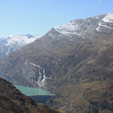
Zervreilasee, reservoir located south-west of Vals in the canton of Graubünden, Switzerland

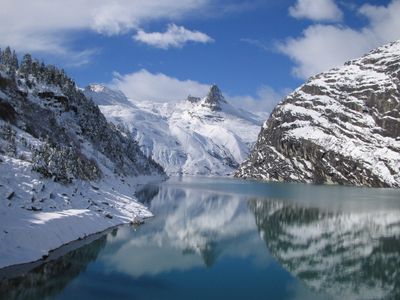
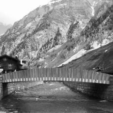
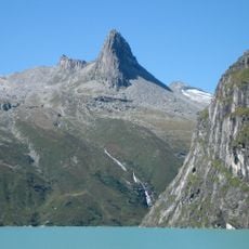
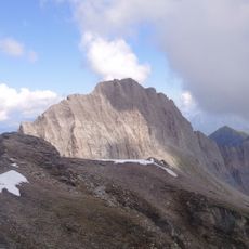
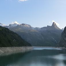
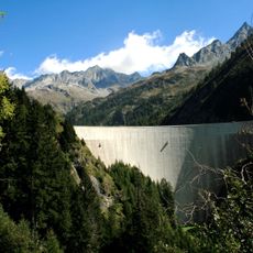
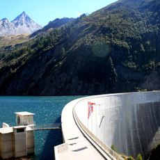
Zervreilasee is a reservoir in the Canton of the Grisons situated at approximately 1900 meters elevation in an alpine valley surrounded by steep cliffs and forests. The clear water fills the valley between high peaks and is held back by a 151-meter-high concrete dam at its lower end.

The lake was created in the 1960s through the construction of a dam that flooded the village of Zervreila, which had existed here for centuries. The storage facility was built to hold water for electricity generation and regional water supply.

The name Zervreilasee refers to the village of Zervreila that once stood here before the dam was built and now lies beneath the water. For local people, this reservoir represents the connection between their mountain heritage and the practical need to manage water resources in the region.

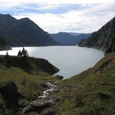
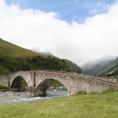
The lake is reachable from Vals by postal bus in about twenty minutes, and short paths from the parking area lead to the dam. A popular hiking route from Vals to the water takes about two and a half hours and passes through meadows and forests.

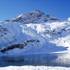
The lake serves as the starting point for an extended hiking circuit that connects all four lakes in the surrounding area - Zervreilasee, Guraletschsee, Ampervreilsee, and Selvasee - in a single tour lasting about six hours. This four-lake loop allows visitors to experience the full variety of the high alpine lake landscape in one outing.

The community of curious travelers

AroundUs brings together thousands of curated places, local tips, and hidden gems, enriched daily by 60,000 contributors worldwide.

Start exploring
GPS coordinates
46.56583,9.09778
Latest update
February 7, 2026 11:01
« Zervreilasee - reservoir located south-west of Vals in the canton of Graubünden, Switzerland » is provided by Around Us (aroundus.com). Images and texts are derived from Wikimedia project under a Creative Commons license. You are allowed to copy, distribute, and modify copies of this page, under the conditions set by the license, as long as this note is clearly visible.

Discover hidden gems everywhere you go!

From secret cafés to breathtaking viewpoints, skip the crowded tourist spots and find places that match your style. Our app makes it easy with voice search, smart filtering, route optimization, and insider tips from travelers worldwide. Download now for the complete mobile experience.

Around Us App Screenshot

A unique approach to discovering new places

Le Figaro

All the places worth exploring

France Info

A tailor-made excursion in just a few clicks

20 Minutes

Around Us
Travel Guide & Maps
Download

Send to your phone

QR Code
1

Open the camera app on your mobile.

2

Point at the QR code with your camera. A notification will appear.

3

Tap the notification to open the link.