Wellhorn, Mountain summit in the Bernese Alps, Bern, Switzerland
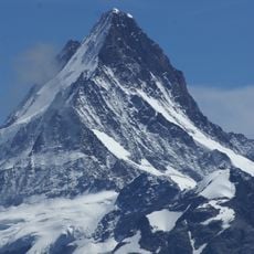
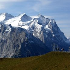
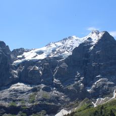
The Wellhorn is a 3191 m summit in the Bernese Alps, rising south of the Reichenbachtal and west of the Rosenlaui Glacier, which lies on its eastern side. About 1 km northeast of the main summit stands the Klein Wellhorn at 2701 m. The summit point is where the municipal areas of Meiringen, Grindelwald, Innertkirchen and Schattenhalb meet.
The first ascent of the Wellhorn was made on 31 July 1866 by Edmund von Fellenberg with the guides Christen Michel and Peter Egger, via the east ridge. The summit, at 3191 m, is where the municipal boundaries of Meiringen, Grindelwald, Innertkirchen and Schattenhalb meet.
The name Wellhorn refers to the mountain above Rosenlaui; the Klein Wellhorn (2701 m) stands about 1 km northeast of the main summit. The summit itself is a tripoint where the municipal areas of Meiringen, Grindelwald, Innertkirchen and Schattenhalb meet. The first ascent on 31 July 1866 by Edmund von Fellenberg with guides Christen Michel and Peter Egger went over the east ridge, a route climbers still follow.
The summit lies south of the Reichenbachtal and west of the Rosenlaui Glacier; the usual approach is from Rosenlaui via the east ridge, the line of the 1866 first ascent. The Klein Wellhorn (2701 m) stands about 1 km to the northeast. The summit is the tripoint of Meiringen, Grindelwald, Innertkirchen and Schattenhalb.
The summit is a tripoint where the municipal areas of Meiringen, Grindelwald, Innertkirchen and Schattenhalb meet. About 1 km to the northeast stands the Klein Wellhorn (2701 m), a separate lower summit. The first ascent on 31 July 1866 went over the east ridge.
The community of curious travelers
AroundUs brings together thousands of curated places, local tips, and hidden gems, enriched daily by 93,783 contributors worldwide.