Enable Location

We need your location to show you interesting places around you

Discover nearby places

Find interesting locations and hidden gems around you

Precise directions

Get accurate directions and distances to places

Your location is never shared with other users. It's only used when you tap the location button.

Bundesautobahn 9

Log in to your account

Start exploring — it's free

Trusted by 62,314 travelers worldwide

Continue with Google
Continue with Apple
or

We will send you a code to connect

By continuing, you accept our Terms and Conditions and our Privacy Policy

Check your inbox

We've sent a pincode in your inbox. Please enter the code below.

Bundesautobahn 9

Bundesautobahn 9, Federal highway in central Germany

Bundesautobahn 9 is a major highway running roughly 530 kilometers from Berlin in the north to Munich in the south, passing through five federal states. The route crosses Brandenburg, Saxony-Anhalt, Saxony, Thuringia, and Bavaria, linking cities such as Leipzig, Halle, and Nuremberg along the way.

Construction began in the late 1930s as part of the Reichsautobahn program and was rebuilt over subsequent decades after wartime damage. The highway served during Germany's division as one of the main links between West Berlin and the West German road network.

The highway connects major German cultural centers, linking the capital Berlin with Munich through Leipzig and Nuremberg.

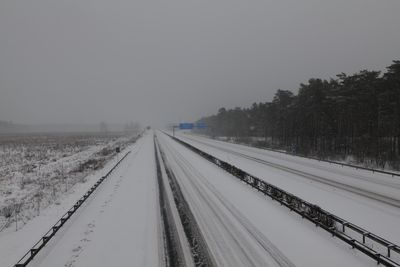
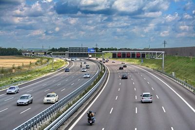
Service areas along the route offer fuel stations, snack bars, and parking for breaks during the journey. The highway is fully accessible for heavy trucks and passenger vehicles, though speed limits may vary depending on the section.

The route crosses the Elbe near Vockerode on a bridge that was rebuilt after the war and represented one of the first major reconstructions on the highway. The original structure from 1938 had been heavily damaged during the fighting.

The community of curious travelers

AroundUs brings together thousands of curated places, local tips, and hidden gems, enriched daily by 60,000 contributors worldwide.

Start exploring
Location
Location
Location
Location
Location
GPS coordinates
50.40530,11.77360
Latest update
December 13, 2025 17:20
Around this place
Baumkronenpfad Beelitz-Heilstätten
Germany

Baumkronenpfad Beelitz-Heilstätten

221.7 km
Anstaltskirche
Germany

Anstaltskirche

221.6 km
Wietkikenberg
Germany

Wietkikenberg

227 km
Church in Kanin
Germany

Church in Kanin

222.3 km
Stadtpfarrkirche St. Marien
Germany

Stadtpfarrkirche St. Marien

220 km
Lienewitz
Germany

Lienewitz

228 km
Lienewitz-Caputher Seen- und Feuchtgebietskette
Germany

Lienewitz-Caputher Seen- und Feuchtgebietskette

229.3 km
Jüdischer Friedhof Beelitz
Germany

Jüdischer Friedhof Beelitz

220.3 km
Seddin church
Germany

Seddin church

225 km
War memorial Kammerode
Germany

War memorial Kammerode

227.5 km
Kunersdorf Försterei
Germany

Kunersdorf Försterei

225.3 km
Kemnitzer Heide
Germany

Kemnitzer Heide

226.5 km
Dorfkirche (Reesdorf)
Germany

Dorfkirche (Reesdorf)

217.2 km
Aussichtsturm Wietkiekenberg
Germany

Aussichtsturm Wietkiekenberg

227 km
Ferch church
Germany

Ferch church

226.8 km
Freibad Wasserturmpark
Germany

Freibad Wasserturmpark

220.3 km
Posthalterei
Germany

Posthalterei

219.9 km
Alte Posthalterei - Museum Beelitz
Germany

Alte Posthalterei - Museum Beelitz

220 km
Naturdenkmal Eiche Klaistow, Grundstück zw. Landstraße und Weg nach Borkwalde, wenig westlich Abzweig nach Lehnin in Busendorf
Germany

Naturdenkmal Eiche Klaistow, Grundstück zw. Landstraße und Weg nach Borkwalde, wenig westlich Abzweig nach Lehnin in Busendorf

222.6 km
Beelitz-Heilstätten Hospital
Germany

Beelitz-Heilstätten Hospital

221.8 km
Naturdenkmal Eichen fast unmittelbar nördlich des Großen Lienewitzsee (am Badestrand) in Michendorf
Germany

Naturdenkmal Eichen fast unmittelbar nördlich des Großen Lienewitzsee (am Badestrand) in Michendorf

228.7 km
Naturdenkmal Silberahorn Karl-Liebknechtstraße (Ecke Clara-Zetkin-Straße) in Beelitz
Germany

Naturdenkmal Silberahorn Karl-Liebknechtstraße (Ecke Clara-Zetkin-Straße) in Beelitz

220.2 km
Hans-Grade-Museum
Germany

Hans-Grade-Museum

216.6 km
Naturdenkmal Eichen nördlich Seddiner See an Heimkreisvolkshochschule (ehem. Revierförsterei), östlich Straßenabzweig B2 nach Ferch in Neuseddin
Germany

Naturdenkmal Eichen nördlich Seddiner See an Heimkreisvolkshochschule (ehem. Revierförsterei), östlich Straßenabzweig B2 nach Ferch in Neuseddin

225.5 km
Naturdenkmal Baumbestand Kirchhof Kirchhof Seddin in Seddin
Germany

Naturdenkmal Baumbestand Kirchhof Kirchhof Seddin in Seddin

225 km
Naturdenkmal Eiche Westufer Kleiner Lienewitzsee in Michendorf
Germany

Naturdenkmal Eiche Westufer Kleiner Lienewitzsee in Michendorf

227.9 km
FRIDA – öffentlicher Büchertausch
Germany

FRIDA – öffentlicher Büchertausch

218.5 km
ND 016-01 Eiche in Beelitz
Germany

ND 016-01 Eiche in Beelitz

220 km
Show the full map
« Bundesautobahn 9 - Federal highway in central Germany » is provided by Around Us (aroundus.com). Images and texts are derived from Wikimedia project under a Creative Commons license. You are allowed to copy, distribute, and modify copies of this page, under the conditions set by the license, as long as this note is clearly visible.

Discover hidden gems everywhere you go!

From secret cafés to breathtaking viewpoints, skip the crowded tourist spots and find places that match your style. Our app makes it easy with voice search, smart filtering, route optimization, and insider tips from travelers worldwide. Download now for the complete mobile experience.

Around Us App Screenshot

A unique approach to discovering new places

Le Figaro

All the places worth exploring

France Info

A tailor-made excursion in just a few clicks

20 Minutes

Around Us
Travel Guide & Maps
Download

Send to your phone

QR Code
1

Open the camera app on your mobile.

2

Point at the QR code with your camera. A notification will appear.

3

Tap the notification to open the link.