Chest opened
+${chestReward.xp} XP
Explorer
NOUVEAU ×${chestReward.collectible.quantity}
tapez pour fermer

See the monuments around you in AR Open chests in the app

Around Us is built for your phone — point your camera at the streets and discover the monuments and places around you in augmented reality. Around Us is built for your phone — chests unlock when you walk, explore and capture nearby places.

•

Enable Location

We need your location to show you interesting places around you

Discover nearby places

Find interesting locations and hidden gems around you

Precise directions

Get accurate directions and distances to places

Your location is never shared with other users. It's only used when you tap the location button.

Ahlen-Falkenberger Moor, Halemer/Dahlemer See

Log in to your account

Start exploring — it's free

Trusted by 94,420 travelers worldwide

Continue with Google
Continue with Apple
or

We will send you a code to connect

By continuing, you accept our Terms and Conditions and our Privacy Policy

Check your inbox

We've sent a pincode in your inbox. Please enter the code below.

Ahlen-Falkenberger Moor, Halemer/Dahlemer See

Ahlen-Falkenberger Moor, Halemer/Dahlemer See, Nature reserve and wetland ecosystem in Lower Saxony, Germany

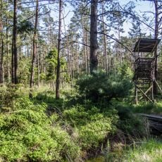
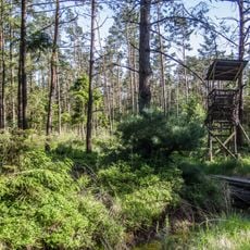
The Ahlen-Falkenberger Moor, Halemer/Dahlemer See is a 40-square-kilometre high moor in the district of Cuxhaven, the largest in the district and among the largest in Lower Saxony. It lies between sandy geest ridges, with the shallow Dahlemer and Halemer lakes covering about 190 hectares, bordered by reed beds and willow scrub. The Dahlemer See has a one-metre steep edge on its eastern shore where it advances into the moor, while its western shore silts up.

Peat cutting by hand began by the 17th century from the moor-edge settlements of Wanna-Süderleda, Ihlienworth-Westerende, Medemstade and Steinau, at only three to five metres a year. Cultivation started during the First World War, using Russian prisoners of war; drainage and fertiliser followed in the 1950s for farmers resettled from Germany's eastern territories. Industrial peat extraction for potting compost began in 1956, and a strip of the Dahlemer See shore was protected as early as 1932.

The name Ahlenmoor combines the villages of Ahlen and Falkenberg with "Moor", the German word for bog. Along the northern and eastern edges, a chain of small peat pits, called Moorkuhlen, marks where farmers cut turf by hand from the 17th century onward, at only three to five metres a year. The cut strips were gradually turned into farmland, and the dried peat was burned as fuel.

The reserve is accessible on foot via marked trails designed to protect the sensitive environment as you walk. Spring and summer offer the best conditions to see wildlife and plants in active growth and movement.

The Dahlemer See shifts with the wind: its eastern bank forms a steep edge about one metre high where the lake pushes into the moor, while the western shore silts up. Boats are banned on both lakes all year, and in winter waterbirds use them as resting grounds.

The community of curious travelers

AroundUs brings together thousands of curated places, local tips, and hidden gems, enriched daily by 94,420 contributors worldwide.

Start exploring
Location
Location
Location
Inception
2011
GPS coordinates
53.68330,8.79167
Latest update
October 26, 2026 01:46
Reviews
Share your experience

No review yet

Discussions
Start a discussion...

No discussion yet

« Ahlen-Falkenberger Moor, Halemer/Dahlemer See - Nature reserve and wetland ecosystem in Lower Saxony, Germany » is provided by Around Us (aroundus.com). Images and texts are derived from Wikimedia project under a Creative Commons license. You are allowed to copy, distribute, and modify copies of this page, under the conditions set by the license, as long as this note is clearly visible.

Discover hidden gems everywhere you go!

From secret cafés to breathtaking viewpoints, skip the crowded tourist spots and find places that match your style. Our app makes it easy with voice search, smart filtering, route optimization, and insider tips from travelers worldwide. Download now for the complete mobile experience.
Around Us App Screenshot
❝

A unique approach to discovering new places❞

— Le Figaro

❝

All the places worth exploring❞

— France Info

❝

A tailor-made excursion in just a few clicks❞

— 20 Minutes

Around Us
Travel Guide & Maps
Download

Send to your phone

QR Code
1

Open the camera app on your mobile.

2

Point at the QR code with your camera. A notification will appear.

3

Tap the notification to open the link.