Enable Location

We need your location to show you interesting places around you

Discover nearby places

Find interesting locations and hidden gems around you

Precise directions

Get accurate directions and distances to places

Your location is never shared with other users. It's only used when you tap the location button.

Hinterreintalschrofen

Log in to your account

Start exploring — it's free

Trusted by 62,179 travelers worldwide

Continue with Google
Continue with Apple
or

We will send you a code to connect

By continuing, you accept our Terms and Conditions and our Privacy Policy

Check your inbox

We've sent a pincode in your inbox. Please enter the code below.

Hinterreintalschrofen

Hinterreintalschrofen, Alpine summit in Bavaria, Germany

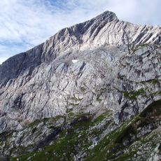
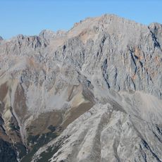
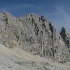
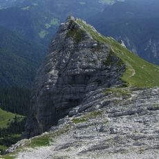
Hinterreintalschrofen rises to 2,669 meters in the Wetterstein Mountains and forms part of the east-west oriented Teufelsgrat ridge in the Eastern Alps. The peak consists of distinctive rock formations and steep slopes that give this mountain region its distinctive character.

The first documented climb occurred on September 1, 1871, when Freiherr Hermann von Barth reached the summit. This ascent marked the beginning of mountaineering exploration in this part of the high Alps.

The summit marks a natural border between Bavaria and Tyrol, embodying centuries of Alpine traditions shared between German and Austrian mountain communities.

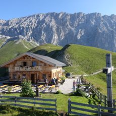
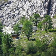
Climbers access the mountain from Rotmoosalm at 1,810 meters and follow a route through rock gullies and scree slopes. This path demands basic climbing skills and secure footing on exposed terrain.

The north face forms a massive rock wall that drops into Reintal valley, serving as one of the most striking features of this mountain chain. This vertical rock flank is visible from many vantage points in the valley below and shapes how the entire region appears.

The community of curious travelers

AroundUs brings together thousands of curated places, local tips, and hidden gems, enriched daily by 60,000 contributors worldwide.

Start exploring
Location
Elevation above the sea
2,669 m
GPS coordinates
47.39611,11.07583
Latest update
December 14, 2025 20:03
« Hinterreintalschrofen - Alpine summit in Bavaria, Germany » is provided by Around Us (aroundus.com). Images and texts are derived from Wikimedia project under a Creative Commons license. You are allowed to copy, distribute, and modify copies of this page, under the conditions set by the license, as long as this note is clearly visible.

Discover hidden gems everywhere you go!

From secret cafés to breathtaking viewpoints, skip the crowded tourist spots and find places that match your style. Our app makes it easy with voice search, smart filtering, route optimization, and insider tips from travelers worldwide. Download now for the complete mobile experience.

Around Us App Screenshot

A unique approach to discovering new places

Le Figaro

All the places worth exploring

France Info

A tailor-made excursion in just a few clicks

20 Minutes

Around Us
Travel Guide & Maps
Download

Send to your phone

QR Code
1

Open the camera app on your mobile.

2

Point at the QR code with your camera. A notification will appear.

3

Tap the notification to open the link.