
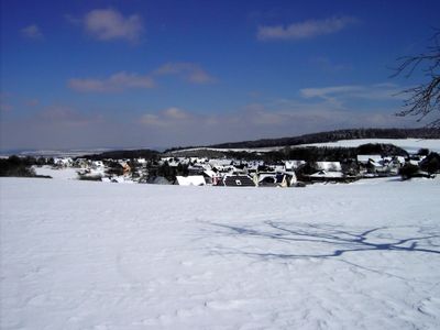
Wiebelsheim, municipality of Germany
Location: Rhein-Hunsrück-Kreis
Elevation above the sea: 440 m
Shares border with: Damscheid, Laudert
Website: http://wiebelsheim.de
GPS coordinates: 50.07667,7.63500
Latest update: March 21, 2025 05:40
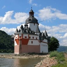
Pfalzgrafenstein Castle
9.4 km
Schönburg
7.5 km
Schönburg
7.5 km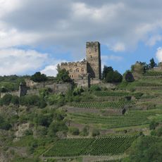
Gutenfels Castle
9.4 km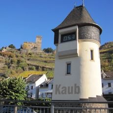
Pegel Kaub
9.3 km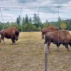
Tierpark Rheinböllen
5.4 km
Liebfrauenkirche Oberwesel
7.5 km
Stahlberg Castle
7.7 km
Wilhelm-Erbstollen
9.5 km
St. Martins-Kirche
7.2 km
Oberwesel station
7.9 km
Burg Herzogenstein
8.6 km
Blüchermuseum Kaub
9.3 km
Schwedenschanze
8.6 km
Landwehr
4 km
St. Anna (Bacharach-Steeg)
8.3 km
Spitzestein
7.2 km
Alte Burg
2.7 km
Dudenrother Schanze
7.2 km
Evangelische Kirche (Oberwesel)
7.3 km
Jüdischer Friedhof
6.6 km
Struth
3.1 km
Rheinhänge von Burg Gutenfels bis zur Loreley
9.1 km
Hotel-Restaurant Birkenhof
8.5 km
Holzbach
9.1 km
Synagoge (Oberwesel)
7.4 km
Saint Quentin Church
9.1 km
Rheingebiet von Bingen bis Koblenz
5.9 kmVisited this place? Tap the stars to rate it and share your experience / photos with the community! Try now! You can cancel it anytime.
Discover hidden gems everywhere you go!
From secret cafés to breathtaking viewpoints, skip the crowded tourist spots and find places that match your style. Our app makes it easy with voice search, smart filtering, route optimization, and insider tips from travelers worldwide. Download now for the complete mobile experience.

A unique approach to discovering new places❞
— Le Figaro
All the places worth exploring❞
— France Info
A tailor-made excursion in just a few clicks❞
— 20 Minutes