Chest opened
+${chestReward.xp} XP
Explorer
NOUVEAU ×${chestReward.collectible.quantity}
tapez pour fermer
Chest locked

Open chests in the app

Around Us is built for your phone — chests unlock when you walk, explore and capture nearby places.

Enable Location

We need your location to show you interesting places around you

Discover nearby places

Find interesting locations and hidden gems around you

Precise directions

Get accurate directions and distances to places

Your location is never shared with other users. It's only used when you tap the location button.

Allier

Log in to your account

Start exploring — it's free

Trusted by 72,889 travelers worldwide

Continue with Google
Continue with Apple
or

We will send you a code to connect

By continuing, you accept our Terms and Conditions and our Privacy Policy

Check your inbox

We've sent a pincode in your inbox. Please enter the code below.

Discussion Reviews 1 Photos
132k Popularity

Allier, River in central France

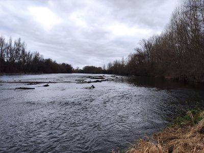
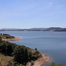
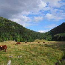
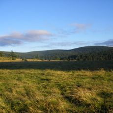
The Allier is a 421 kilometer waterway in central France that flows north from the Massif Central and joins the Loire near Nevers. Its course crosses mountain valleys, rolling hills, and flat basins with gravel zones and tree-lined banks.

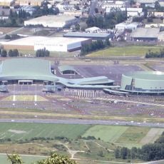
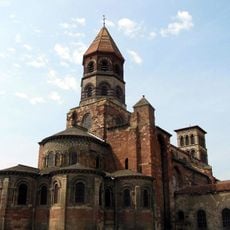
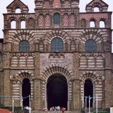
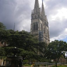
The Romans called this waterway Elaver and founded settlements along it that grew into towns such as Vichy and Moulins. Over centuries the water shaped the landscape and supplied surrounding areas with resources for daily life.

People along its banks have fished for grayling and other freshwater species for generations, especially between Langogne and Brioude. This practice connects local families with the water and its natural resources.

The water flows shallow and calm in some places, while other stretches form rapids and gravel zones suitable for canoeing. Some sections are visible from roads and railways, while others require walking or boat access.

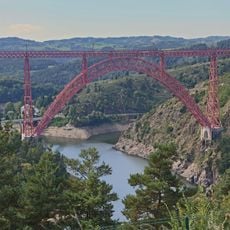
The Gorges de Haut Allier section shows steep rock walls and bends crossed by a railway line running over several viaducts. These stone and metal structures carry trains across deep valleys and offer views into remote parts of the valley.

The community of curious travelers

AroundUs brings together thousands of curated places, local tips, and hidden gems, enriched daily by 60,000 contributors worldwide.

Start exploring
Location
Elevation above the sea
658 m
Shares border with
Aubazat, Chanteuges, Chazelles, Ferrussac, Mazeyrat-d'Allier, Pébrac, Pinols, Saint-Arcons-d'Allier, Tailhac
Address
Allier River, France
Phone
GPS coordinates
46.95944,3.07889
Latest update
December 16, 2025 08:30
Reviews
Share your experience

No review yet

Discussions
Start a discussion...

No discussion yet

« Allier - River in central France » is provided by Around Us (aroundus.com). Images and texts are derived from Wikimedia project under a Creative Commons license. You are allowed to copy, distribute, and modify copies of this page, under the conditions set by the license, as long as this note is clearly visible.

Discover hidden gems everywhere you go!

From secret cafés to breathtaking viewpoints, skip the crowded tourist spots and find places that match your style. Our app makes it easy with voice search, smart filtering, route optimization, and insider tips from travelers worldwide. Download now for the complete mobile experience.

Around Us App Screenshot

A unique approach to discovering new places

Le Figaro

All the places worth exploring

France Info

A tailor-made excursion in just a few clicks

20 Minutes

Around Us
Travel Guide & Maps
Download

Send to your phone

QR Code
1

Open the camera app on your mobile.

2

Point at the QR code with your camera. A notification will appear.

3

Tap the notification to open the link.