Enable Location

We need your location to show you interesting places around you

Discover nearby places

Find interesting locations and hidden gems around you

Precise directions

Get accurate directions and distances to places

Your location is never shared with other users. It's only used when you tap the location button.

Nanterre

Log in to your account

Start exploring — it's free

Trusted by 62,828 travelers worldwide

Continue with Google
Continue with Apple
or

We will send you a code to connect

By continuing, you accept our Terms and Conditions and our Privacy Policy

Check your inbox

We've sent a pincode in your inbox. Please enter the code below.

Nanterre, Administrative center in western Paris suburbs, France

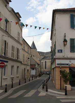
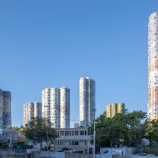
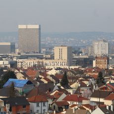
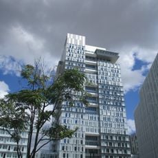
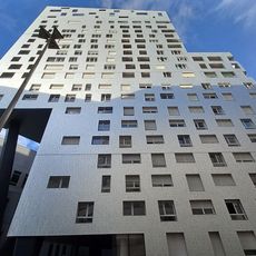
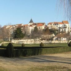
Nanterre is a commune in the western suburban area of Paris, home to parts of the La Défense business district with its office towers and corporate headquarters. The city spreads along the Seine, connecting denser built-up quarters with green spaces and university buildings.

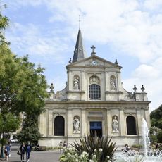
The settlement began as Nemetodorum during Roman rule, evolving from a Celtic shrine into a key administrative center. In the 20th century the city transformed through the expansion of Parisian suburbs and the arrival of major corporations in the La Défense area.

The name comes from the Celtic Nemeto-duron, meaning sacred enclosure, a reminder of its pre-Roman past. Today the city serves as the seat of the Hauts-de-Seine prefecture, with administrative offices standing beside modern residential neighborhoods.

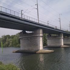
Three RER A stations—Nanterre-Préfecture, Nanterre-Université, and Nanterre-Ville—offer direct connections to central Paris and surrounding areas. Pedestrians and cyclists find paths along the Seine that link different parts of the city.

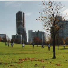
The Paris Nanterre University campus served as the starting point for the May 1968 student protests that later swept across France. This campus remains a lively hub for thousands of students studying humanities and social sciences.

The community of curious travelers

AroundUs brings together thousands of curated places, local tips, and hidden gems, enriched daily by 60,000 contributors worldwide.

Start exploring
Location
Location
Elevation above the sea
42 m
Shares border with
Rueil-Malmaison, Chatou, Carrières-sur-Seine, Bezons, Colombes, La Garenne-Colombes, Courbevoie, Puteaux, Suresnes
Address
92000 Nanterre, France
Phone
GPS coordinates
48.89056,2.20361
Latest update
December 15, 2025 00:33
They are part of the 50 most populated communes in France

From Paris to La Réunion, these 50 French cities hold the energy of the country and each show a different side of modern France.

« Nanterre - Administrative center in western Paris suburbs, France » is provided by Around Us (aroundus.com). Images and texts are derived from Wikimedia project under a Creative Commons license. You are allowed to copy, distribute, and modify copies of this page, under the conditions set by the license, as long as this note is clearly visible.

Discover hidden gems everywhere you go!

From secret cafés to breathtaking viewpoints, skip the crowded tourist spots and find places that match your style. Our app makes it easy with voice search, smart filtering, route optimization, and insider tips from travelers worldwide. Download now for the complete mobile experience.

Around Us App Screenshot

A unique approach to discovering new places

Le Figaro

All the places worth exploring

France Info

A tailor-made excursion in just a few clicks

20 Minutes

Around Us
Travel Guide & Maps
Download

Send to your phone

QR Code
1

Open the camera app on your mobile.

2

Point at the QR code with your camera. A notification will appear.

3

Tap the notification to open the link.