
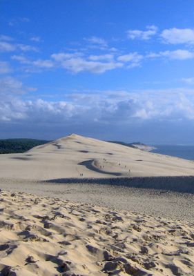
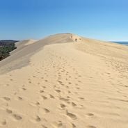
Dune of Pilat, Sand dune in La Teste-de-Buch, France
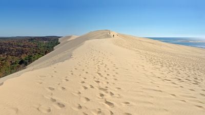
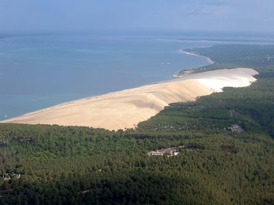
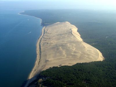
The Dune of Pilat extends 2.7 kilometers along the Atlantic coast, reaching a height of 106.6 meters and covering an area of 1.35 square kilometers.
Archaeological excavations at the dune's base in 2013 led to the discovery of burial urns and artifacts dating back to 800 BC, indicating ancient human presence.
The name Pilat derives from the Gascon word 'Pilhar', meaning heap or mound, reflecting the local linguistic heritage of the Gironde region.
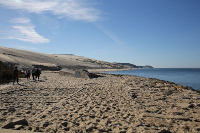
The dune welcomes over two million visitors annually, with regulations prohibiting activities such as camping, fires, and motorized vehicles to protect the natural environment.
Winter storms with winds reaching 175 kilometers per hour have caused substantial changes to the dune's structure, demonstrating its constant transformation.
Location: La Teste-de-Buch
Inception: 1998
Elevation above the sea: 106.6 m
Made from material: sand
Address: Dune of Pilat, France 33260 La Teste-de-Buch
Website: http://ladunedupilat.com
GPS coordinates: 44.59776,-1.20655
Latest update: October 24, 2025 17:38
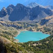
France features a notable variety of protected natural areas, showcasing the country’s geological and ecological richness. From Lake Allos in the Alpes-de-Haute-Provence to the underground rivers of Padirac in Dordogne, from the mountain ranges of Savoy to the limestone formations of the Ardèche gorges, each region displays landscapes shaped over millennia of natural evolution. This collection gathers sites where nature is expressed freely: primary forests, karst systems, high-altitude lakes, moving dunes of the Atlantic coast, and rock formations carved by erosion. These areas provide diverse ecosystems, home to species adapted to different environments, from Alpine flora and fauna to dune communities and underground cave biodiversity. Each natural site in this selection serves as an open-air laboratory where geological processes, ecosystem dynamics, and living adaptation to local conditions can be observed. These sites invite discovery of authentic landscapes, removed from human impact, where geological time is evident in every rock formation and glacier valley.
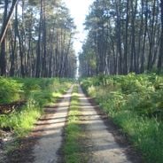
The Landes region features natural parks, medieval churches, castles, and coastal areas. The territory includes pine forests, lakes, and nature reserves with diverse flora and fauna. The historical buildings display Romanesque and Gothic architecture from different centuries.
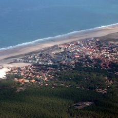
The Bassin d'Arcachon covers 155 square kilometers along the French Atlantic coast and offers numerous subjects for photography. The Dune du Pilat rises 110 meters above sea level and forms the tallest sand dune in Europe. Oyster farming villages such as Gujan-Mestras, L'Herbe, and Le Canon display wooden huts on stilts distributed along the shores. The Cap Ferret peninsula separates the basin from the Atlantic and presents long sandy beaches on both sides. The Cap Ferret lighthouse from 1947 reaches a height of 53 meters. The Île aux Oiseaux sits in the center of the basin and hosts two traditional stilt cabins, the Cabanes Tchanquées, which are surrounded by water at high tide. The town of Arcachon displays 19th-century villas in the Ville d'Hiver, a district with over 300 buildings in Belle Époque style. The Domaine de Certes et Graveyron nature reserve includes former salt marshes and fish ponds now inhabited by herons, spoonbills, and other water birds. The beaches of Pereire and Pyla-sur-Mer provide direct views of the basin and nearby pine forests.
Côte d'Argent
3.8 km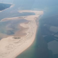
Banc d'Arguin Natural Reserve
3.2 km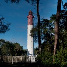
Cap-Ferret lighthouse
6.3 km
Église Notre-Dame-des-Passes d'Arcachon
4.9 km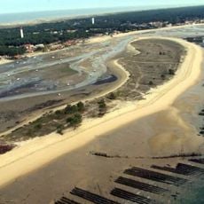
Mimbeau beach
6.2 km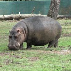
Zoo du Bassin d'Arcachon
5.7 km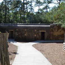
Blockhaus du phare du Cap Ferret
6.4 km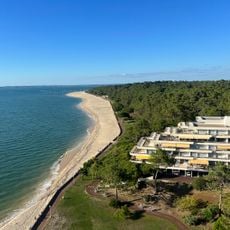
Plage des Arbousiers
5.4 km
Pyla Camping
2.3 km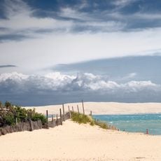
Pointe du Cap Ferret
4.2 km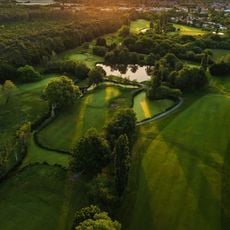
Golf d'Arcachon
5.8 km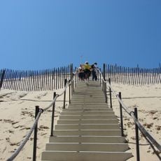
Escaliers de la corniche
154 m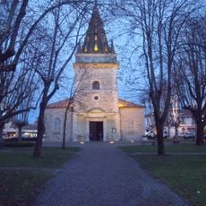
Église Saint-Vincent de La Teste-de-Buch
5.9 km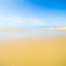
Plage de la Pointe aux Chevaux
4.5 km
Église Saint-Louis des Abatilles
5.8 km
Plage du petit Nice
5.3 km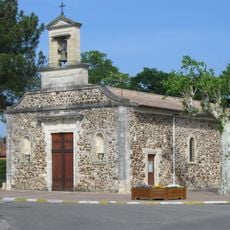
Église Saint-Pierre-ès-Liens de Cazaux
7.9 km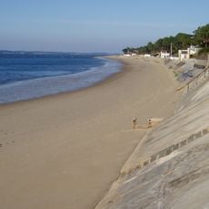
Plage de la Corniche
582 m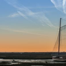
Plage de la Lagune
6.7 km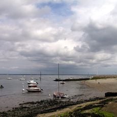
Plage des Abatilles
6.2 km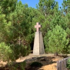
Croix des Marins
4.4 km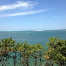
La Corniche
575 m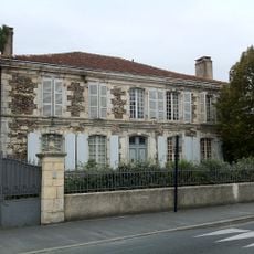
Hôtel de Baleste
6.3 km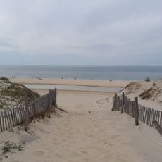
Plage de la Lagune
6.4 km
Manège du Moulleau
4.9 km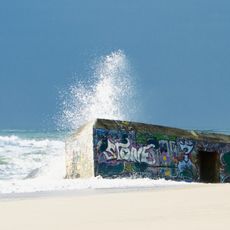
Bunker Vault d'Arthur
6.3 km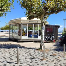
Cap Carmmel
6.7 km
Reviews
Real people, real opinions — but not verified.
Visited this place? Tap the stars to rate it and share your experience / photos with the community! Try now! You can cancel it anytime.

Is it a peak? Is it a rock? No, it is a dune! It is even the highest in Europe at 102 meters tall (this varies from year to year). It moves approximately 1 to 5 meters inland each year, gradually engulfing the forest behind it. Interestingly, excavations have revealed the presence of a Roman camp under the dune!

It goes up, it goes up, but it's worth it!
Is it a peak? Is it a rock? No, it is a dune! It is even the highest in Europe at 102 meters tall (this varies from year to year). It moves approximately 1 to 5 meters inland each year, gradually engulfing the forest behind it. Interestingly, excavations have revealed the presence of a Roman camp under the dune!
It goes up, it goes up, but it's worth it!
Discover hidden gems everywhere you go!
From secret cafés to breathtaking viewpoints, skip the crowded tourist spots and find places that match your style. Our app makes it easy with voice search, smart filtering, route optimization, and insider tips from travelers worldwide. Download now for the complete mobile experience.

A unique approach to discovering new places❞
— Le Figaro
All the places worth exploring❞
— France Info
A tailor-made excursion in just a few clicks❞
— 20 Minutes