Place Charles-de-Gaulle

Log in to your account

AroundUs is a community-driven map of interesting places, built by curious explorers like you. It grows with every review, story, and photo you share.
Connect to save your favorite spots, contribute locations, and create personalized routes.
Continue with Google
Continue with Apple
Continue with X
Continue with Facebook
Continue with email
By continuing, you accept our Terms and Conditions and our Privacy Policy
Create an account

Place Charles-de-Gaulle

Add to collection
Map
Suggest a change
Share

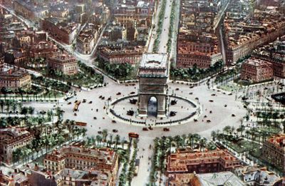
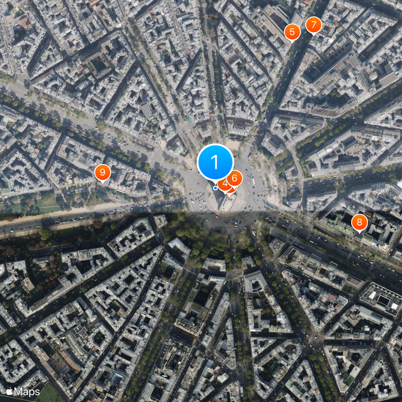
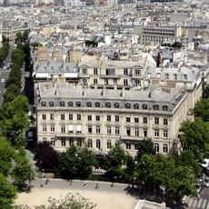
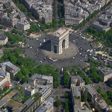
Place Charles-de-Gaulle, Grand square at the intersection of three arrondissements in Paris, France.

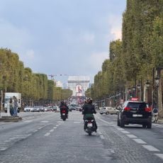
Place Charles-de-Gaulle is a circular square with a diameter of about 240 meters, with twelve broad avenues radiating outward from the center. This geometric layout creates a significant traffic hub in the heart of Paris, where the famous Arc of Triumph stands.

The square was originally known as Place de l'Étoile, named for its star-shaped layout created by the radiating streets. It received its current name in 1970 following the death of President Charles de Gaulle.

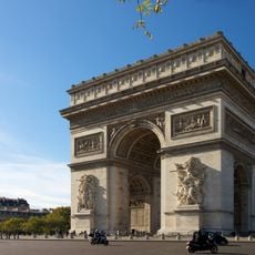
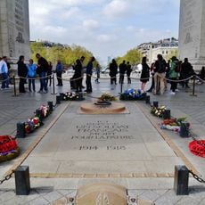
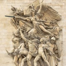
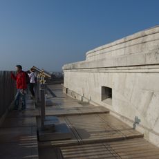
The Arc of Triumph at the center holds the Tomb of the Unknown Soldier and an eternal flame that honors those who served in the French military. Visitors can climb to the top and look out over the city from above.

Use the pedestrian tunnels underneath the square to reach the Arc safely, as crossing the multiple traffic lanes on foot is dangerous. Early morning or late evening visits work best when traffic is lighter and the area is easier to navigate.

The twelve streets radiating from the square create such complex traffic patterns that some insurance companies refuse to cover drivers in this area. This chaotic system has made the spot a notorious place in Paris traffic.

Location: 8th arrondissement of Paris

Location: 16th arrondissement of Paris

Location: 17th arrondissement of Paris

Location: Quartier des Champs-Élysées

Location: Chaillot

Location: Quartier du Faubourg-du-Roule

Location: Quartier des Ternes

Inception: 1670

Length: 240 m

Width: 240 m

Part of: road network of Paris

Shares border with: avenue Carnot, avenue de Friedland, avenue de la Grande-Armée, Avenue de Wagram, avenue des Champs-Élysées, avenue d'Iéna, avenue Foch, avenue Hoche, avenue Kléber, avenue Mac-Mahon, avenue Marceau, avenue Victor-Hugo

GPS coordinates: 48.87389,2.29472

Latest update: December 17, 2025 08:10

Photos
Reviews

Visited this place? Tap the stars to rate it and share your experience / photos with the community! Try now! You can cancel it anytime.

« Place Charles-de-Gaulle - Grand square at the intersection of three arrondissements in Paris, France » is provided by Around Us (aroundus.com). Images and texts are derived from Wikimedia project under a Creative Commons license. You are allowed to copy, distribute, and modify copies of this page, under the conditions set by the license, as long as this note is clearly visible.

Discover hidden gems everywhere you go!

From secret cafés to breathtaking viewpoints, skip the crowded tourist spots and find places that match your style. Our app makes it easy with voice search, smart filtering, route optimization, and insider tips from travelers worldwide. Download now for the complete mobile experience.

Around Us App Screenshot

A unique approach to discovering new places

Le Figaro

All the places worth exploring

France Info

A tailor-made excursion in just a few clicks

20 Minutes