Enable Location

We need your location to show you interesting places around you

Discover nearby places

Find interesting locations and hidden gems around you

Precise directions

Get accurate directions and distances to places

Your location is never shared with other users. It's only used when you tap the location button.

Mont Neiglier

Log in to your account

Join the adventure

Create your free account and start exploring (like 60k+ others)

We will send you a code to connect

or
Continue with Google
Continue with Apple
By continuing, you accept our Terms and Conditions and our Privacy Policy

Check your inbox

We've sent a pincode in your inbox. Please enter the code below.

Mont Neiglier

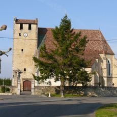
Mont Neiglier, Mountain peak in Mercantour National Park, France

Description

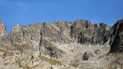
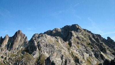
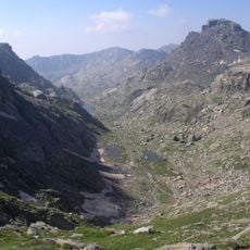
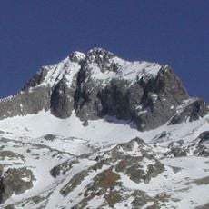
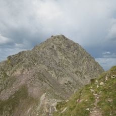
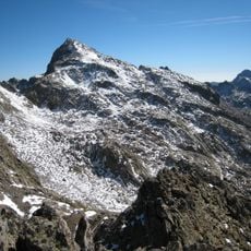
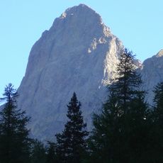
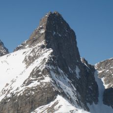
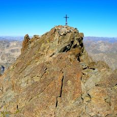
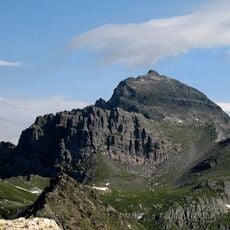
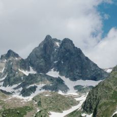
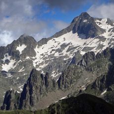
Mont Neiglier is a mountain summit located within Mercantour National Park, rising to 2,786 meters between Saint-Martin-Vésubie and Belvédère. The peak features steep rocky slopes and exposed stone faces that dominate its profile throughout the range.

History

The mountain's name originates from its dark coloration, shaped by linguistic changes that occurred through regional speech patterns over centuries. This naming reflects how the natural landscape influenced local place names in the Alps.

Culture

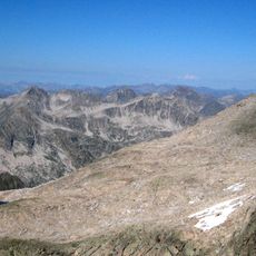
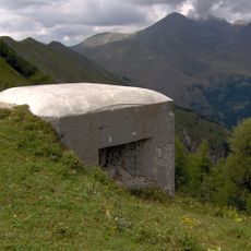
Mont Neiglier marks a significant boundary within the Mercantour-Argentera massif, representing a natural divide between different territorial jurisdictions in the French Alps.

Practical

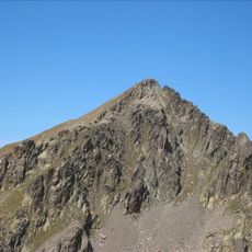
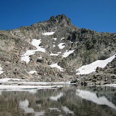
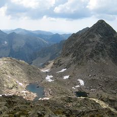
Climbers can access the summit through the southwest couloir starting from Madone de Fenestre, following a diagonal route across scree fields toward the ridge. Good fitness and mountain climbing experience help navigate this steep approach.

Did you know?

The northwest face contains multiple climbing routes through gullies and stone slabs that present varying levels of difficulty depending on season and conditions. These changing challenges appeal to climbers seeking different experiences at different times of year.

Location
Elevation above the sea
2,786 m
GPS coordinates
44.08854,7.38691
Latest update
December 14, 2025 20:02

AroundUs brings together thousands of curated places, local tips, and hidden gems, enriched daily by 60,000 contributors worldwide. Discover all places nearby (Alpes-Maritimes).

« Mont Neiglier - Mountain peak in Mercantour National Park, France » is provided by Around Us (aroundus.com). Images and texts are derived from Wikimedia project under a Creative Commons license. You are allowed to copy, distribute, and modify copies of this page, under the conditions set by the license, as long as this note is clearly visible.

Discover hidden gems everywhere you go!

From secret cafés to breathtaking viewpoints, skip the crowded tourist spots and find places that match your style. Our app makes it easy with voice search, smart filtering, route optimization, and insider tips from travelers worldwide. Download now for the complete mobile experience.

Around Us App Screenshot

A unique approach to discovering new places

Le Figaro

All the places worth exploring

France Info

A tailor-made excursion in just a few clicks

20 Minutes

Around Us
Travel Guide & Maps
Download

Send to your phone

QR Code
1

Open the camera app on your mobile.

2

Point at the QR code with your camera. A notification will appear.

3

Tap the notification to open the link.