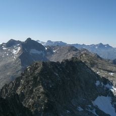
Pic d'Ayre, Mountain summit in Hautes-Pyrénées, France
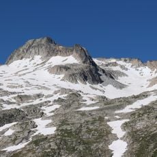
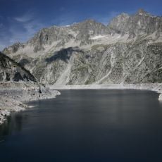
Pic d'Ayre is a mountain summit in the Hautes-Pyrénées region of the French Pyrenees, rising to approximately 2140 meters. The peak is accessible via several hiking trails starting from different locations, each offering varying levels of difficulty and scenery.
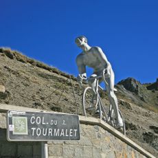
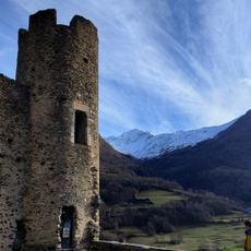
The mountain has served as a landmark for shepherds and travelers crossing the French Pyrenees since medieval times, marking established routes through the region. This long history of use made it an important reference point in regional trade networks.
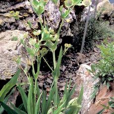
Shepherds still graze their flocks on the mountain's slopes today, following seasonal patterns that have shaped life in these valleys for hundreds of years. You can see the effects of this pastoral tradition everywhere in how the landscape is used and maintained.
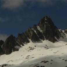
Visitors should bring proper mountain equipment and monitor weather conditions carefully, as they change rapidly at this elevation. It helps to plan your route in advance and check current conditions before heading out.
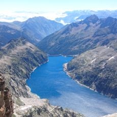
From the summit, visitors can see distinctly different rock formations on the French and Spanish sides of the mountain range. These differences reveal how the mountain's geology changed across the international border.
Elevation above the sea: 2,140 m
GPS coordinates: 42.87297,0.07099
Latest update: December 15, 2025 13:23
Col du Tourmalet
7.2 km
Napoléon bridge
6.4 km
Lac Bleu de Lesponne
7.1 km
Pic de Néouvielle
5.5 km
Lac de Cap-de-Long
7.2 km
Station thermale de Barèges
2.8 km
Château de Sainte-Marie
5.7 km
Le Géant
7.2 km
Turon de Néouvielle
5.9 km
Pic Ramougn
5.8 km
Jardin botanique du Tourmalet
7.2 km
Trois Conseillers
5.8 km
Église Saint-Nicolas d'Esquièze
6.1 km
Église des templiers, Luz-Saint-Sauveur
6.1 km
Église Saint-Jean-Baptiste de Sère
6.4 km
Église Saint-Vincent de Sers
3.1 km
Église Saint-Michel de Viella
4.7 km
Punta Reboul Vidal
6 km
Église Saint-Joseph de Luz-Saint-Sauveur
6.6 km
Chapelle de Solférino de Luz-Saint-Sauveur
6.5 km
Église Saint-Étienne d'Esterre
5.2 km
Église Notre-Dame-de-l'Assomption de Sassis
7.1 km
Église Saint-Sylvestre de Viey
4 km
Église Saint-Laurent de Barèges
2.7 km
ÉgIise Saint-Michel de Vizos
7.2 km
Église Saint-Sébastien de Betpouey
3.2 km
Thermes de Saint-Sauveur
6.8 km
Chapelle Sainte-Barbe de Luz-Saint-Sauveur
6.1 kmVisited this place? Tap the stars to rate it and share your experience / photos with the community! Try now! You can cancel it anytime.
Discover hidden gems everywhere you go!
From secret cafés to breathtaking viewpoints, skip the crowded tourist spots and find places that match your style. Our app makes it easy with voice search, smart filtering, route optimization, and insider tips from travelers worldwide. Download now for the complete mobile experience.
A unique approach to discovering new places❞
— Le Figaro
All the places worth exploring❞
— France Info
A tailor-made excursion in just a few clicks❞
— 20 Minutes