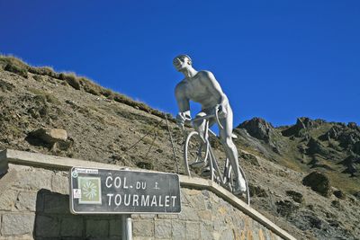
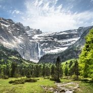
Col du Tourmalet, Mountain pass in Hautes-Pyrénées, France.
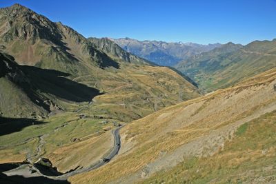
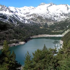
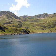
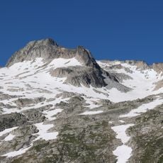
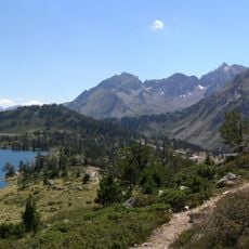
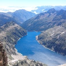
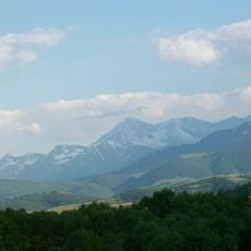
The Col du Tourmalet is a mountain pass in the Hautes-Pyrénées that sits at 2,115 meters elevation and connects two valleys through a paved road. The pass can be approached from either side, with longer slopes from the west and shorter but steeper sections from the east, both routes marked by continuous hairpin turns.
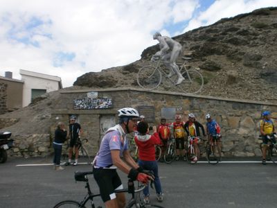
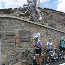
The pass first appeared in the Tour de France in 1910 when it was still just a rough farm track. Since then it has been transformed into a major climbing stage and remains one of the race's most legendary destinations.
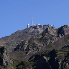
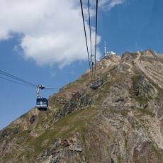
The name comes from the many tight turns of the road that define the climb, which locals still call 'Tournalet.' Today visitors encounter monuments to cycling history at the summit, marking how deeply this pass is woven into the sport's story.
Be prepared for changing weather, as the summit can be wrapped in clouds even when the valley below is sunny. The best time to visit is from May through October when the road is typically open and services are most readily available.
The road features markers throughout that show not just remaining kilometers to the summit but also the gradient of the next section ahead. These practical guides help cyclists understand what terrain lies before them on the climb.
Location: Hautes-Pyrénées
Elevation above the sea: 2,115 m
GPS coordinates: 42.90839,0.14529
Latest update: December 6, 2025 16:01
France offers motorcyclists a diverse landscape, from Alpine peaks to Mediterranean coasts, including wine regions. The country is suitable for all riding styles, with demanding mountain roads, winding coastal routes, and rural paths. Key routes include the Col de la Bonette, reaching 2802 meters...
Pic du Midi de Bigorre
3.2 km
Téléphérique du pic du Midi de Bigorre
2.8 km
Lac d'Orédon
9.3 km
Lac Bleu de Lesponne
6.2 kmNéouvielle National Nature Reserve
7.4 km
Émetteur du pic du Midi de Bigorre
3.2 km
Pic de Néouvielle
8.5 km
Lac d'Aumar
7.3 km
Lac de Cap-de-Long
9.4 km
Station thermale de Barèges
6.6 km
Pic du Midi Observatory
3.2 km
Pic du Montaigu
10.5 km
Le Géant
49 m
Turon de Néouvielle
9.5 km
Pic Ramougn
8.4 km
Jardin botanique du Tourmalet
24 m
Trois Conseillers
9 km
Pic de Bastan
6.5 km
Chapelle Notre-Dame de La Mongie
2.6 km
Église Notre-Dame-de-l'Assomption de Sainte-Marie-de-Campan
10.8 km
Église Saint-Vincent de Sers
9 km
Punta Reboul Vidal
9.6 km
Église Saint-Vincent-de-Paul de la Séoube
10.5 km
Église Saint-Sylvestre de Viey
10.4 km
Église Saint-Laurent de Barèges
6.7 km
Église Saint-Michel de Gripp
8.1 km
Église Saint-Sébastien de Betpouey
9.6 km
Chapelle Saint-Roch de Sainte-Marie-de-Campan
10.9 kmVisited this place? Tap the stars to rate it and share your experience / photos with the community! Try now! You can cancel it anytime.
Discover hidden gems everywhere you go!
From secret cafés to breathtaking viewpoints, skip the crowded tourist spots and find places that match your style. Our app makes it easy with voice search, smart filtering, route optimization, and insider tips from travelers worldwide. Download now for the complete mobile experience.
A unique approach to discovering new places❞
— Le Figaro
All the places worth exploring❞
— France Info
A tailor-made excursion in just a few clicks❞
— 20 Minutes