Enable Location

We need your location to show you interesting places around you

Discover nearby places

Find interesting locations and hidden gems around you

Precise directions

Get accurate directions and distances to places

Your location is never shared with other users. It's only used when you tap the location button.

Téléphérique du pic du Midi de Bigorre

Log in to your account

Start exploring — it's free

Trusted by 66,049 travelers worldwide

Continue with Google
Continue with Apple
or

We will send you a code to connect

By continuing, you accept our Terms and Conditions and our Privacy Policy

Check your inbox

We've sent a pincode in your inbox. Please enter the code below.

Téléphérique du pic du Midi de Bigorre
Discussion Reviews 1 Photos
5.3k Popularity

Téléphérique du pic du Midi de Bigorre, Aerial tramway in Bagnères-de-Bigorre, France.

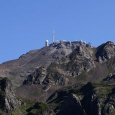
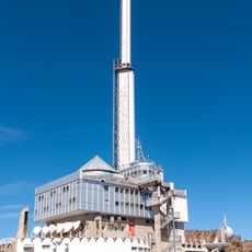
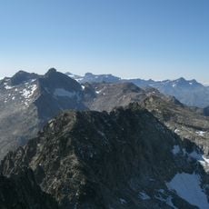
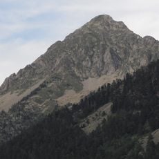
The Téléphérique du Pic du Midi de Bigorre is an aerial tramway in the Hautes-Pyrénées, near Bagnères-de-Bigorre, that carries passengers from the mountain station of La Mongie up to the summit of Pic du Midi de Bigorre at about 2,877 ft (2,877 m). The ride runs in two sections, stopping at the intermediate Taoulet station before reaching the top.

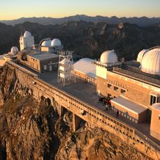
The observatory at the summit dates back to the late 19th century, but for decades reaching it required a long and difficult climb on foot or by mule. The cable car was built in the 1950s to make the ascent manageable for both researchers and regular visitors.

At the top, a working astronomical observatory lets visitors look through telescopes and see the same instruments that scientists use for real research. The place draws people curious about astronomy, and on clear nights special sessions open the observatory to the public.

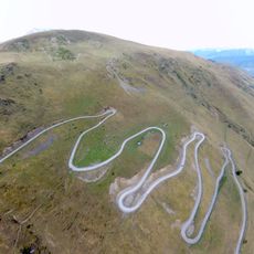
Warm clothing and wind-resistant layers are worth packing, as temperatures at the top drop well below what you feel at the base. The intermediate stop at Taoulet is a good place to pause if you need time to adjust before going higher.

The observatory here was used to produce some of the first detailed maps of the Moon, and NASA used images from this site to help plan the Apollo missions. That connection to the Moon landings is something most visitors walking through the summit station never suspect.

The community of curious travelers

AroundUs brings together thousands of curated places, local tips, and hidden gems, enriched daily by 60,000 contributors worldwide.

Start exploring
GPS coordinates
42.90953,0.17898
Latest update
March 3, 2026 08:17
Reviews
Share your experience

No review yet

Discussions
Start a discussion...

No discussion yet

« Téléphérique du pic du Midi de Bigorre - Aerial tramway in Bagnères-de-Bigorre, France » is provided by Around Us (aroundus.com). Images and texts are derived from Wikimedia project under a Creative Commons license. You are allowed to copy, distribute, and modify copies of this page, under the conditions set by the license, as long as this note is clearly visible.

Discover hidden gems everywhere you go!

From secret cafés to breathtaking viewpoints, skip the crowded tourist spots and find places that match your style. Our app makes it easy with voice search, smart filtering, route optimization, and insider tips from travelers worldwide. Download now for the complete mobile experience.

Around Us App Screenshot

A unique approach to discovering new places

Le Figaro

All the places worth exploring

France Info

A tailor-made excursion in just a few clicks

20 Minutes

Around Us
Travel Guide & Maps
Download

Send to your phone

QR Code
1

Open the camera app on your mobile.

2

Point at the QR code with your camera. A notification will appear.

3

Tap the notification to open the link.