Chest opened
+${chestReward.xp} XP
Explorer
NOUVEAU ×${chestReward.collectible.quantity}
tapez pour fermer
Chest locked

Open chests in the app

Around Us is built for your phone — chests unlock when you walk, explore and capture nearby places.

Enable Location

We need your location to show you interesting places around you

Discover nearby places

Find interesting locations and hidden gems around you

Precise directions

Get accurate directions and distances to places

Your location is never shared with other users. It's only used when you tap the location button.

Log in to your account

Start exploring — it's free

Trusted by 72,882 travelers worldwide

Continue with Google
Continue with Apple
or

We will send you a code to connect

By continuing, you accept our Terms and Conditions and our Privacy Policy

Check your inbox

We've sent a pincode in your inbox. Please enter the code below.

Rocher des Tampes
Discussion Reviews Photo
300+ Popularity

Rocher des Tampes, Mountain summit in Glières-Val-de-Borne, France.

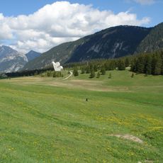
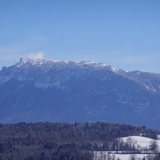
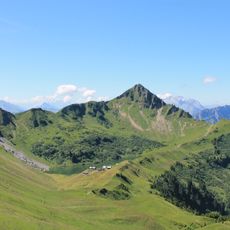
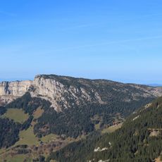
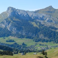
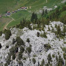
Rocher des Tampes is a mountain summit in the French Alps characterized by sheer limestone cliffs on its northern side and a narrow, jagged ridge that defines its distinctive profile. The rock formations create dramatic vertical walls that make this peak visually striking from multiple approaches.

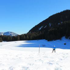
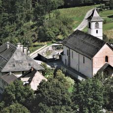
This peak sits in a region where French resistance forces operated during World War II, establishing positions in the surrounding mountains for strategic advantage. The high elevation areas nearby served as natural strongholds during wartime activities.

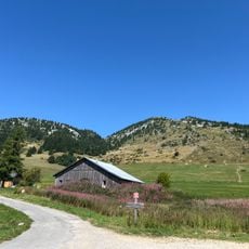
Local mountaineers share their knowledge about unmarked paths to reach Rocher des Tampes, maintaining a tradition of natural exploration.

The hike from Sambuis parking takes about four hours with roughly 900 meters (3000 feet) of elevation gain along unmarked paths and some scrambling sections. Proper hiking boots and climbing experience help navigate the challenging terrain safely.

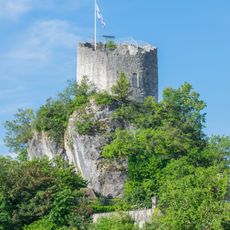
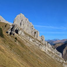
The south-western ridge offers a technical climbing route that demands advanced skills and provides direct engagement with the exposed limestone rock. Experienced mountaineers favor this challenging alternative to more conventional approaches.

The community of curious travelers

AroundUs brings together thousands of curated places, local tips, and hidden gems, enriched daily by 60,000 contributors worldwide.

Start exploring
Elevation above the sea
1,865 m
GPS coordinates
46.01028,6.35861
Latest update
December 14, 2025 20:23
Reviews
Share your experience

No review yet

Discussions
Start a discussion...

No discussion yet

« Rocher des Tampes - Mountain summit in Glières-Val-de-Borne, France » is provided by Around Us (aroundus.com). Images and texts are derived from Wikimedia project under a Creative Commons license. You are allowed to copy, distribute, and modify copies of this page, under the conditions set by the license, as long as this note is clearly visible.

Discover hidden gems everywhere you go!

From secret cafés to breathtaking viewpoints, skip the crowded tourist spots and find places that match your style. Our app makes it easy with voice search, smart filtering, route optimization, and insider tips from travelers worldwide. Download now for the complete mobile experience.

Around Us App Screenshot

A unique approach to discovering new places

Le Figaro

All the places worth exploring

France Info

A tailor-made excursion in just a few clicks

20 Minutes

Around Us
Travel Guide & Maps
Download

Send to your phone

QR Code
1

Open the camera app on your mobile.

2

Point at the QR code with your camera. A notification will appear.

3

Tap the notification to open the link.