Chest opened
+${chestReward.xp} XP
Explorer
NOUVEAU ×${chestReward.collectible.quantity}
tapez pour fermer
Chest locked

Open chests in the app

Around Us is built for your phone — chests unlock when you walk, explore and capture nearby places.

Enable Location

We need your location to show you interesting places around you

Discover nearby places

Find interesting locations and hidden gems around you

Precise directions

Get accurate directions and distances to places

Your location is never shared with other users. It's only used when you tap the location button.

Log in to your account

Start exploring — it's free

Trusted by 72,930 travelers worldwide

Continue with Google
Continue with Apple
or

We will send you a code to connect

By continuing, you accept our Terms and Conditions and our Privacy Policy

Check your inbox

We've sent a pincode in your inbox. Please enter the code below.

Tête de Fer
Discussion Reviews Photo
20+ Popularity

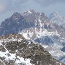
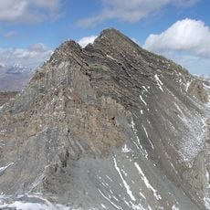
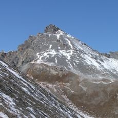
Tête de Fer, Mountain summit in Provence-Alpes-Côte d'Azur, France.

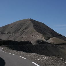
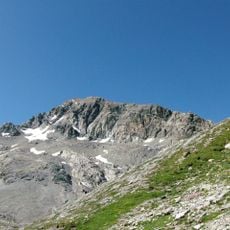
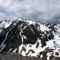
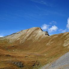
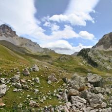
Tête de Fer is a mountain summit in the Massif du Mercantour-Argentera range rising to 2,885 meters. The peak stands about 74 meters above its immediate surroundings and commands views across the surrounding alpine terrain.

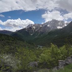
The Maritime Alps formed through geological processes that took millions of years to create the current alpine relief. This formation shaped the entire character of the Mercantour range where this peak now stands.

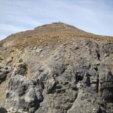
The paths around this summit follow ancient shepherd routes where herds moved seasonally through the Mercantour massif. These traditional routes still shape the landscape and show how people have lived with these mountains for centuries.

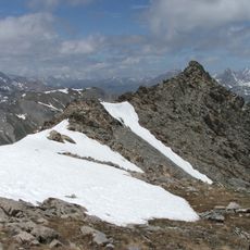
Hikers should plan for winter conditions from November through April, as temperatures regularly drop below freezing with heavy snow accumulation. Proper preparation and equipment are needed for a safe ascent during these months.

On clear days this peak offers views of both Mediterranean influences from the south and alpine characteristics from the north in a single panorama. This rare perspective shows how different climate zones and landscapes meet in this mountain region.

The community of curious travelers

AroundUs brings together thousands of curated places, local tips, and hidden gems, enriched daily by 60,000 contributors worldwide.

Start exploring
GPS coordinates
44.40000,6.85000
Latest update
December 15, 2025 13:23
Reviews
Share your experience

No review yet

Discussions
Start a discussion...

No discussion yet

« Tête de Fer - Mountain summit in Provence-Alpes-Côte d'Azur, France » is provided by Around Us (aroundus.com). Images and texts are derived from Wikimedia project under a Creative Commons license. You are allowed to copy, distribute, and modify copies of this page, under the conditions set by the license, as long as this note is clearly visible.

Discover hidden gems everywhere you go!

From secret cafés to breathtaking viewpoints, skip the crowded tourist spots and find places that match your style. Our app makes it easy with voice search, smart filtering, route optimization, and insider tips from travelers worldwide. Download now for the complete mobile experience.

Around Us App Screenshot

A unique approach to discovering new places

Le Figaro

All the places worth exploring

France Info

A tailor-made excursion in just a few clicks

20 Minutes

Around Us
Travel Guide & Maps
Download

Send to your phone

QR Code
1

Open the camera app on your mobile.

2

Point at the QR code with your camera. A notification will appear.

3

Tap the notification to open the link.