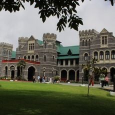
Champawat district, Administrative district in Kumaon division, India
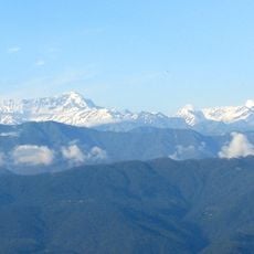
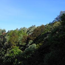
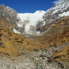
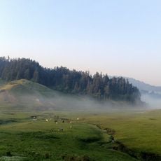
Champawat district is an administrative area in the Kumaon region, sitting in the eastern Himalaya mountains at about 1,615 meters elevation across valleys and hills. The Champavati stream winds through the terrain, shaping the landscape as it flows between steep hillsides and narrow valleys.
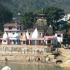
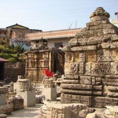
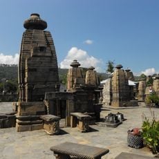
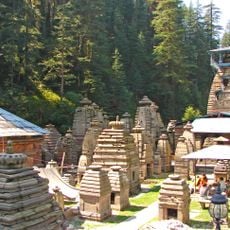
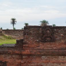
The area became a major administrative center under the Chand dynasty, which established its power there and shaped the region. Their rule set standards for regional governance and culture in northern India during medieval times.
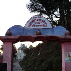
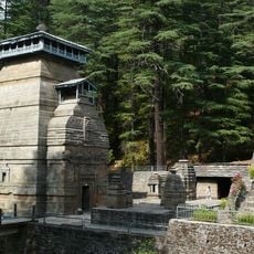
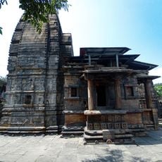
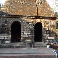
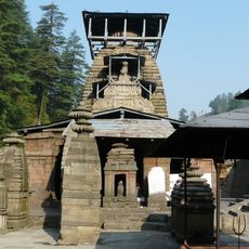
The Baleshwar Temple displays stone carvings that show how craftspeople worked in medieval times. Temples throughout the district remain active places where locals gather for worship and celebrations that follow traditions passed down through generations.
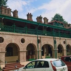
The district connects to major cities through National Highway 9, with regular buses and shared taxis running between towns and neighboring regions. The hilly terrain means travel takes longer than on flat ground, so allowing extra time for journeys is helpful when moving around.
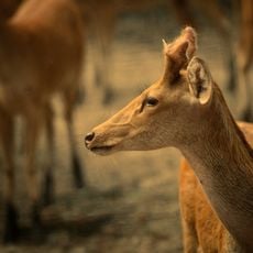
In 1907, hunter Jim Corbett tracked and killed a tiger that had caused many deaths in the area, becoming a historic moment for the region. This event remains significant in local memory as an important turning point in the district's past.
Location: Kumaon division
Capital city: Champawat
Shares border with: Almora district
Website: http://champawat.nic.in
GPS coordinates: 29.33000,80.10000
Latest update: December 7, 2025 20:24
Dudhwa National Park
112.1 km
Kumaon division
49.1 km
Patal Bhuvaneshwar
79.9 km
Golu Devata Udepur
56.3 km
Pilibhit Tiger Reserve
75 km
Binsar Wildlife Sanctuary
81.2 km
3.6m Devasthal Optical Telescope
40.5 km
Dudhwa Tiger Reserve
106.9 km
Dodhara Chandani Bridge
45.4 km
Bagnath Temple
62.5 km
Baleshwar Temple
1.2 km
Devasthal Observatory
40.4 km
Kafni Glacier
99 km
Baijnath Temple Complex
39.8 km
Api Nampa Conservation Area
88.5 km
Naina Devi Himalayan Bird Conservation Reserve
63.3 km
Panchchuli Glacier
99.3 km
Jama Masjid mosque
82.6 km
Jageshwar Temple Complex
41.7 km
Raj Bhawan, Governor House, Nainital, Uttarakhand, India
62.6 km
Khaptad National Park
86.7 km
Shuklaphanta National Park
55.9 km
Dandeshwar Temple
41.7 km
Imperial Bacteriological Laboratory
46.4 km
Three temples of the Indo-Aryan shikara type known as Lakshmi Narayan, Rakshas Deval and Satya Narayan
36.7 km
Old temple sacred to Sita
85.6 km
Excavated site at Dronsagar
109.9 km
Mrityunjaya Temple
41.7 kmVisited this place? Tap the stars to rate it and share your experience / photos with the community! Try now! You can cancel it anytime.
Discover hidden gems everywhere you go!
From secret cafés to breathtaking viewpoints, skip the crowded tourist spots and find places that match your style. Our app makes it easy with voice search, smart filtering, route optimization, and insider tips from travelers worldwide. Download now for the complete mobile experience.
A unique approach to discovering new places❞
— Le Figaro
All the places worth exploring❞
— France Info
A tailor-made excursion in just a few clicks❞
— 20 Minutes