Chest opened
+${chestReward.xp} XP
Explorer
NOUVEAU ×${chestReward.collectible.quantity}
tapez pour fermer
Chest locked

Open chests in the app

Around Us is built for your phone — chests unlock when you walk, explore and capture nearby places.

Enable Location

We need your location to show you interesting places around you

Discover nearby places

Find interesting locations and hidden gems around you

Precise directions

Get accurate directions and distances to places

Your location is never shared with other users. It's only used when you tap the location button.

Log in to your account

Start exploring — it's free

Trusted by 72,882 travelers worldwide

Continue with Google
Continue with Apple
or

We will send you a code to connect

By continuing, you accept our Terms and Conditions and our Privacy Policy

Check your inbox

We've sent a pincode in your inbox. Please enter the code below.

Kunjargad
Discussion Reviews Photo
1.3k Popularity

Kunjargad, Mountain fort in Ahilyanagar district, India.

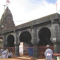
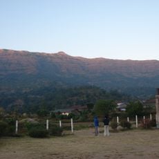
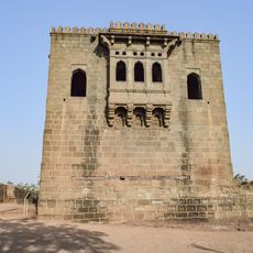
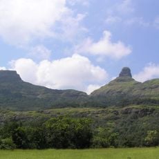
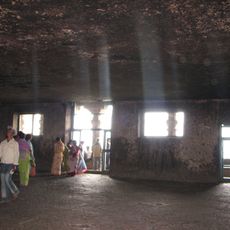
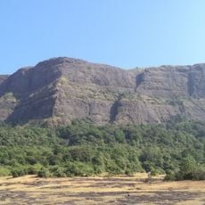
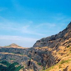
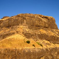
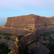
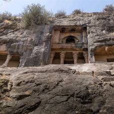
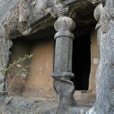
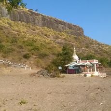
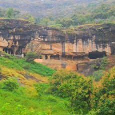
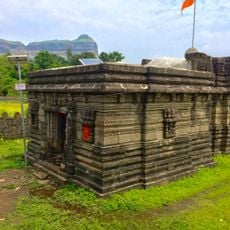
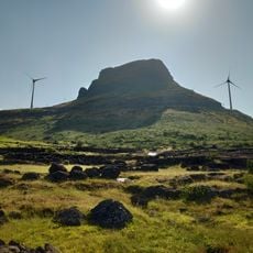
Kunjargad is a mountain fort in Ahilyanagar district that rises to about 1,400 meters (4,600 feet) on the Harishchandragad mountain range, marked by stone walls and defensive structures. The layout spreads across multiple plateaus, creating distinct sections at different elevations.

The fort developed as a strategic military stronghold during the rule of the Deccani Sultanates, particularly under the Nizam Shahi dynasty. It held importance in regional power struggles that centered on controlling these mountain passages.

The Sanskrit name refers to the fort's elephant-like shape, linking its design to ancient naming traditions. Locals view it as a landmark that shaped how people understood the landscape around them.

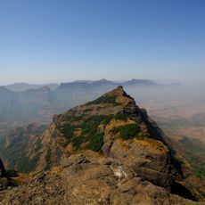
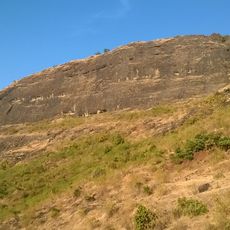
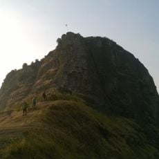
You can climb from two directions: from Vihir village in the north or Phopsandi village in the south, with the walk taking roughly 2 to 3 hours depending on your route. Wear sturdy shoes and bring plenty of water, as the path is steep and exposed in places.

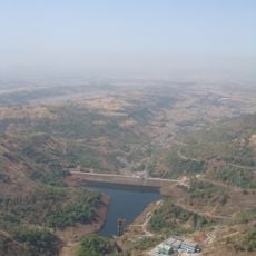
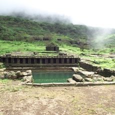
The fort sits at a geographical junction between the Mula river valley and the Mandvi river valley, making it historically vital for the region's water management. This location meant that controlling it was essential for monitoring the flow of water resources across the area.

The community of curious travelers

AroundUs brings together thousands of curated places, local tips, and hidden gems, enriched daily by 60,000 contributors worldwide.

Start exploring
GPS coordinates
19.39236,73.86200
Latest update
December 14, 2025 17:41
Reviews
Share your experience

No review yet

Discussions
Start a discussion...

No discussion yet

« Kunjargad - Mountain fort in Ahilyanagar district, India » is provided by Around Us (aroundus.com). Images and texts are derived from Wikimedia project under a Creative Commons license. You are allowed to copy, distribute, and modify copies of this page, under the conditions set by the license, as long as this note is clearly visible.

Discover hidden gems everywhere you go!

From secret cafés to breathtaking viewpoints, skip the crowded tourist spots and find places that match your style. Our app makes it easy with voice search, smart filtering, route optimization, and insider tips from travelers worldwide. Download now for the complete mobile experience.

Around Us App Screenshot

A unique approach to discovering new places

Le Figaro

All the places worth exploring

France Info

A tailor-made excursion in just a few clicks

20 Minutes

Around Us
Travel Guide & Maps
Download

Send to your phone

QR Code
1

Open the camera app on your mobile.

2

Point at the QR code with your camera. A notification will appear.

3

Tap the notification to open the link.