Sila National Park, National park in Calabria, Italy
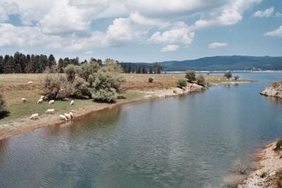
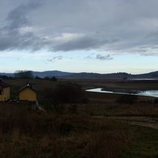
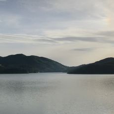
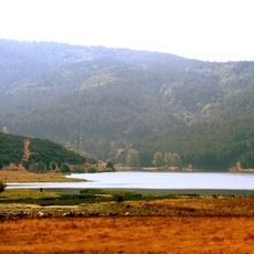
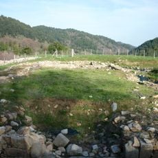
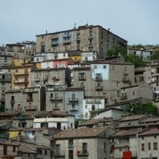
Sila National Park is a protected area in Calabria spanning the provinces of Cosenza, Catanzaro, and Crotone, covering more than 73,000 hectares. The terrain alternates between broad plateaus, forested slopes, and several lakes fed by rivers.
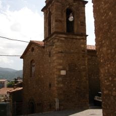
The area was established as a national park in 1997, expanding earlier protection zones introduced in the 1920s. UNESCO recognized it as a Biosphere Reserve in 2014, acknowledging its ecological importance.
The name Sila comes from a Latin word for forest and reflects the dense pine stands that have shaped the landscape for centuries. Visitors still see shepherds with their flocks on the plateaus, especially in early summer when the grass is fresh and green.
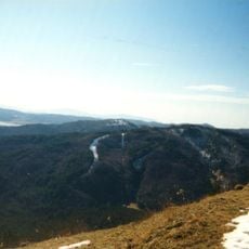
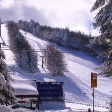
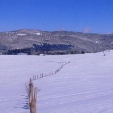
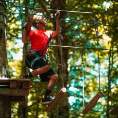
The terrain is suitable for walking and cycling on marked trails that pass through forests and along lakes. In winter, skiing is possible in Lorica and Camigliatello, while in summer the higher areas remain cooler than the coastal regions.
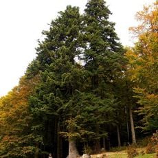
The Fossiata and Gallopane forests near Lake Cecita are home to ancient Laricio pines, some over 350 years old and reaching heights of 45 meters (148 feet). These trees are locally called Giants of Sila and rank among the tallest in southern Italy.
Location: Calabria
Location: Acri
Location: Albi
Location: Aprigliano
Location: Bocchigliero
Location: Casali del Manco
Location: Celico
Location: Corigliano-Rossano
Location: Cotronei
Location: Longobucco
Location: Magisano
Location: Mesoraca
Location: Petilia Policastro
Location: Petronà
Location: San Giovanni in Fiore
Location: Savelli
Location: Sersale
Location: Spezzano della Sila
Location: Taverna
Location: Zagarise
Inception: 1997
Website: http://parcosila.it
GPS coordinates: 39.37611,16.59194
Latest update: December 5, 2025 22:25
Lago Cecita
6.2 km
Lago Ampollino
20.4 km
San Giovanni in Fiore Abbey
16.4 km
Monte Botte Donato
15.9 km
Abbazia di Santa Maria di Corazzo
37.9 km
Monte Curcio
16 km
Monte Gariglione
27 km
Tirivolo
31.2 km
Santa Maria delle Grazie
16.5 km
Lago di Ariamacina
6.4 km
Basilica del Beato Angelo d'Acri
21.6 km
Castello di Acri
22.2 km
Abbazia di Sant'Angelo de Frigillo
35.9 km
Protocenobio di Jure Vetere
13.1 km
Museo Demologico dell'Economia, del Lavoro e del
16.7 km
Civic Museum of Taverna
39.6 km
Monte Volpintesta
5.6 km
Arco normanno
16.6 km
Palazzo Lopez
16.5 km
San Francesco di Paola
21.8 km
Monastero dei Tre Fanciulli
22.8 km
Palazzo Barberio Toscano
16.2 km
Annunziata
16.6 km
Orme nel parco
30.8 km
Palazzo De Luca
16.4 km
Palazzo De Marco
16.6 km
Monte Paganella
23.9 km
Palazzo Benincasa
16.4 kmReviews
Visited this place? Tap the stars to rate it and share your experience / photos with the community! Try now! You can cancel it anytime.
Discover hidden gems everywhere you go!
From secret cafés to breathtaking viewpoints, skip the crowded tourist spots and find places that match your style. Our app makes it easy with voice search, smart filtering, route optimization, and insider tips from travelers worldwide. Download now for the complete mobile experience.
A unique approach to discovering new places❞
— Le Figaro
All the places worth exploring❞
— France Info
A tailor-made excursion in just a few clicks❞
— 20 Minutes