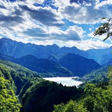
Monte Cavallo, Mountain summit in Prealpi Bellunesi, Italy
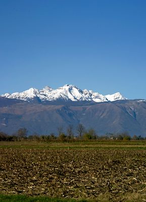
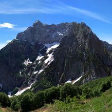
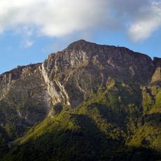
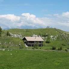
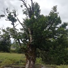
Monte Cavallo is a mountain summit in the Prealpi Bellunesi reaching 2251 meters in elevation and straddling the border between Friuli Venezia Giulia and Veneto. The terrain includes marked hiking paths, rock formations, and climbing routes that define the alpine character of this region.
The mountain takes its name from historical routes and settlements that formed the backbone of regional trade for centuries. Early mountaineers and alpine club members developed climbing routes here in the 20th century, transforming it from a remote crossing point into an organized hiking destination.
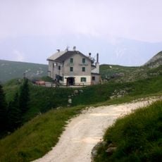
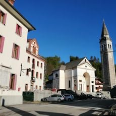
The mountain serves as a gathering point for hikers from neighboring regions who share trails and mountain shelters in this border area. Visitors find themselves naturally connecting with the simple rhythms of alpine culture through their passage across these well-used routes.
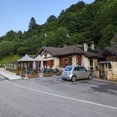
Hikers will find multiple entry routes and mountain shelters positioned along the trails for breaks and refreshment. Parking is available near the Passo di Pramollo area, and sturdy footwear is essential since the paths can be rocky and slippery depending on weather and season.
The mountain provides two distinct return options: a southeast ridge path following the Alta Via CAI Pontebbia or an Austrian-side route descending toward Baita Winkel. This choice allows hikers to experience different slopes and terrain types on the same outing.
Location: Friuli Venezia Giulia
Location: Veneto
Elevation above the sea: 2,251 m
GPS coordinates: 46.12992,12.49691
Latest update: December 10, 2025 16:20
Barcis
8.4 km
Bus de la Lum
6.8 km
Pizzoc
15.3 km
Col Nudo
13 km
Ponte Antoi
9.1 km
Castello di Polcenigo
11 km
Monte Dolada
14.3 km
Riserva naturale Forra del Cellina
10.3 km
Santa Maria del Rosario Church
11.9 km
Santa Maria Assunta
16 km
Palazzo Fullini-Zaia
11 km
Chiesa dei Santi Ermacora e Fortunato
5.7 km
Chiesa di Santa Maria
10.3 km
Giardino Botanico delle Alpi Orientali
16 km
Santa Croce
13.5 km
Santa Maria Assunta Church
13.2 km
San Bartolomeo Apostolo
10.6 km
Chiesa di Sant'Andrea Apostolo
10 km
Maniagolibero
15 km
Scout Base Andreis
13.3 km
San Giovanni Battista
8.3 km
San Giuseppe
9 km
Santa Maria delle Grazie
11.9 km
Fadalto Viaduct
14.9 km
Chiesa di Santa Maria Maddalena
9.9 km
A. Pitter hydroelectric plant Malnisio
10.8 km
Cornus mas
11.1 km
Fagheron di Sant'Anna
5.1 kmVisited this place? Tap the stars to rate it and share your experience / photos with the community! Try now! You can cancel it anytime.
Discover hidden gems everywhere you go!
From secret cafés to breathtaking viewpoints, skip the crowded tourist spots and find places that match your style. Our app makes it easy with voice search, smart filtering, route optimization, and insider tips from travelers worldwide. Download now for the complete mobile experience.
A unique approach to discovering new places❞
— Le Figaro
All the places worth exploring❞
— France Info
A tailor-made excursion in just a few clicks❞
— 20 Minutes