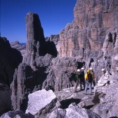
Via ferrata delle Bocchette Centrali, Mountain climbing route in Dolomites di Brenta, Italy.
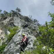
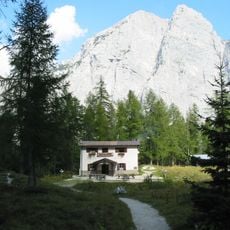
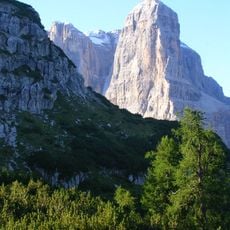
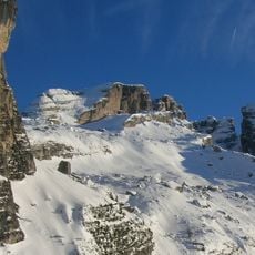
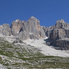
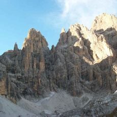
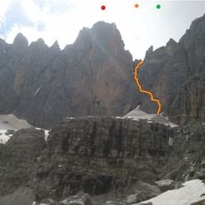
Via Ferrata delle Bocchette Centrali is a climbing route in the Dolomiti di Brenta that stretches 2930 meters and passes between two mountain passes. The path connects two mountain huts and leads over vertical rock walls and exposed alpine passages.
Work on this climbing route started in 1937 but was halted by World War II. The route was finally completed in 1957 in four separate phases.
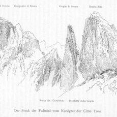
The route is named after Italian climbers who worked in this region. These names reflect the long tradition of mountaineering in the Dolomites.
Good footwear and proper climbing experience are essential, as the route has exposed sections and steep passages. Pay attention to weather conditions at high elevation and start early in the day.
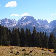
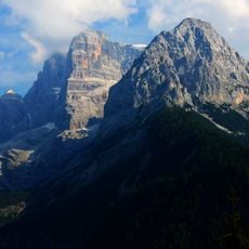
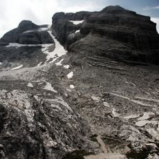
The route uses natural rock ledges and maintains high elevation throughout. This layout creates spectacular views into the surrounding mountain valleys.
Location: Tre Ville
Length: 2,930 m
Reference: 305C
Operator: Società degli Alpinisti Tridentini
Part of: Via delle Bocchette
Address: 38018 Molveno TN, Italy
Website: https://sat.tn.it
GPS coordinates: 46.16482,10.89463
Latest update: December 12, 2025 16:42
Via ferrata routes in the Alps combine steel cables, metal rungs, and bridges into protected climbing paths through alpine rock faces. The routes extend through the Dolomites, French Alps, Austrian Ötztal, and Swiss mountain regions between 2,600 and 9,800 feet in elevation. Routes such as the Ivano...
Brenta group
2 km
Cima Tosa
2 km
Cima del Grostè
3.8 km
Croz dell'Altissimo
3.6 km
Campanile Basso
319 m
Cima Brenta
1.7 km
Crozzon di Brenta
2 km
Cima Falkner
3.2 km
Cima d'Ambiez
2.5 km
Campanile Alto
102 m
Torre di Brenta
274 m
Cima Brenta Alta
519 m
Via ferrata "Ettore Castiglioni"
2.8 km
Vedretta d'Ambiez
2.4 km
Bocchetta dei Camosci
2.7 km
Campanile Stek
2.4 km
Castello di Vallesinella
3.3 km
Cima Garbari
2.2 km
Castelletto Superiore
2.8 km
Cima d'Agola
3.2 km
Cima di Ceda Orientale
2.4 km
Cima Prato Fiorito
3.8 km
Croz del Rifugio
1.4 km
Cima Mandron
1.9 km
Punta dell'Ideale
2.3 km
Spallone dei Massodi
1.2 km
Redeemer chapel
1.2 km
Monte Cresole
3.1 kmVisited this place? Tap the stars to rate it and share your experience / photos with the community! Try now! You can cancel it anytime.
Discover hidden gems everywhere you go!
From secret cafés to breathtaking viewpoints, skip the crowded tourist spots and find places that match your style. Our app makes it easy with voice search, smart filtering, route optimization, and insider tips from travelers worldwide. Download now for the complete mobile experience.
A unique approach to discovering new places❞
— Le Figaro
All the places worth exploring❞
— France Info
A tailor-made excursion in just a few clicks❞
— 20 Minutes