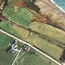
Monbetsu district, district in Hokkaido, Japan
Location: Okhotsk Subprefecture
Inception: July 23, 1879
GPS coordinates: 44.39000,143.19000
Latest update: March 16, 2025 13:25
Daisetsuzan Volcanic Group
82.3 km
Sounkyo
76.1 km
Kitakitsune Farm
74.8 km
Yama no Aquarium
75 km
Daisetsuzan Sounkyo Kurodake Ropeway
77.4 km
Mount Teshio
53.2 km
ゴメ島
44.8 km
Taisetsu Dam
80.4 km
Shiokari Pass Museum
75.2 km
Mount Niseikaushuppe
69.9 km
オホーツクとっかりセンター
15.9 km
Nayoro City Museum
57.8 km
Roadside station Ai-land Yubetsu
51.1 km
Nayoro Municipal Observatory Kitasubaru
56.3 km
Toyono Station
7.5 km
Okhotsk Sky Tower
12 km
Taisetsu Observatory
68.6 km
Teshiodake Prefectural Natural Park
52 km
Asahi sunrise hall
56.3 km
Soshin-no-matsu
69.9 km
近藤重蔵ゆかりの地
74.7 km
Monbetsu Lighthouse
13.2 km
Mount Eboshi
81.9 km
Ginga Falls
76.9 km
Torokko Okoku Bifuka
52.3 km
Mount Ryōun
80.5 km
Mombetsu Municipal Museum
13.5 km
Ryūsei Falls
76.7 kmReviews
Visited this place? Tap the stars to rate it and share your experience / photos with the community! Try now! You can cancel it anytime.
Discover hidden gems everywhere you go!
From secret cafés to breathtaking viewpoints, skip the crowded tourist spots and find places that match your style. Our app makes it easy with voice search, smart filtering, route optimization, and insider tips from travelers worldwide. Download now for the complete mobile experience.
A unique approach to discovering new places❞
— Le Figaro
All the places worth exploring❞
— France Info
A tailor-made excursion in just a few clicks❞
— 20 Minutes