Chest opened
+${chestReward.xp} XP
Explorer
NOUVEAU ×${chestReward.collectible.quantity}
tapez pour fermer
Chest locked

Open chests in the app

Around Us is built for your phone — chests unlock when you walk, explore and capture nearby places.

Enable Location

We need your location to show you interesting places around you

Discover nearby places

Find interesting locations and hidden gems around you

Precise directions

Get accurate directions and distances to places

Your location is never shared with other users. It's only used when you tap the location button.

Athi-Galana-Sabaki River

Log in to your account

Start exploring — it's free

Trusted by 73,002 travelers worldwide

Continue with Google
Continue with Apple
or

We will send you a code to connect

By continuing, you accept our Terms and Conditions and our Privacy Policy

Check your inbox

We've sent a pincode in your inbox. Please enter the code below.

Athi-Galana-Sabaki River
Discussion Reviews 1 Photos
14.9k Popularity

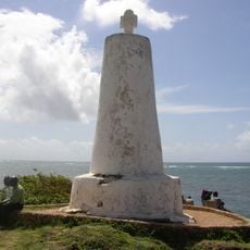
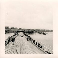
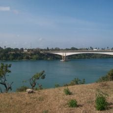
Athi-Galana-Sabaki River, Second longest river in Eastern Kenya.

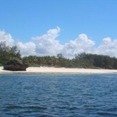
The Athi-Galana-Sabaki River runs about 390 kilometers from the Ngong Hills through changing landscapes until it reaches the Indian Ocean near Malindi. Along the way, it cuts through different zones ranging from drier highlands to greener lowland areas before meeting the sea.

The Maasai people named the upper section Em-pakasi, referring to the acacia trees that lined its banks during their early settlement of the area. This naming reflects how natural features shaped the language and culture of those who first inhabited the region.

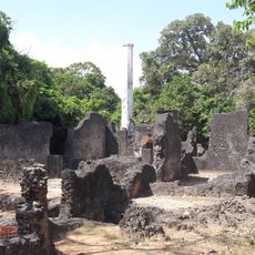
Multiple communities, including Swahili, Pokomo, and Mijikenda peoples, have historically depended on this waterway for fishing and farming practices that remain central to their daily lives. The river continues to shape how local groups organize their settlements and sustain themselves through agricultural activities.

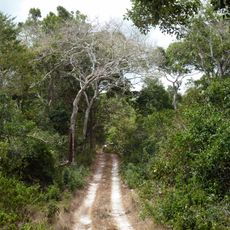
Visitors can explore different sections on foot or by boat, depending on the season and water conditions along the river. It is advisable to check water levels in advance and travel during drier months when access is easier.

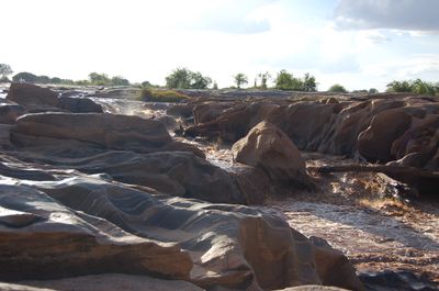
During rainy seasons, water levels can rise up to 10 meters in certain sections, turning the river into a murky yellow stream. This dramatic swelling is well known to locals and significantly affects their fishing and farming activities.

The community of curious travelers

AroundUs brings together thousands of curated places, local tips, and hidden gems, enriched daily by 60,000 contributors worldwide.

Start exploring
GPS coordinates
-3.15000,40.13333
Latest update
December 7, 2025 19:32
Reviews
Share your experience

No review yet

Discussions
Start a discussion...

No discussion yet

« Athi-Galana-Sabaki River - Second longest river in Eastern Kenya » is provided by Around Us (aroundus.com). Images and texts are derived from Wikimedia project under a Creative Commons license. You are allowed to copy, distribute, and modify copies of this page, under the conditions set by the license, as long as this note is clearly visible.

Discover hidden gems everywhere you go!

From secret cafés to breathtaking viewpoints, skip the crowded tourist spots and find places that match your style. Our app makes it easy with voice search, smart filtering, route optimization, and insider tips from travelers worldwide. Download now for the complete mobile experience.

Around Us App Screenshot

A unique approach to discovering new places

Le Figaro

All the places worth exploring

France Info

A tailor-made excursion in just a few clicks

20 Minutes

Around Us
Travel Guide & Maps
Download

Send to your phone

QR Code
1

Open the camera app on your mobile.

2

Point at the QR code with your camera. A notification will appear.

3

Tap the notification to open the link.