Chest opened
+${chestReward.xp} XP
Explorer
NOUVEAU ×${chestReward.collectible.quantity}
tapez pour fermer
Chest locked

Open chests in the app

Around Us is built for your phone — chests unlock when you walk, explore and capture nearby places.

Enable Location

We need your location to show you interesting places around you

Discover nearby places

Find interesting locations and hidden gems around you

Precise directions

Get accurate directions and distances to places

Your location is never shared with other users. It's only used when you tap the location button.

Mangyshlak Peninsula

Log in to your account

Start exploring — it's free

Trusted by 72,966 travelers worldwide

Continue with Google
Continue with Apple
or

We will send you a code to connect

By continuing, you accept our Terms and Conditions and our Privacy Policy

Check your inbox

We've sent a pincode in your inbox. Please enter the code below.

Mangyshlak Peninsula
Discussion Reviews 3 Photos
35.7k Popularity

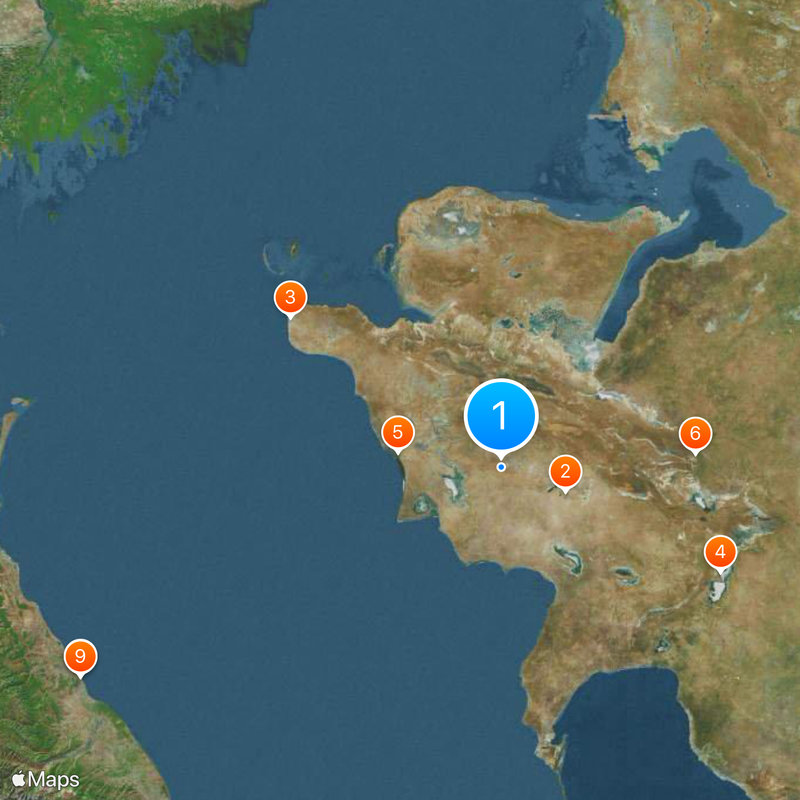
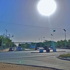
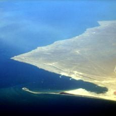
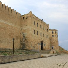
Mangyshlak Peninsula, Desert peninsula in western Kazakhstan.

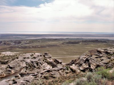
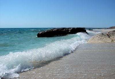
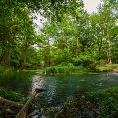
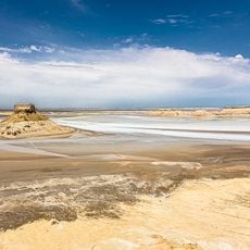
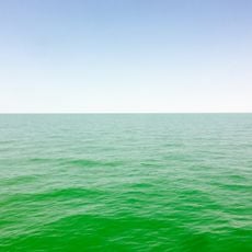
Mangyshlak Peninsula stretches along the eastern coast of the Caspian Sea with three mountain ranges featuring peaks up to 555 meters high. The land has no rivers or freshwater sources and experiences a dry continental climate.

The peninsula transferred from Turkestan ASSR to Kazakh ASSR in August 1920 following efforts by Kazakh activists seeking regional autonomy. This boundary shift reflected broader changes in how the region's administration was organized after the fall of the Russian Empire.

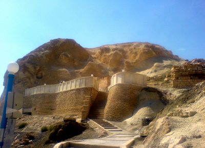
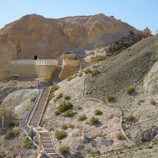
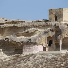
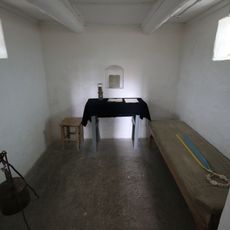
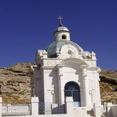
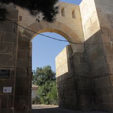
The peninsula holds underground mosques and meditation spaces carved into rock, showing how people have practiced their faith in this remote landscape. These sacred sites reflect the spiritual traditions that have endured here for generations.

The area is arid and sparsely populated, so bring plenty of water and supplies for your visit. Conditions are more comfortable during cooler months when intense heat does not limit your ability to explore.

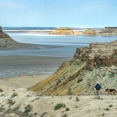
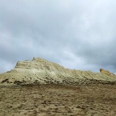
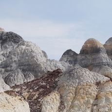
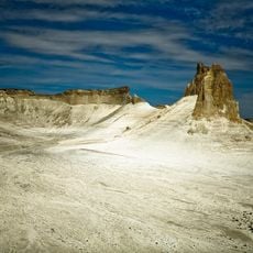
The Valley of Balls holds spherical rock formations left from the Jurassic period, shaped by natural erosion over time. Nearby, the Boszhira Tract displays white canyons formed by geological processes tied to ancient seas.

The community of curious travelers

AroundUs brings together thousands of curated places, local tips, and hidden gems, enriched daily by 60,000 contributors worldwide.

Start exploring
Location
GPS coordinates
43.50000,52.25000
Latest update
December 18, 2025 20:11
Around this place
Zhanaozen
Kazakhstan

Zhanaozen

52.1 km
Fort-Shevchenko
Kazakhstan

Fort-Shevchenko

195 km
Ustyurt Nature Reserve
Kazakhstan

Ustyurt Nature Reserve

184.8 km
BN-350 reactor
Kazakhstan

BN-350 reactor

78.9 km
Beket-Ata mosque
Kazakhstan

Beket-Ata mosque

147.2 km
Cidadela, cidade velha e fortificações de Derbent
Russian Federation

Cidadela, cidade velha e fortificações de Derbent

360.1 km
Cabin of Peter the Great
Russian Federation

Cabin of Peter the Great

359.9 km
Derbent Lighthouse
Russian Federation

Derbent Lighthouse

360.5 km
Shakpak-ata mosque
Kazakhstan

Shakpak-ata mosque

136.8 km
Church of the Intercession of the Holy Virgin of Derbent
Russian Federation

Church of the Intercession of the Holy Virgin of Derbent

360.4 km
Monument to Taras Shevchenko
Kazakhstan

Monument to Taras Shevchenko

89.3 km
Mangyshlak experimental Botanical Garden
Kazakhstan

Mangyshlak experimental Botanical Garden

89.4 km
Zhastar Stadium
Kazakhstan

Zhastar Stadium

90.8 km
Taras Shevchenko museum
Kazakhstan

Taras Shevchenko museum

194.4 km
Armenian Chapel, Fort-Shevchenko
Kazakhstan

Armenian Chapel, Fort-Shevchenko

194.9 km
Taras Shevchenko haykali (Fort-Shevchenko)
Kazakhstan

Taras Shevchenko haykali (Fort-Shevchenko)

194.2 km
Aktau-Buzachi State Zoological Nature Sanctuary
Kazakhstan

Aktau-Buzachi State Zoological Nature Sanctuary

140.6 km
State Nature Sanctuary Karakiya-Karakol (zoological)
Kazakhstan

State Nature Sanctuary Karakiya-Karakol (zoological)

39.8 km
Samursky National Park
Russian Federation

Samursky National Park

357.6 km
Boszhira Valley
Kazakhstan

Boszhira Valley

147.6 km
Zhabayushkan sanctuary
Kazakhstan

Zhabayushkan sanctuary

148.7 km
Бывшее здание гостиницы "Гранд-Отель" (Дербент)
Russian Federation

Бывшее здание гостиницы "Гранд-Отель" (Дербент)

360.2 km
Памятник воинам 345-й стрелковой дивизии (Дербент)
Russian Federation

Памятник воинам 345-й стрелковой дивизии (Дербент)

360.1 km
Kenderly-Kayasan State Reserved Zone
Kazakhstan

Kenderly-Kayasan State Reserved Zone

127.3 km
State Reserved Zone in Northern part of Caspian Sea
Kazakhstan

State Reserved Zone in Northern part of Caspian Sea

304.7 km
Дом купца Штурмана (Дербент)
Russian Federation

Дом купца Штурмана (Дербент)

360.6 km
El Faro Aquapark \ Nabran
Azerbaijan

El Faro Aquapark \ Nabran

349.5 km
Ворота «Дубары-Капы» (Дербент)
Russian Federation

Ворота «Дубары-Капы» (Дербент)

360 km
Show the full map
Reviews
Share your experience

No review yet

Discussions
Start a discussion...

No discussion yet

« Mangyshlak Peninsula - Desert peninsula in western Kazakhstan » is provided by Around Us (aroundus.com). Images and texts are derived from Wikimedia project under a Creative Commons license. You are allowed to copy, distribute, and modify copies of this page, under the conditions set by the license, as long as this note is clearly visible.

Discover hidden gems everywhere you go!

From secret cafés to breathtaking viewpoints, skip the crowded tourist spots and find places that match your style. Our app makes it easy with voice search, smart filtering, route optimization, and insider tips from travelers worldwide. Download now for the complete mobile experience.

Around Us App Screenshot

A unique approach to discovering new places

Le Figaro

All the places worth exploring

France Info

A tailor-made excursion in just a few clicks

20 Minutes

Around Us
Travel Guide & Maps
Download

Send to your phone

QR Code
1

Open the camera app on your mobile.

2

Point at the QR code with your camera. A notification will appear.

3

Tap the notification to open the link.