Enable Location

We need your location to show you interesting places around you

Discover nearby places

Find interesting locations and hidden gems around you

Precise directions

Get accurate directions and distances to places

Your location is never shared with other users. It's only used when you tap the location button.

Ust-Kamenogorsk Fortress

Log in to your account

Start exploring — it's free

Trusted by 62,479 travelers worldwide

Continue with Google
Continue with Apple
or

We will send you a code to connect

By continuing, you accept our Terms and Conditions and our Privacy Policy

Check your inbox

We've sent a pincode in your inbox. Please enter the code below.

Ust-Kamenogorsk Fortress

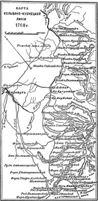
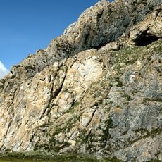
Ust-Kamenogorsk Fortress, Military fortress at the confluence of Irtysh and Ulba rivers, Kazakhstan.

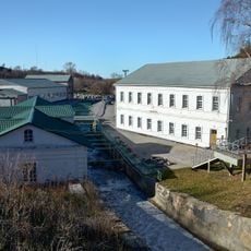
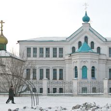
Ust-Kamenogorsk Fortress is a stone fortification at the confluence of the Irtysh and Ulba rivers that housed military barracks, a hospital, storerooms, and prison facilities within its defensive perimeter walls. The remaining structures still reveal how these different functional areas were organized within the defensive layout.

Commander Ivan Vasilievich Likharev built the fortress in 1720 under orders from Peter the Great while searching for gold deposits in the region. This establishment was part of Russia's strategy to strengthen its southern frontier in Siberia and establish control over new territories.

The fortress represents early Russian expansion into Central Asia and served as a military outpost that facilitated trade between Russia, Mongolia, and China. Visitors can still sense how this location functioned as a meeting point between different cultures and trade routes.

The site is relatively open for free exploration, allowing you to walk through and examine the remaining stone structures and their 18th-century Russian frontier architecture. It is best to visit during daylight hours and wear comfortable shoes, as the ground can be uneven in places.

This fortress marked the southernmost point of the Irtysh defensive line and later developed into the modern industrial city of Oskemen. The transformation from military outpost to populated city happened directly at this historical location.

The community of curious travelers

AroundUs brings together thousands of curated places, local tips, and hidden gems, enriched daily by 60,000 contributors worldwide.

Start exploring
Location
Inception
1720
GPS coordinates
49.93809,82.61947
Latest update
December 8, 2025 19:46
« Ust-Kamenogorsk Fortress - Military fortress at the confluence of Irtysh and Ulba rivers, Kazakhstan » is provided by Around Us (aroundus.com). Images and texts are derived from Wikimedia project under a Creative Commons license. You are allowed to copy, distribute, and modify copies of this page, under the conditions set by the license, as long as this note is clearly visible.

Discover hidden gems everywhere you go!

From secret cafés to breathtaking viewpoints, skip the crowded tourist spots and find places that match your style. Our app makes it easy with voice search, smart filtering, route optimization, and insider tips from travelers worldwide. Download now for the complete mobile experience.

Around Us App Screenshot

A unique approach to discovering new places

Le Figaro

All the places worth exploring

France Info

A tailor-made excursion in just a few clicks

20 Minutes

Around Us
Travel Guide & Maps
Download

Send to your phone

QR Code
1

Open the camera app on your mobile.

2

Point at the QR code with your camera. A notification will appear.

3

Tap the notification to open the link.