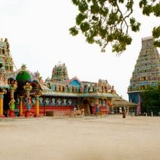
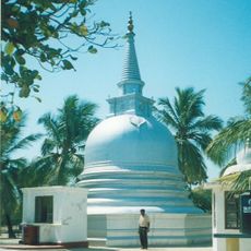
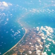
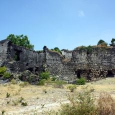
Mannar Island, Island in northwestern Sri Lanka.
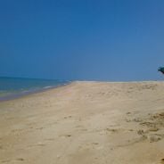
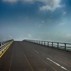
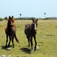
Mannar Island is a dry landmass covering around 130 square kilometers in northwestern Sri Lanka, connected to the mainland by a causeway. The land is marked by stretches of sand and vegetation scattered across a flat landscape.
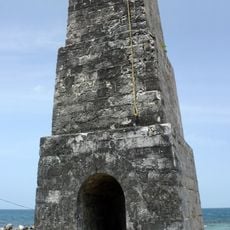
From 1914 to 1964, the island operated a rail and ferry connection that linked India with Colombo via Talaimannar and Dhanushkodi. This route served as a major transport link for people and goods across the region.
The Tamil name of this island means 'the raised place of sand', reflecting how the terrain was naturally formed over time. You can still see this sandy, flat character today as you walk across the land.
The island is easily reached by road via the causeway, and the flat landscape makes it straightforward to explore. Visitors should prepare for hot, dry weather and bring sun protection for their visit.
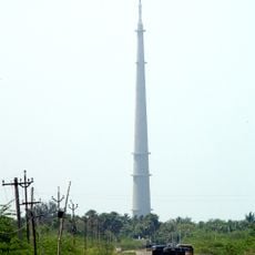
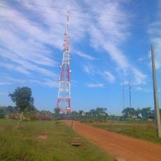
The island is home to the largest wind power facility in Sri Lanka, producing 100 megawatts of electricity for the national grid. This modern installation stands out dramatically against the windswept terrain and is a striking feature of the landscape.
Location: Mannar District
Capital city: Mannar
GPS coordinates: 9.05000,79.83333
Latest update: December 6, 2025 16:02
Sri Lanka holds remote beaches, ancient temples, and nature parks that few travelers visit. Kalpitiya Peninsula offers whale watching opportunities, while Mannar Island draws bird watchers throughout the year. Gal Oya National Park invites boat tours past forested shores, and old monasteries like...
Ramanathaswamy Temple
62.6 km
Sethusamudram Shipping Canal Project
31.9 km
Gulf of Mannar Marine National Park
40.8 km
Nainativu Nagapooshani Amman Temple
63.7 km
Shrine of Our Lady of Madhu
46.1 km
Rameswaram TV Tower
63.6 km
Jaffna Fort
70.8 km
Nagadeepa Purana Viharaya
63 km
Adam's Bridge Marine National Park
22.7 km
Delft Island Fort
57.2 km
Sangupiddy Bridge
70 km
Mannar Fort
12.4 km
Kokavil transmission tower
67.7 km
Delft National Park
51.9 km
Queen's Tower
48.9 km
St. Sebastian's Cathedral, Mannar
11.3 km
Pooneryn Fort
65.4 km
Talaimannar Lighthouse
12.9 km
Akkarayan Kulam
60.7 km
Giants Tank
30.5 km
Kakkarayan Kulam
64.7 km
Nallavillan Kulam
67.9 km
Pandivirichchan Kulam
51.8 km
Chalanpan Kulam
52.9 km
Kanthaudaiyarpuvarasan Kulam
67.3 km
Helambagas Wewa
67.7 km
Parappukkadanthankulam
28.3 km
Cheddi Kulam
68.4 kmVisited this place? Tap the stars to rate it and share your experience / photos with the community! Try now! You can cancel it anytime.
Discover hidden gems everywhere you go!
From secret cafés to breathtaking viewpoints, skip the crowded tourist spots and find places that match your style. Our app makes it easy with voice search, smart filtering, route optimization, and insider tips from travelers worldwide. Download now for the complete mobile experience.
A unique approach to discovering new places❞
— Le Figaro
All the places worth exploring❞
— France Info
A tailor-made excursion in just a few clicks❞
— 20 Minutes