Enable Location

We need your location to show you interesting places around you

Discover nearby places

Find interesting locations and hidden gems around you

Precise directions

Get accurate directions and distances to places

Your location is never shared with other users. It's only used when you tap the location button.

Schéissendëmpel

Log in to your account

Start exploring — it's free

Trusted by 63,326 travelers worldwide

Continue with Google
Continue with Apple
or

We will send you a code to connect

By continuing, you accept our Terms and Conditions and our Privacy Policy

Check your inbox

We've sent a pincode in your inbox. Please enter the code below.

Schéissendëmpel
Discussion Reviews 1 Photos 1 Collections
4.3k Popularity

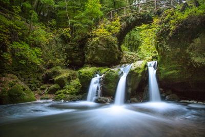
Schéissendëmpel, Natural waterfall in Mullerthal region, Luxembourg

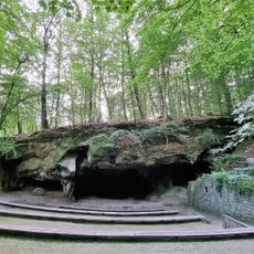
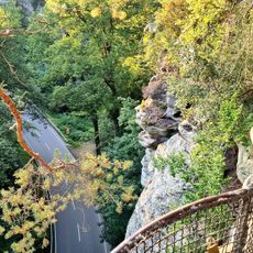
The Schéissendëmpel is a waterfall in the Mullerthal region that forms multiple cascades along the Black Ernz river, flowing between sandstone rock formations and dense forest vegetation. The water drops across different rock levels, creating a series of smaller pools as it descends.

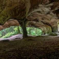
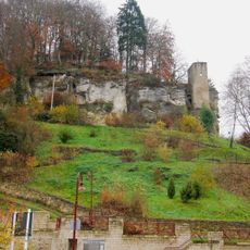
This area was shaped over millions of years through erosion processes that carved through the sandstone formations during the Triassic period. The continuous flow of the river gradually cut the rock layers, creating the cliff faces and pools visible today.

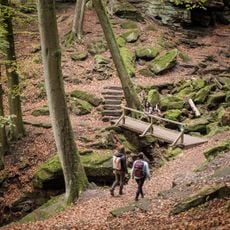
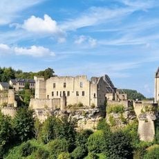
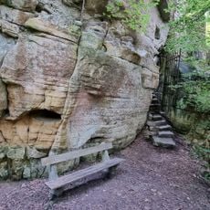
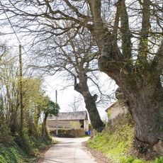
Local communities have built and maintained wooden paths and bridges around this spot, making it a central part of their outdoor recreation network. These structures show how the natural landscape has been woven into daily regional activities.

Access is through marked hiking trails W6 and W7, starting from the Tourist Center Heringer Millen or the parking area near Breidweiler bridge. The paths are well-marked, but the ground can be wet and slippery, especially after rain, so sturdy footwear is helpful.

A stone bridge crossing above the waterfall provides a symmetrical view of three separate water streams descending through different rock levels. This vantage point is particularly striking and offers a rare perspective on how the water divides across the formations.

The community of curious travelers

AroundUs brings together thousands of curated places, local tips, and hidden gems, enriched daily by 60,000 contributors worldwide.

Start exploring
Location
GPS coordinates
49.78510,6.29930
Latest update
December 6, 2025 17:42
Luxembourg's stone fortresses and hidden landscapes

Between the stone castles on the cliffs and the tunnels of abandoned mines, Luxembourg tells many years of its history.

Reviews
Share your experience

No review yet

Discussions
Start a discussion...

No discussion yet

« Schéissendëmpel - Natural waterfall in Mullerthal region, Luxembourg » is provided by Around Us (aroundus.com). Images and texts are derived from Wikimedia project under a Creative Commons license. You are allowed to copy, distribute, and modify copies of this page, under the conditions set by the license, as long as this note is clearly visible.

Discover hidden gems everywhere you go!

From secret cafés to breathtaking viewpoints, skip the crowded tourist spots and find places that match your style. Our app makes it easy with voice search, smart filtering, route optimization, and insider tips from travelers worldwide. Download now for the complete mobile experience.

Around Us App Screenshot

A unique approach to discovering new places

Le Figaro

All the places worth exploring

France Info

A tailor-made excursion in just a few clicks

20 Minutes

Around Us
Travel Guide & Maps
Download

Send to your phone

QR Code
1

Open the camera app on your mobile.

2

Point at the QR code with your camera. A notification will appear.

3

Tap the notification to open the link.