Enable Location

We need your location to show you interesting places around you

Discover nearby places

Find interesting locations and hidden gems around you

Precise directions

Get accurate directions and distances to places

Your location is never shared with other users. It's only used when you tap the location button.

Naga Hills

Log in to your account

Start exploring — it's free

Trusted by 70,041 travelers worldwide

Continue with Google
Continue with Apple
or

We will send you a code to connect

By continuing, you accept our Terms and Conditions and our Privacy Policy

Check your inbox

We've sent a pincode in your inbox. Please enter the code below.

Naga Hills
Discussion Reviews 1 Photos
19.6k Popularity

Naga Hills, Mountain range between India and Myanmar.

The Naga Hills form a mountain range spanning the India-Myanmar border, rising to approximately 3,800 meters and cloaked in thick forests throughout. The terrain features steep slopes and valleys that shape how the land appears and how communities have settled within it.

The British administration established the Naga Hills District in 1866, consolidating territories of different ethnic groups through systematic control that extended until 1910. This period shaped administrative patterns that continue to influence the region today.

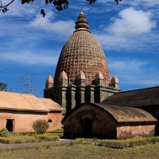
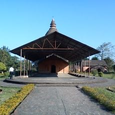
The Naga communities living in these mountains maintain distinct traditions visible in their villages, from local festivals to traditional crafts and architecture. You notice this cultural diversity when walking through settlements where each group follows its own customs and designs.

Heavy rainfall occurs throughout the year, creating lush vegetation and supporting diverse wildlife across the region. Visitors should expect wet conditions and slippery terrain, particularly during monsoon months, and prepare accordingly with proper footwear.

Near Pungro lies the Naga Hill Ophiolite Site, an unusual geological formation combining rocks from Earth's mantle and oceanic crust. This rare rock composition offers insight into how the region's geology was shaped by deeper earth processes.

The community of curious travelers

AroundUs brings together thousands of curated places, local tips, and hidden gems, enriched daily by 60,000 contributors worldwide.

Start exploring
Elevation above the sea
3,827 m
GPS coordinates
26.00000,95.00000
Latest update
December 7, 2025 10:07
Reviews
Share your experience

No review yet

Discussions
Start a discussion...

No discussion yet

« Naga Hills - Mountain range between India and Myanmar » is provided by Around Us (aroundus.com). Images and texts are derived from Wikimedia project under a Creative Commons license. You are allowed to copy, distribute, and modify copies of this page, under the conditions set by the license, as long as this note is clearly visible.

Discover hidden gems everywhere you go!

From secret cafés to breathtaking viewpoints, skip the crowded tourist spots and find places that match your style. Our app makes it easy with voice search, smart filtering, route optimization, and insider tips from travelers worldwide. Download now for the complete mobile experience.

Around Us App Screenshot

A unique approach to discovering new places

Le Figaro

All the places worth exploring

France Info

A tailor-made excursion in just a few clicks

20 Minutes

Around Us
Travel Guide & Maps
Download

Send to your phone

QR Code
1

Open the camera app on your mobile.

2

Point at the QR code with your camera. A notification will appear.

3

Tap the notification to open the link.