Aldan, Mining center in Aldansky District, Russia
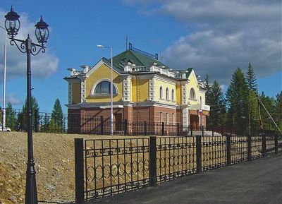
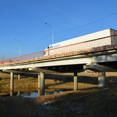
Aldan sits on the highlands at roughly 650 meters elevation and spreads across several valley zones between forested slopes. The built-up area follows the terrain contours with multistory residential blocks, administrative buildings, and industrial facilities along the main traffic routes.
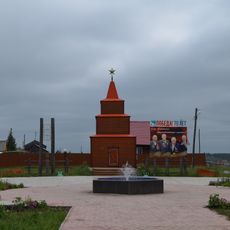
The settlement formed in 1923 under the name Nezametny after prospectors discovered gold in the region, and quickly grew into a supply center for miners. It gained city status in 1939 under its present name and remained the anchor point for the regional resource economy.
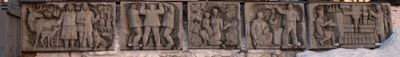
Russian and Yakut customs shape daily life, visible in regional dishes, handcraft traditions, and family gatherings. The mining heritage connects generations and shapes local identity through shared stories and experiences.
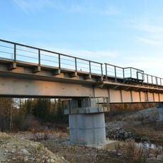
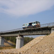
Access is provided by the A360 highway or the regional airport, which connects the city to larger centers. Sturdy clothing and winter gear are advisable year-round due to extreme temperature swings and subarctic conditions.
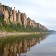
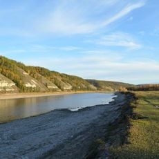
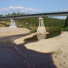
Gold extraction takes place both in open pits and through river dredging operations, whose scale becomes visible from satellite perspective. The soil discoloration and digging traces document over a century of mineral prospecting in the surrounding river channels.
Location: Aldansky District
Inception: 1924
Elevation above the sea: 650 m
GPS coordinates: 58.60000,125.38333
Latest update: December 5, 2025 16:36
Lena Pillars
300.2 km
Highland of Aldan
115.2 km
Olyokma Nature Reserve
181.2 km
Lake Bolshoye Toko
435.1 km
Сиреневый Камень
368.1 km
Buotama
261.4 km
Tokinsko-Stanovoy National Park
439 km
Kyuryulyur
389.4 km
Памятник воинам-землякам, погибшим в годы Великой Отечественной войны (Томмот)
66.1 km
Мемориал Славы (Нерюнгри)
219.6 km
Памятник И. Н. Кульбертинову (Олёкминск)
343.3 km
Памятник воинам-землякам, участникам Великой Отечественной войны (Петровка, Якутия)
440.9 km
Памятник-часовня (Петровка)
440.9 km
Orthodox church of the New Martyrs and Confessors of Russia in Aldan
1.6 km
Railway bridge through Myla river
429.5 km
Road bridge over Aldan River in Tommot
65.9 km
Railway bridge through Amga river in Verkhnyaya Amga
153.2 km
Railway bridge through Aldan river in Tommot
66 km
Road bridge over Amga River in Verkhnyaya Amga
153.1 km
Railway bridge through Lyutenge river
332.5 km
Turuk Khaya Rocks
381.9 km
Railway bridge through Kirim river
359.3 km
Railway bridge through Menda river
391.8 km
Rail bridge over Ulu river
223 km
Railway bridge through Ulakhan-Taryng river
403.3 km
Railway bridge through Tamma river
424 km
Railway bridge through Lyutenge river
380 km
Road bridge over Ulu River in Ulu
223.1 kmVisited this place? Tap the stars to rate it and share your experience / photos with the community! Try now! You can cancel it anytime.
Discover hidden gems everywhere you go!
From secret cafés to breathtaking viewpoints, skip the crowded tourist spots and find places that match your style. Our app makes it easy with voice search, smart filtering, route optimization, and insider tips from travelers worldwide. Download now for the complete mobile experience.
A unique approach to discovering new places❞
— Le Figaro
All the places worth exploring❞
— France Info
A tailor-made excursion in just a few clicks❞
— 20 Minutes