
Neryungrinsky District, Municipal district in Sakha Republic, Russia.
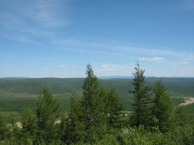
Neryungrinsky District is a municipal area in southern Sakha with mountains and forests spread across its territory. The region is defined by the Toko-Stanovik mountain range and contains valuable mineral deposits.
The district was established in November 1975 as a way to develop mineral resources in southern Sakha. Coal deposits became the main driver of growth and settlement in the region.
The population here includes Russians, Ukrainians, Yakuts, Buryats, and Evenks, whose languages and traditions shape local life. You can see their influence in place names and how communities use the land.
The area is connected through the Amur-Yakutsk Mainline railway and Lena Highway, making travel and transport possible across the region. The mountain terrain and climate require planning ahead for any visit.
Lake Bolshoye Toko sits in the eastern part of the district and happens to be the deepest lake in Yakutia. This natural body of water stands out for its extraordinary depth.
Location: Sakha
Inception: 1975
Capital city: Neryungri
Website: http://neruadmin.ru
GPS coordinates: 56.65833,124.72500
Latest update: December 7, 2025 20:42

Chara Sands
401.7 km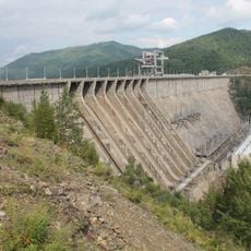
Zeya Dam
360.8 km
Highland of Aldan
104.8 km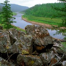
Olyokma Nature Reserve
266.5 km
Zeya Nature Reserve
343.7 km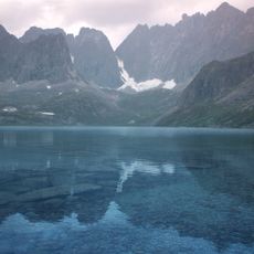
Vitim Nature Reserve
484.4 km
Lake Bolshoye Toko
385.7 km
Pik BAM
436.6 km
Kodar National Park
437.2 km
Сиреневый Камень
386.1 km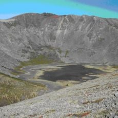
Aku Volcano
450.2 km
Udokan Plateau
429.6 km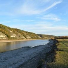
Buotama
479.3 km
Tokinsko-Stanovoy National Park
353.6 km
Памятник воинам-землякам, погибшим в годы Великой Отечественной войны (Томмот)
273.7 km
Ayachi, Amur Oblast
345.1 km
Текан (Амурська область)
345.8 km
Мемориал Славы (Нерюнгри)
1.4 km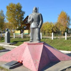
Памятник И. Н. Кульбертинову (Олёкминск)
483.4 km
Ягодний (Амурська область)
344.2 km
Orthodox church of the New Martyrs and Confessors of Russia in Aldan
221.3 km
Road bridge over Aldan River in Tommot
272.8 km
Gora Burgalenzha
499.4 km
Railway bridge through Aldan river in Tommot
273 km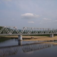
Railway bridge through Amga river in Verkhnyaya Amga
361.4 km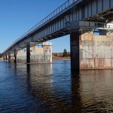
Road bridge over Amga River in Verkhnyaya Amga
361.2 km
Gora Yuzhnyy Krest
490.8 km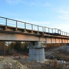
Rail bridge over Ulu river
436.2 kmVisited this place? Tap the stars to rate it and share your experience / photos with the community! Try now! You can cancel it anytime.
Discover hidden gems everywhere you go!
From secret cafés to breathtaking viewpoints, skip the crowded tourist spots and find places that match your style. Our app makes it easy with voice search, smart filtering, route optimization, and insider tips from travelers worldwide. Download now for the complete mobile experience.

A unique approach to discovering new places❞
— Le Figaro
All the places worth exploring❞
— France Info
A tailor-made excursion in just a few clicks❞
— 20 Minutes