Chest opened
+${chestReward.xp} XP
Explorer
NOUVEAU ×${chestReward.collectible.quantity}
tapez pour fermer
Chest locked

Open chests in the app

Around Us is built for your phone — chests unlock when you walk, explore and capture nearby places.

Enable Location

We need your location to show you interesting places around you

Discover nearby places

Find interesting locations and hidden gems around you

Precise directions

Get accurate directions and distances to places

Your location is never shared with other users. It's only used when you tap the location button.

Kizlyarsky District

Log in to your account

Start exploring — it's free

Trusted by 72,966 travelers worldwide

Continue with Google
Continue with Apple
or

We will send you a code to connect

By continuing, you accept our Terms and Conditions and our Privacy Policy

Check your inbox

We've sent a pincode in your inbox. Please enter the code below.

Discussion Reviews 1 Photos
16.4k Popularity

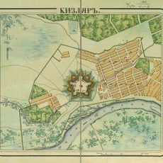
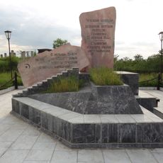
Kizlyarsky District, Administrative district in northern Dagestan, Russia

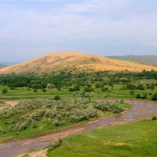
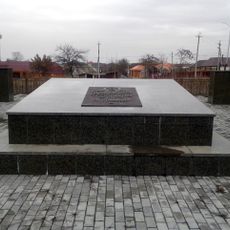
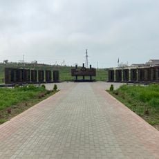
Kizlyarsky District is an administrative division in northern Dagestan that covers a large rural area containing numerous settlements and villages. The district is organized into smaller administrative units, each serving its own communities.

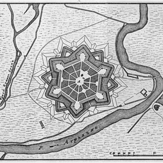
This administrative district was established in the early 20th century during a period of broad administrative reorganization in the North Caucasus region. Its formation was part of larger changes to the Soviet administrative structure.

The district maintains multiple rural communities across nineteen selsoviets, representing the diverse ethnic populations characteristic of the Dagestan republic.

This region is largely rural and best explored through local roads, with most visitors traveling through the area's administrative center. It is wise to prepare for limited local services and plan for a degree of self-sufficiency.

The district combines both municipal and administrative functions while operating independently from its capital city, creating a distinct governance structure.

The community of curious travelers

AroundUs brings together thousands of curated places, local tips, and hidden gems, enriched daily by 60,000 contributors worldwide.

Start exploring
Location
Inception
November 22, 1928
Capital city
Kizlyar
GPS coordinates
43.85000,46.71667
Latest update
December 7, 2025 19:27
Around this place
Sulak Canyon
Russian Federation

Sulak Canyon

94 km
Chirkey Dam
Russian Federation

Chirkey Dam

98 km
Aymani Kadyrova Mosque
Russian Federation

Aymani Kadyrova Mosque

91.4 km
Dagestan Nature Reserve
Russian Federation

Dagestan Nature Reserve

67.5 km
Chirkey Reservoir
Russian Federation

Chirkey Reservoir

99.3 km
Church of the Theotokos of the Sign
Russian Federation

Church of the Theotokos of the Sign

68.2 km
Fortress of the Holy Cross
Russian Federation

Fortress of the Holy Cross

64.8 km
Grozny Russian Dramatic Theatre M. J. Lermontov
Russian Federation

Grozny Russian Dramatic Theatre M. J. Lermontov

99.7 km
Kizlyar Fortress
Russian Federation

Kizlyar Fortress

705 m
Chechen Lighthouse
Russian Federation

Chechen Lighthouse

75.2 km
Sultan Delimkhanov Mosque
Russian Federation

Sultan Delimkhanov Mosque

83.2 km
Memorial to the Victims of the Deportation of 1944
Russian Federation

Memorial to the Victims of the Deportation of 1944

101 km
Kurchaloy Mosque
Russian Federation

Kurchaloy Mosque

87.9 km
Крестовоздвиженский монастырь (Кизляр)
Russian Federation

Крестовоздвиженский монастырь (Кизляр)

2 km
Leo Tolstoy museum
Russian Federation

Leo Tolstoy museum

33.5 km
Monument to the Victims of Stalinism Chechens Akkin
Russian Federation

Monument to the Victims of Stalinism Chechens Akkin

78 km
Geldegan Mosque
Russian Federation

Geldegan Mosque

89.4 km
Oyskhara Mosque
Russian Federation

Oyskhara Mosque

76 km
Gerzel-aul
Russian Federation

Gerzel-aul

72.2 km
Айдамиров Абузаран Литературин-мемориалан музей
Russian Federation

Айдамиров Абузаран Литературин-мемориалан музей

81.9 km
Avtury Mosque
Russian Federation

Avtury Mosque

95.7 km
Школа языков имени Дени Арсанова
Russian Federation

Школа языков имени Дени Арсанова

100.6 km
Mass grave of the Red Army soldiers who died during the 100-Day Battles
Russian Federation

Mass grave of the Red Army soldiers who died during the 100-Day Battles

101 km
Мемориальный комплекс участникам ВОВ
Russian Federation

Мемориальный комплекс участникам ВОВ

78 km
Mayrtup Cuma Mosque
Russian Federation

Mayrtup Cuma Mosque

85.9 km
Горячеводский редут
Russian Federation

Горячеводский редут

88.6 km
Yurd-Aux məscidi
Russian Federation

Yurd-Aux məscidi

87.7 km
Аквапарк
Russian Federation

Аквапарк

74.7 km
Show the full map
Reviews
Share your experience

No review yet

Discussions
Start a discussion...

No discussion yet

« Kizlyarsky District - Administrative district in northern Dagestan, Russia » is provided by Around Us (aroundus.com). Images and texts are derived from Wikimedia project under a Creative Commons license. You are allowed to copy, distribute, and modify copies of this page, under the conditions set by the license, as long as this note is clearly visible.

Discover hidden gems everywhere you go!

From secret cafés to breathtaking viewpoints, skip the crowded tourist spots and find places that match your style. Our app makes it easy with voice search, smart filtering, route optimization, and insider tips from travelers worldwide. Download now for the complete mobile experience.

Around Us App Screenshot

A unique approach to discovering new places

Le Figaro

All the places worth exploring

France Info

A tailor-made excursion in just a few clicks

20 Minutes

Around Us
Travel Guide & Maps
Download

Send to your phone

QR Code
1

Open the camera app on your mobile.

2

Point at the QR code with your camera. A notification will appear.

3

Tap the notification to open the link.