Enable Location

We need your location to show you interesting places around you

Discover nearby places

Find interesting locations and hidden gems around you

Precise directions

Get accurate directions and distances to places

Your location is never shared with other users. It's only used when you tap the location button.

Nyrob

Log in to your account

Start exploring — it's free

Trusted by 63,117 travelers worldwide

Continue with Google
Continue with Apple
or

We will send you a code to connect

By continuing, you accept our Terms and Conditions and our Privacy Policy

Check your inbox

We've sent a pincode in your inbox. Please enter the code below.

Discussion Reviews 1 Photos
12.1k Popularity

Nyrob, Urban settlement in Perm Krai, Russia

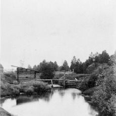
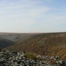
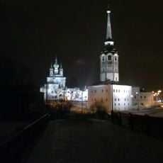
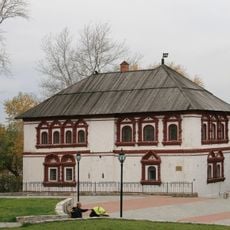
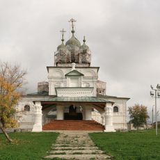
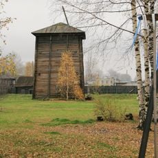
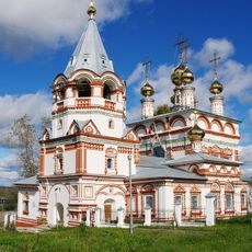
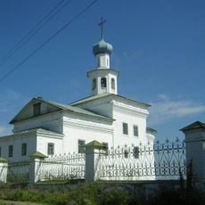
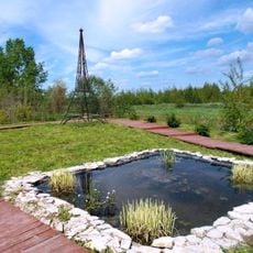
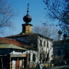
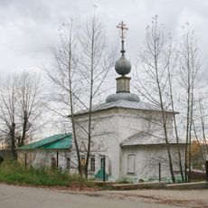
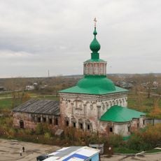
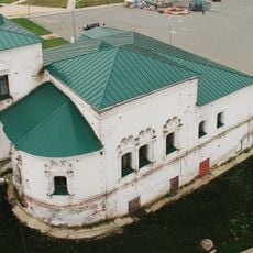
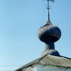
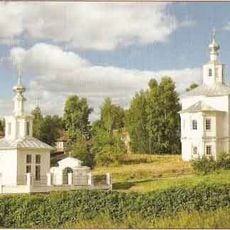
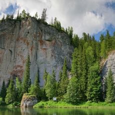
Nyrob is an urban-type settlement in Perm Krai in northwestern Russia, located within a forested mountain area of the Urals. The community is modest in size and functions as a local administrative center in this remote region.

The settlement was part of larger administrative territories that governed the Ural region for centuries before political boundaries shifted during the 20th century. The administrative reorganizations of that era determined its current role as a local center.

The settlement's name has roots in local indigenous languages of the region, reflecting centuries of habitation in these northern forests. Residents understand their home through this linguistic connection to the Ural area.

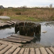
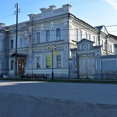
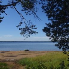
Visitors will find a small functioning community with basic everyday infrastructure in a northern, forest-covered area. Access is limited since it sits far from larger cities and transportation connections depend on regional routes.

The settlement represents a specific Soviet classification system for communities that were neither purely rural villages nor full cities, but rather something in between. This system of settlement categories remains visible in Russia today and shapes how smaller places like this are organized.

The community of curious travelers

AroundUs brings together thousands of curated places, local tips, and hidden gems, enriched daily by 60,000 contributors worldwide.

Start exploring
GPS coordinates
60.73944,56.72361
Latest update
December 7, 2025 20:47
Around this place
Pechora-Ilych Nature Reserve
Russian Federation

Pechora-Ilych Nature Reserve

82.5 km
Vetlan Rock
Russian Federation

Vetlan Rock

35.6 km
Polyudov Kamen
Russian Federation

Polyudov Kamen

32.5 km
Northern Catherine Canal
Russian Federation

Northern Catherine Canal

94.5 km
Kvarkush
Russian Federation

Kvarkush

125.1 km
Synagogue in Yekaterinburg
Russian Federation

Synagogue in Yekaterinburg

15.6 km
Lyudmila's Well, Solikamsk
Russian Federation

Lyudmila's Well, Solikamsk

120.4 km
Bell Tower, Solikamsk
Russian Federation

Bell Tower, Solikamsk

121.2 km
Voivode House, Solikamsk
Russian Federation

Voivode House, Solikamsk

121.1 km
Holy Trinity Church
Russian Federation

Holy Trinity Church

121.3 km
Ust-Borovaya Saltworks
Russian Federation

Ust-Borovaya Saltworks

114.6 km
Church of the Epiphany, Solikamsk
Russian Federation

Church of the Epiphany, Solikamsk

121.1 km
Cherdyn museum
Russian Federation

Cherdyn museum

39.9 km
John the Theologian monastery
Russian Federation

John the Theologian monastery

39.1 km
Lake Nyukhti
Russian Federation

Lake Nyukhti

66.7 km
Transfiguration Church, Solikamsk
Russian Federation

Transfiguration Church, Solikamsk

121.7 km
Saint Nicholas Church, Nyrob
Russian Federation

Saint Nicholas Church, Nyrob

612 m
Transfiguration Church in Transfiguration Monastery, Solikamsk
Russian Federation

Transfiguration Church in Transfiguration Monastery, Solikamsk

121 km
Church of the Nativity of John the Baptist, Solikamsk
Russian Federation

Church of the Nativity of John the Baptist, Solikamsk

122.5 km
Мемориальный ботанический сад Г. А. Демидова
Russian Federation

Мемориальный ботанический сад Г. А. Демидова

120 km
Russian Federation

Соликамский кремль

121.6 km
Saint Michael Church, Solikamsk
Russian Federation

Saint Michael Church, Solikamsk

121.6 km
Holy Myrrhbearers Church, Solikamsk
Russian Federation

Holy Myrrhbearers Church, Solikamsk

120.8 km
Church of the Exaltation of the Cross, Solikamsk
Russian Federation

Church of the Exaltation of the Cross, Solikamsk

121.2 km
Church of the Resurrection of Jesus Christ in Solikamsk
Russian Federation

Church of the Resurrection of Jesus Christ in Solikamsk

121.3 km
Church of the Entry of the Theotokos into the Temple, Solikamsk
Russian Federation

Church of the Entry of the Theotokos into the Temple, Solikamsk

121 km
Church of the Dormition
Russian Federation

Church of the Dormition

39.9 km
Varysh Rock on the Beryozovaya River
Russian Federation

Varysh Rock on the Beryozovaya River

66.4 km
Show the full map
Reviews
Share your experience

No review yet

Discussions
Start a discussion...

No discussion yet

« Nyrob - Urban settlement in Perm Krai, Russia » is provided by Around Us (aroundus.com). Images and texts are derived from Wikimedia project under a Creative Commons license. You are allowed to copy, distribute, and modify copies of this page, under the conditions set by the license, as long as this note is clearly visible.

Discover hidden gems everywhere you go!

From secret cafés to breathtaking viewpoints, skip the crowded tourist spots and find places that match your style. Our app makes it easy with voice search, smart filtering, route optimization, and insider tips from travelers worldwide. Download now for the complete mobile experience.

Around Us App Screenshot

A unique approach to discovering new places

Le Figaro

All the places worth exploring

France Info

A tailor-made excursion in just a few clicks

20 Minutes

Around Us
Travel Guide & Maps
Download

Send to your phone

QR Code
1

Open the camera app on your mobile.

2

Point at the QR code with your camera. A notification will appear.

3

Tap the notification to open the link.