Enable Location

We need your location to show you interesting places around you

Discover nearby places

Find interesting locations and hidden gems around you

Precise directions

Get accurate directions and distances to places

Your location is never shared with other users. It's only used when you tap the location button.

Sipaliwini District

Log in to your account

Start exploring — it's free

Trusted by 62,834 travelers worldwide

Continue with Google
Continue with Apple
or

We will send you a code to connect

By continuing, you accept our Terms and Conditions and our Privacy Policy

Check your inbox

We've sent a pincode in your inbox. Please enter the code below.

Sipaliwini District

Sipaliwini District, Administrative district in southern Suriname

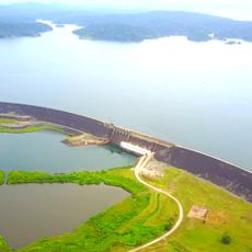
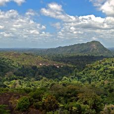
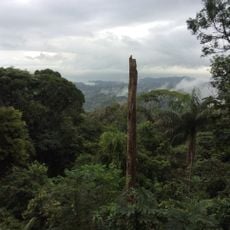
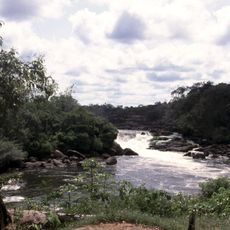
Sipaliwini District is an administrative region in southern Suriname composed mainly of rainforest, mountains, and savannas. The territory covers a vast area and shares a border with Brazil.

The district was created in 1983 and is the youngest and largest administrative region in the country. It came into being through the redistribution of territories from other regions.

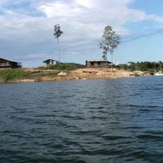
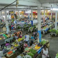
Indigenous peoples and Maroon communities live in riverside villages and speak their own languages. Visitors can observe how these communities maintain their traditions through daily life and customs.

Access depends heavily on small aircraft landing at local airstrips and river travel through extensive waterways. Visitors should prepare for limited infrastructure before venturing into the district's interior.

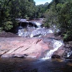
The district contains a large nature reserve of rainforest that has held UNESCO recognition since 2000. This reserve protects an untouched ecosystem with rare wildlife and plant species.

The community of curious travelers

AroundUs brings together thousands of curated places, local tips, and hidden gems, enriched daily by 60,000 contributors worldwide.

Start exploring
Location
Shares border with
Nickerie District, Coronie District, Saramacca District, Para District, Brokopondo District, Marowijne District, arrondissement of Saint-Laurent-du-Maroni, Amapá, Pará, East Berbice-Corentyne
GPS coordinates
3.77694,-56.02778
Latest update
December 7, 2025 20:40
« Sipaliwini District - Administrative district in southern Suriname » is provided by Around Us (aroundus.com). Images and texts are derived from Wikimedia project under a Creative Commons license. You are allowed to copy, distribute, and modify copies of this page, under the conditions set by the license, as long as this note is clearly visible.

Discover hidden gems everywhere you go!

From secret cafés to breathtaking viewpoints, skip the crowded tourist spots and find places that match your style. Our app makes it easy with voice search, smart filtering, route optimization, and insider tips from travelers worldwide. Download now for the complete mobile experience.

Around Us App Screenshot

A unique approach to discovering new places

Le Figaro

All the places worth exploring

France Info

A tailor-made excursion in just a few clicks

20 Minutes

Around Us
Travel Guide & Maps
Download

Send to your phone

QR Code
1

Open the camera app on your mobile.

2

Point at the QR code with your camera. A notification will appear.

3

Tap the notification to open the link.