Enable Location

We need your location to show you interesting places around you

Discover nearby places

Find interesting locations and hidden gems around you

Precise directions

Get accurate directions and distances to places

Your location is never shared with other users. It's only used when you tap the location button.

King William County

Log in to your account

Start exploring — it's free

Trusted by 61,979 travelers worldwide

Continue with Google
Continue with Apple
or

We will send you a code to connect

By continuing, you accept our Terms and Conditions and our Privacy Policy

Check your inbox

We've sent a pincode in your inbox. Please enter the code below.

King William County, Administrative county in Virginia, US

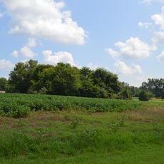
King William County is an administrative county in Virginia that lies between the Mattaponi River to the north and the Pamunkey River to the south. These two rivers converge and form the York River at West Point, defining the geography of the region.

The county was formed in 1702 from the territory of King and Queen County and took its name from King William III of England. Boundary adjustments in 1720 and 1727 shaped its current borders.

The name comes from King William III of England, and this royal connection remains part of how locals understand their region. Place names and local institutions reflect this historical tie to the English crown.

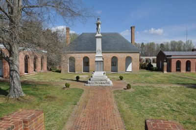
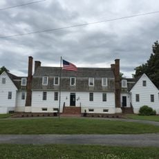
The historic courthouse, built in 1725, remains the center of local government and provides access to public records for residents and researchers. Visitors should know that past losses mean some records may be incomplete or need alternative sources.

A fire in 1885 destroyed many of the county's records, and British forces also eliminated the 1810 census data. Genealogists now rely on tax records and other documents to trace family histories and compensate for these losses.

The community of curious travelers

AroundUs brings together thousands of curated places, local tips, and hidden gems, enriched daily by 60,000 contributors worldwide.

Start exploring
Location
Inception
1702
Capital city
King William
Shares border with
King and Queen County, New Kent County, Caroline County, Hanover County
GPS coordinates
37.70660,-77.08839
Latest update
December 7, 2025 10:07
Around this place
Show the full map
« King William County - Administrative county in Virginia, US » is provided by Around Us (aroundus.com). Images and texts are derived from Wikimedia project under a Creative Commons license. You are allowed to copy, distribute, and modify copies of this page, under the conditions set by the license, as long as this note is clearly visible.

Discover hidden gems everywhere you go!

From secret cafés to breathtaking viewpoints, skip the crowded tourist spots and find places that match your style. Our app makes it easy with voice search, smart filtering, route optimization, and insider tips from travelers worldwide. Download now for the complete mobile experience.

Around Us App Screenshot

A unique approach to discovering new places

Le Figaro

All the places worth exploring

France Info

A tailor-made excursion in just a few clicks

20 Minutes

Around Us
Travel Guide & Maps
Download

Send to your phone

QR Code
1

Open the camera app on your mobile.

2

Point at the QR code with your camera. A notification will appear.

3

Tap the notification to open the link.