Enable Location

We need your location to show you interesting places around you

Discover nearby places

Find interesting locations and hidden gems around you

Precise directions

Get accurate directions and distances to places

Your location is never shared with other users. It's only used when you tap the location button.

Wood County

Log in to your account

Start exploring — it's free

Trusted by 61,471 travelers worldwide

Continue with Google
Continue with Apple
or

We will send you a code to connect

By continuing, you accept our Terms and Conditions and our Privacy Policy

Check your inbox

We've sent a pincode in your inbox. Please enter the code below.

Wood County, County seat in northwestern Ohio, United States.

Description

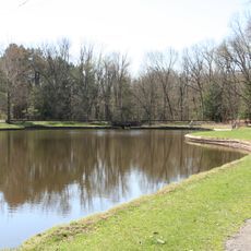
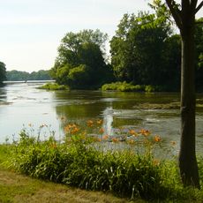
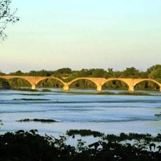
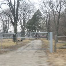
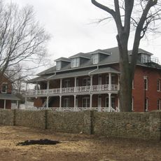
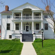
Wood County is an administrative division in northwestern Ohio featuring a blend of urban centers, farmland, and natural areas along the Maumee River. The region spans agricultural land and developed areas, with different landscapes and environments throughout.

History

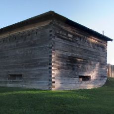
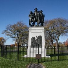
The county was established in 1820 and named after Captain Eleazer D. Wood, an engineer who built Fort Meigs during the War of 1812. This naming reflects the region's connection to early American military construction and defense efforts.

Culture

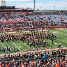
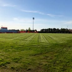
Bowling Green State University shapes the cultural life of the area through its arts programs, sports teams, and community events that draw people together. Students and visitors gather in the campus spaces and cultural venues that influence how the region develops.

Practical

Visitors can use the Wood County District Public Library system, which maintains multiple branches with extensive collections throughout the area. These libraries offer educational programs and serve as good starting points for learning about the region.

Did you know?

First Solar operates one of the largest solar panel manufacturing facilities in the United States in this area. The production site demonstrates the region's role in renewable energy industries and modern economic development.

Location
Inception
February 12, 1820
Capital city
Bowling Green
Reference
WOO
Shares border with
Lucas County, Ottawa County, Sandusky County, Seneca County, Hancock County, Putnam County, Henry County
GPS coordinates
41.36000,-83.62000
Latest update
December 20, 2025 14:26

AroundUs brings together thousands of curated places, local tips, and hidden gems, enriched daily by 60,000 contributors worldwide. Discover all places nearby (Ohio).

Around this place
Toledo Zoo
United States of America

Toledo Zoo

29 km
Doyt Perry Stadium
United States of America

Doyt Perry Stadium

2 km
Fort Meigs
United States of America

Fort Meigs

21.6 km
Fort Miami
United States of America

Fort Miami

23.7 km
Oak Openings Preserve Metropark
United States of America

Oak Openings Preserve Metropark

29.1 km
Slater Family Ice Arena
United States of America

Slater Family Ice Arena

2.2 km
Stranahan Theater
United States of America

Stranahan Theater

26 km
Fallen Timbers Battlefield
United States of America

Fallen Timbers Battlefield

21.5 km
Mary Jane Thurston State Park
United States of America

Mary Jane Thurston State Park

22.2 km
Farnsworth Metropark
United States of America

Farnsworth Metropark

17 km
United States of America

Side Cut Metropark

22.1 km
Islamic Center of Greater Toledo
United States of America

Islamic Center of Greater Toledo

18.7 km
Battle of Fallen Timbers Monument
United States of America

Battle of Fallen Timbers Monument

21.4 km
Interurban Bridge
United States of America

Interurban Bridge

16.7 km
United States of America

Providence Metropark

20.9 km
United States of America

Swan Creek Preserve Metropark

28.6 km
Wood County Courthouse and Jail
United States of America

Wood County Courthouse and Jail

3 km
Dodge Site
United States of America

Dodge Site

16.5 km
Wood County Museum
United States of America

Wood County Museum

1.1 km
Hull-Wolcott House
United States of America

Hull-Wolcott House

23.7 km
United States of America

Lucas County Recreation Center

25.2 km
Cornerstone Church
United States of America

Cornerstone Church

25.4 km
Mickey Cochrane Stadium
United States of America

Mickey Cochrane Stadium

2.2 km
Governor's Inn
United States of America

Governor's Inn

22.9 km
U.S. Post Office
United States of America

U.S. Post Office

3.3 km
United States of America

National Construction Equipment Museum

8.6 km
United States of America

Blue Creek Conservation Area

21.9 km
Rossford Public Library
United States of America

Rossford Public Library

28.1 km
Show the full map
« Wood County - County seat in northwestern Ohio, United States » is provided by Around Us (aroundus.com). Images and texts are derived from Wikimedia project under a Creative Commons license. You are allowed to copy, distribute, and modify copies of this page, under the conditions set by the license, as long as this note is clearly visible.

Discover hidden gems everywhere you go!

From secret cafés to breathtaking viewpoints, skip the crowded tourist spots and find places that match your style. Our app makes it easy with voice search, smart filtering, route optimization, and insider tips from travelers worldwide. Download now for the complete mobile experience.

Around Us App Screenshot

A unique approach to discovering new places

Le Figaro

All the places worth exploring

France Info

A tailor-made excursion in just a few clicks

20 Minutes

Around Us
Travel Guide & Maps
Download

Send to your phone

QR Code
1

Open the camera app on your mobile.

2

Point at the QR code with your camera. A notification will appear.

3

Tap the notification to open the link.