Rhea County

Log in to your account

AroundUs is a community-driven map of interesting places, built by curious explorers like you. It grows with every review, story, and photo you share.
Connect to save your favorite spots, contribute locations, and create personalized routes.
By continuing, you accept our Terms and Conditions and our Privacy Policy
Add to collection
Map
Suggest a change
Share

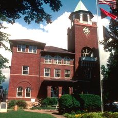
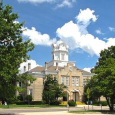
Rhea County, County seat in eastern Tennessee, United States

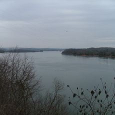
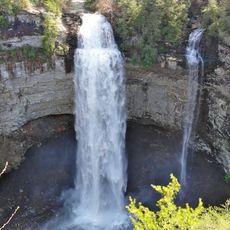
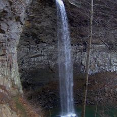
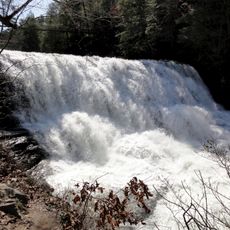
Rhea County is an administrative division in eastern Tennessee situated between the Tennessee River and Walden Ridge. The area spans approximately 336 square miles of land and water.

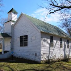
The county was established in 1807 and named after John Rhea, a politician and veteran of the American Revolutionary War. The area became an important part of Tennessee's early development during the nation's formative years.

The Rhea County Extension Office provides agricultural education, family sciences programs, and youth development initiatives throughout the year for local residents.

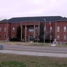
Visitors can contact the County Election Commission office in Dayton for information on voter services and local administration. The central location provides convenient access for residents and travelers seeking government services.

During the Civil War in 1862, an unusual all-female cavalry unit called the Rhea County Spartans formed in the area. This group represented a rare exception among armed formations of that era.

Location: Tennessee

Inception: 1807

Capital city: Dayton

Shares border with: Cumberland County, Roane County, Meigs County, Hamilton County, Bledsoe County

Website: http://rheacountytn.com

GPS coordinates: 35.61000,-84.92000

Latest update: December 7, 2025 10:06

Photos
Around this place
Show the full map
Fall Creek Falls State Park
United States of America

Fall Creek Falls State Park

39.3 km
Watts Bar Lake
United States of America

Watts Bar Lake

12.6 km
Fall Creek Falls
United States of America

Fall Creek Falls

39.9 km
Cumberland Mountain State Park
United States of America

Cumberland Mountain State Park

33.1 km
Ozone Falls State Natural Area
United States of America

Ozone Falls State Natural Area

31.7 km
Cumberland Homesteads
United States of America

Cumberland Homesteads

33.4 km
Ozone Falls
United States of America

Ozone Falls

31.4 km
Rhea County Courthouse
United States of America

Rhea County Courthouse

15.3 km
Cane Creek Falls
United States of America

Cane Creek Falls

39.4 km
Laurel-Snow State Natural Area
United States of America

Laurel-Snow State Natural Area

13.1 km
Palace Theater
United States of America

Palace Theater

38.7 km
Rockhouse Falls
United States of America

Rockhouse Falls

39.3 km
Cane Creek Cascades
United States of America

Cane Creek Cascades

39.4 km
Tamke-Allan Observatory
United States of America

Tamke-Allan Observatory

36.9 km
Pikeville Chapel African Methodist Episcopal Zion Church
United States of America

Pikeville Chapel African Methodist Episcopal Zion Church

24 km
Bledsoe County Jail
United States of America

Bledsoe County Jail

24.3 km
Lincoln School
United States of America

Lincoln School

24.5 km
John Bridgman House
United States of America

John Bridgman House

23.8 km
Bledsoe County Courthouse
United States of America

Bledsoe County Courthouse

24.3 km
Cumberland County Courthouse
United States of America

Cumberland County Courthouse

38.9 km
Dr. James A. Ross House
United States of America

Dr. James A. Ross House

24.2 km
First United Presbyterian Church
United States of America

First United Presbyterian Church

34.5 km
Broyles-Darwin House
United States of America

Broyles-Darwin House

16.6 km
Plateau Bowling Lanes
United States of America

Plateau Bowling Lanes

38.7 km
Dr. Walter Thomison House
United States of America

Dr. Walter Thomison House

16.5 km
Meigs County Courthouse
United States of America

Meigs County Courthouse

15.8 km
Gooch Creek Arch
United States of America

Gooch Creek Arch

10.5 km
Rhea County Court House Historic landmark
United States of America

Rhea County Court House Historic landmark

15.3 km
Show the full map
Reviews

Visited this place? Tap the stars to rate it and share your experience / photos with the community! Try now! You can cancel it anytime.

Administrative divisions
« Rhea County - County seat in eastern Tennessee, United States » is provided by Around Us (aroundus.com). Images and texts are derived from Wikimedia project under a Creative Commons license. You are allowed to copy, distribute, and modify copies of this page, under the conditions set by the license, as long as this note is clearly visible.

Discover hidden gems everywhere you go!

From secret cafés to breathtaking viewpoints, skip the crowded tourist spots and find places that match your style. Our app makes it easy with voice search, smart filtering, route optimization, and insider tips from travelers worldwide. Download now for the complete mobile experience.

Around Us App Screenshot

A unique approach to discovering new places

Le Figaro

All the places worth exploring

France Info

A tailor-made excursion in just a few clicks

20 Minutes