Enable Location

We need your location to show you interesting places around you

Discover nearby places

Find interesting locations and hidden gems around you

Precise directions

Get accurate directions and distances to places

Your location is never shared with other users. It's only used when you tap the location button.

Carroll County

Log in to your account

Start exploring — it's free

Trusted by 61,864 travelers worldwide

Continue with Google
Continue with Apple
or

We will send you a code to connect

By continuing, you accept our Terms and Conditions and our Privacy Policy

Check your inbox

We've sent a pincode in your inbox. Please enter the code below.

Carroll County, County in northeastern Ohio, United States.

Description

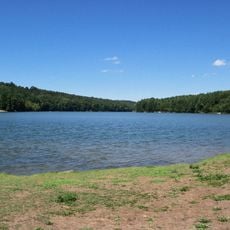
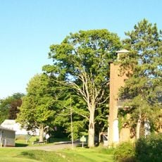
Carroll County is a rural county in northeastern Ohio, spanning rolling hills across the Appalachian region. The area contains numerous small villages, townships, and communities scattered throughout the landscape.

History

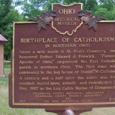
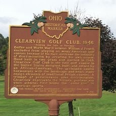
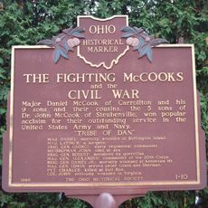
The county was established in December 1832, formed from portions of five neighboring counties. Its creation followed an ancient Native American trade route that passed through the region.

Culture

The Great Trail Festival showcases local crafts and traditional music, reflecting the region's ties to French and Native American heritage. Visitors experience how communities here keep their roots alive through these gatherings.

Practical

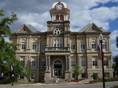
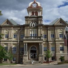
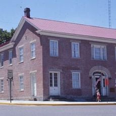
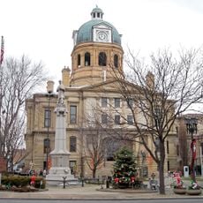
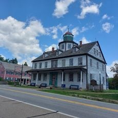
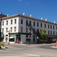
Administrative offices are located in Carrollton and handle property records and resident services. The area is largely rural, so services and amenities are spread across smaller communities rather than concentrated in one place.

Did you know?

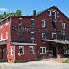
The area leads Ohio in nursery plant production and operates extensive oil well operations from Utica Shale deposits. This combination of farming and energy production defines the local economy in unexpected ways.

Location
Inception
January 1, 1833
Capital city
Carrollton
Shares border with
Columbiana County, Jefferson County, Harrison County, Tuscarawas County, Stark County
GPS coordinates
40.58000,-81.09000
Latest update
December 7, 2025 19:24

AroundUs brings together thousands of curated places, local tips, and hidden gems, enriched daily by 60,000 contributors worldwide. Discover all places nearby (Ohio).

Around this place
Atwood Lake
United States of America

Atwood Lake

17.5 km
Clearview Golf Club
United States of America

Clearview Golf Club

25.2 km
Fort Laurens
United States of America

Fort Laurens

31.6 km
Leesville Lake
United States of America

Leesville Lake

15.3 km
Kendal, Ohio
United States of America

Kendal, Ohio

10.5 km
Carroll County Courthouse
United States of America

Carroll County Courthouse

935 m
Daniel McCook House
United States of America

Daniel McCook House

927 m
Conotton Creek Trail
United States of America

Conotton Creek Trail

22.1 km
Seven Ranges Terminus
United States of America

Seven Ranges Terminus

20.9 km
Tuscarawas County Courthouse
United States of America

Tuscarawas County Courthouse

31.7 km
St. Mary of the Immaculate Conception Church
United States of America

St. Mary of the Immaculate Conception Church

14.2 km
Jeremiah Reeves House and Carriage House
United States of America

Jeremiah Reeves House and Carriage House

32.3 km
Hanoverton Canal Town District
United States of America

Hanoverton Canal Town District

23.2 km
John Herrington House and Herrington Bethel Church
United States of America

John Herrington House and Herrington Bethel Church

10.1 km
Middle Sandy Presbyterian Church
United States of America

Middle Sandy Presbyterian Church

28.7 km
Kilgore Union Presbyterian Church
United States of America

Kilgore Union Presbyterian Church

15.3 km
Columbiana County Infirmary
United States of America

Columbiana County Infirmary

31.2 km
Henry Law Farm Historic District
United States of America

Henry Law Farm Historic District

26.4 km
Patrick Hull House
United States of America

Patrick Hull House

14.5 km
Deersville Historic District
United States of America

Deersville Historic District

31.5 km
Fort Laurens Museum
United States of America

Fort Laurens Museum

31.6 km
Historic Zoar Village
United States of America

Historic Zoar Village

28.3 km
Mohawk Theater
United States of America

Mohawk Theater

17.2 km
Elson-Magnolia Flour Mill
United States of America

Elson-Magnolia Flour Mill

19.5 km
Birthplace of Catholicism in Northern Ohio
United States of America

Birthplace of Catholicism in Northern Ohio

24.5 km
Clearview Golf Club, 1946
United States of America

Clearview Golf Club, 1946

25.3 km
Zoarville Bridge
United States of America

Zoarville Bridge

25.5 km
The Fighting McCooks and the Civil War
United States of America

The Fighting McCooks and the Civil War

912 m
Show the full map
Administrative divisions
« Carroll County - County in northeastern Ohio, United States » is provided by Around Us (aroundus.com). Images and texts are derived from Wikimedia project under a Creative Commons license. You are allowed to copy, distribute, and modify copies of this page, under the conditions set by the license, as long as this note is clearly visible.

Discover hidden gems everywhere you go!

From secret cafés to breathtaking viewpoints, skip the crowded tourist spots and find places that match your style. Our app makes it easy with voice search, smart filtering, route optimization, and insider tips from travelers worldwide. Download now for the complete mobile experience.

Around Us App Screenshot

A unique approach to discovering new places

Le Figaro

All the places worth exploring

France Info

A tailor-made excursion in just a few clicks

20 Minutes

Around Us
Travel Guide & Maps
Download

Send to your phone

QR Code
1

Open the camera app on your mobile.

2

Point at the QR code with your camera. A notification will appear.

3

Tap the notification to open the link.