Conotton Creek Trail

Log in to your account

AroundUs is a community-driven map of interesting places, built by curious explorers like you. It grows with every review, story, and photo you share.
Connect to save your favorite spots, contribute locations, and create personalized routes.
Continue with Google
Continue with Apple
Continue with X
Continue with Facebook
Continue with email
By continuing, you accept our Terms and Conditions and our Privacy Policy
Create an account
Add to collection
Map
Suggest a change
Share

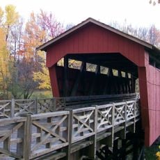
Conotton Creek Trail, Rail trail in Harrison County, Ohio, US

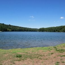
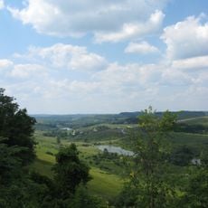
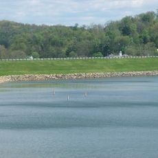
Conotton Creek Trail is a former railroad corridor that stretches more than 10 kilometers through wetlands, farmland, woods, and rock formations. The path links several small towns and offers walkers and cyclists a continuous route through changing landscapes.

The trail follows the former Wheeling and Lake Erie Railway line, which once carried iron ore from the Great Lakes to steel mills. The railroad corridor also played an important role in moving coal from local mines in the area.

The trail forms part of the Industrial Heartlands Trails network and the Great American Rail-Trail, connecting communities across multiple states for recreational purposes.

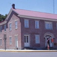
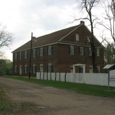
The trail has informational signs at six different staging areas that provide guidance and context about the nature and history of the route. There are rest spots with benches, shelters, and portable toilets for longer visits.

More than 40 birdhouses line the entire route and provide homes for various bird species. Particularly east of Bowerston, ponds shelter herons, eagles, geese, and ducks in large numbers.

Location: Harrison County

Part of: Great American Rail-Trail

GPS coordinates: 40.38260,-81.06180

Latest update: December 14, 2025 16:47

Photos
Around this place
Atwood Lake
United States of America

Atwood Lake

24.8 km
Leesville Lake
United States of America

Leesville Lake

14.8 km
Egypt Valley Wildlife Area
United States of America

Egypt Valley Wildlife Area

30 km
Kendal, Ohio
United States of America

Kendal, Ohio

32.5 km
Carroll County Courthouse
United States of America

Carroll County Courthouse

21.2 km
Mount Pleasant Historic District
United States of America

Mount Pleasant Historic District

32.2 km
Harrison County Courthouse
United States of America

Harrison County Courthouse

13.4 km
Daniel McCook House
United States of America

Daniel McCook House

21.2 km
Friends Meetinghouse
United States of America

Friends Meetinghouse

32 km
Shaeffer Campbell Covered Bridge
United States of America

Shaeffer Campbell Covered Bridge

35.2 km
Tuscarawas County Courthouse
United States of America

Tuscarawas County Courthouse

34.6 km
St. Mary of the Immaculate Conception Church
United States of America

St. Mary of the Immaculate Conception Church

31.9 km
Benjamin Lundy House
United States of America

Benjamin Lundy House

31.9 km
Schiappa Branch Library
United States of America

Schiappa Branch Library

33 km
Franklin College Building No. 5
United States of America

Franklin College Building No. 5

22.4 km
Harrison National Bank
United States of America

Harrison National Bank

13.4 km
John Herrington House and Herrington Bethel Church
United States of America

John Herrington House and Herrington Bethel Church

30 km
Kilgore Union Presbyterian Church
United States of America

Kilgore Union Presbyterian Church

10.1 km
Ourant's School
United States of America

Ourant's School

12 km
Henry Law Farm Historic District
United States of America

Henry Law Farm Historic District

15.2 km
Deersville Historic District
United States of America

Deersville Historic District

13.7 km
Clark Gable Museum
United States of America

Clark Gable Museum

13.8 km
Piedmont Lake
United States of America

Piedmont Lake

29.2 km
John Reaves House
United States of America

John Reaves House

25.9 km
Skull Fork Covered Bridge
United States of America

Skull Fork Covered Bridge

28.3 km
Benjamin Lundy Home
United States of America

Benjamin Lundy Home

31.9 km
Gnadenhutten
United States of America

Gnadenhutten

31.8 km
The Fighting McCooks and the Civil War
United States of America

The Fighting McCooks and the Civil War

21.2 km
Show the full map
Reviews

Visited this place? Tap the stars to rate it and share your experience / photos with the community! Try now! You can cancel it anytime.

« Conotton Creek Trail - Rail trail in Harrison County, Ohio, US » is provided by Around Us (aroundus.com). Images and texts are derived from Wikimedia project under a Creative Commons license. You are allowed to copy, distribute, and modify copies of this page, under the conditions set by the license, as long as this note is clearly visible.

Discover hidden gems everywhere you go!

From secret cafés to breathtaking viewpoints, skip the crowded tourist spots and find places that match your style. Our app makes it easy with voice search, smart filtering, route optimization, and insider tips from travelers worldwide. Download now for the complete mobile experience.

Around Us App Screenshot

A unique approach to discovering new places

Le Figaro

All the places worth exploring

France Info

A tailor-made excursion in just a few clicks

20 Minutes