Enable Location

We need your location to show you interesting places around you

Discover nearby places

Find interesting locations and hidden gems around you

Precise directions

Get accurate directions and distances to places

Your location is never shared with other users. It's only used when you tap the location button.

Halifax County

Log in to your account

Start exploring — it's free

Trusted by 61,953 travelers worldwide

Continue with Google
Continue with Apple
or

We will send you a code to connect

By continuing, you accept our Terms and Conditions and our Privacy Policy

Check your inbox

We've sent a pincode in your inbox. Please enter the code below.

Halifax County, Administrative county in Virginia, US

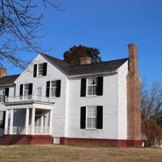
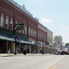
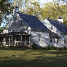
Halifax County is an administrative region in Virginia spanning roughly 2,150 square kilometers (830 sq mi) and containing several municipalities including South Boston and the town of Halifax. The area covers both rural and semi-urban zones with distinct local governance structures.

The county was established in 1752 and named after an English town. It has remained part of Virginia's administrative structure ever since.

The county maintains several educational institutions, including Halifax County Middle School and Wilson Memorial Elementary School, serving the local community needs.

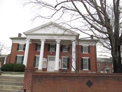
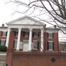
The Halifax County Courthouse serves as the administrative center for local government matters. Both William M Tuck Airport and Aaron Penston Field offer nearby air travel options if you need to arrive by plane.

The region is home to the South Boston Speedway and Virginia International Racetrack, two notable racing venues that draw motorsports fans. These facilities have made the area a destination for racing events and speed enthusiasts.

The community of curious travelers

AroundUs brings together thousands of curated places, local tips, and hidden gems, enriched daily by 60,000 contributors worldwide.

Start exploring
Location
Inception
1752
Capital city
Halifax
Shares border with
Charlotte County, Campbell County, Mecklenburg County, Granville County, Person County, Caswell County, Pittsylvania County
GPS coordinates
36.77000,-78.94000
Latest update
December 20, 2025 11:41
Around this place
Virginia International Raceway
United States of America

Virginia International Raceway

33.1 km
United States of America

South Boston Speedway

9.3 km
Berry Hill Plantation
United States of America

Berry Hill Plantation

8 km
Red Hill Patrick Henry National Memorial
United States of America

Red Hill Patrick Henry National Memorial

29.4 km
Prestwould
United States of America

Prestwould

36.1 km
Staunton River State Park
United States of America

Staunton River State Park

24.2 km
Black Walnut (Clover, Virginia)
United States of America

Black Walnut (Clover, Virginia)

22 km
Staunton River Battlefield State Park
United States of America

Staunton River Battlefield State Park

24.7 km
Roanoke Plantation
United States of America

Roanoke Plantation

25.6 km
United States of America

Difficult Creek Natural Area Preserve

18.4 km
South Boston Historic District
United States of America

South Boston Historic District

8.6 km
Annefield
United States of America

Annefield

33.3 km
Brandon Plantation
United States of America

Brandon Plantation

26.7 km
United States of America

Charlotte State Forest

35.9 km
Clarkton Bridge
United States of America

Clarkton Bridge

23.8 km
Mulberry Hill
United States of America

Mulberry Hill

26.6 km
Clarksville Historic District
United States of America

Clarksville Historic District

37.8 km
Carlbrook
United States of America

Carlbrook

18.2 km
Buckingham Courthouse Historic District
United States of America

Buckingham Courthouse Historic District

42.3 km
Charlotte County Courthouse
United States of America

Charlotte County Courthouse

41.6 km
Halifax County Courthouse
United States of America

Halifax County Courthouse

1.1 km
Brooklyn Tobacco Factory
United States of America

Brooklyn Tobacco Factory

20.9 km
E. L. Evans House
United States of America

E. L. Evans House

8.1 km
Glennmary
United States of America

Glennmary

10.2 km
Buffalo Springs Historical Archeological District
United States of America

Buffalo Springs Historical Archeological District

28.2 km
Tarover
United States of America

Tarover

8 km
Woodlawn
United States of America

Woodlawn

19.9 km
The Cove
United States of America

The Cove

29.2 km
Show the full map
Administrative divisions
« Halifax County - Administrative county in Virginia, US » is provided by Around Us (aroundus.com). Images and texts are derived from Wikimedia project under a Creative Commons license. You are allowed to copy, distribute, and modify copies of this page, under the conditions set by the license, as long as this note is clearly visible.

Discover hidden gems everywhere you go!

From secret cafés to breathtaking viewpoints, skip the crowded tourist spots and find places that match your style. Our app makes it easy with voice search, smart filtering, route optimization, and insider tips from travelers worldwide. Download now for the complete mobile experience.

Around Us App Screenshot

A unique approach to discovering new places

Le Figaro

All the places worth exploring

France Info

A tailor-made excursion in just a few clicks

20 Minutes

Around Us
Travel Guide & Maps
Download

Send to your phone

QR Code
1

Open the camera app on your mobile.

2

Point at the QR code with your camera. A notification will appear.

3

Tap the notification to open the link.