Enable Location

We need your location to show you interesting places around you

Discover nearby places

Find interesting locations and hidden gems around you

Precise directions

Get accurate directions and distances to places

Your location is never shared with other users. It's only used when you tap the location button.

Lake County

Log in to your account

Start exploring — it's free

Trusted by 61,902 travelers worldwide

Continue with Google
Continue with Apple
or

We will send you a code to connect

By continuing, you accept our Terms and Conditions and our Privacy Policy

Check your inbox

We've sent a pincode in your inbox. Please enter the code below.

Lake County, County seat in northwestern Tennessee, US

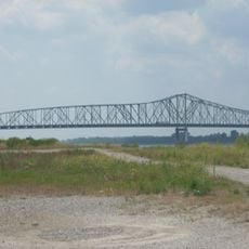
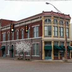
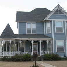
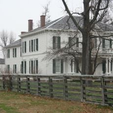
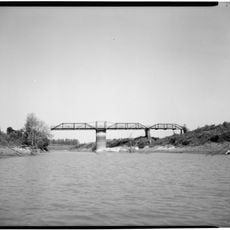
Lake County sits in northwestern Tennessee and encompasses agricultural lands, rivers, and residential communities. The region is anchored by Tiptonville, which serves as its administrative center.

Lake County was established in 1870 during a period of growth in Tennessee. Its creation marked the founding of Tiptonville as the administrative seat.

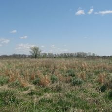
Residents here maintain strong ties to outdoor pursuits and rural life. Fishing, hunting, and farming shape the daily rhythms and social gatherings of the community.

The area is best explored by car, as the flat terrain and rural road network make navigation straightforward. Visitors should note that services and shops are spread out, so advance planning helps.

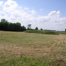
The Tiptonville Dome is a geological formation beneath the surface that forms part of the New Madrid Seismic Zone. This underground structure shapes the region's geological character and seismic activity.

The community of curious travelers

AroundUs brings together thousands of curated places, local tips, and hidden gems, enriched daily by 60,000 contributors worldwide.

Start exploring
Location
Inception
1870
Capital city
Tiptonville
Shares border with
Fulton County, Dyer County, Obion County, Pemiscot County, New Madrid County
GPS coordinates
36.34000,-89.49000
Latest update
December 7, 2025 19:26
Around this place
Reelfoot Lake
United States of America

Reelfoot Lake

9.6 km
Reelfoot Lake State Park
United States of America

Reelfoot Lake State Park

11.5 km
Caruthersville Bridge
United States of America

Caruthersville Bridge

27.4 km
Big Oak Tree State Park
United States of America

Big Oak Tree State Park

37.9 km
Eaker Site
United States of America

Eaker Site

57.9 km
Towosahgy State Historic Site
United States of America

Towosahgy State Historic Site

45.4 km
Murphy Mound Archeological Site
United States of America

Murphy Mound Archeological Site

27.8 km
Campbell Archeological Site
United States of America

Campbell Archeological Site

42.9 km
United States Highway 61 Arch
United States of America

United States Highway 61 Arch

52.8 km
Confederate Monument
United States of America

Confederate Monument

40.7 km
Morris State Park
United States of America

Morris State Park

55.1 km
Confederate Memorial Gateway in Hickman
United States of America

Confederate Memorial Gateway in Hickman

37 km
Thomas Chapel C.M.E. Church
United States of America

Thomas Chapel C.M.E. Church

37.3 km
Mt. Zion Colored Methodist Episcopal Church
United States of America

Mt. Zion Colored Methodist Episcopal Church

41.1 km
Edward Moody King House
United States of America

Edward Moody King House

35.2 km
Obion County Courthouse
United States of America

Obion County Courthouse

39.7 km
Caruthersville Water Tower
United States of America

Caruthersville Water Tower

22.1 km
Charles and Bettie Birthright House
United States of America

Charles and Bettie Birthright House

44.5 km
Bank of Dyersburg
United States of America

Bank of Dyersburg

35.5 km
Houser House
United States of America

Houser House

38.8 km
Thomas Leroy Bransford House
United States of America

Thomas Leroy Bransford House

40.8 km
Carnegie Library
United States of America

Carnegie Library

37.5 km
Caldwell-Hopson House
United States of America

Caldwell-Hopson House

4.1 km
Reelfoot Lake State Park Visitor Center
United States of America

Reelfoot Lake State Park Visitor Center

5.7 km
Deering Building
United States of America

Deering Building

40 km
Hunter-Dawson State Historic Site
United States of America

Hunter-Dawson State Historic Site

28.6 km
Masquerade Theatre
United States of America

Masquerade Theatre

39.9 km
Lenox Bridge
United States of America

Lenox Bridge

26.9 km
Show the full map
« Lake County - County seat in northwestern Tennessee, US » is provided by Around Us (aroundus.com). Images and texts are derived from Wikimedia project under a Creative Commons license. You are allowed to copy, distribute, and modify copies of this page, under the conditions set by the license, as long as this note is clearly visible.

Discover hidden gems everywhere you go!

From secret cafés to breathtaking viewpoints, skip the crowded tourist spots and find places that match your style. Our app makes it easy with voice search, smart filtering, route optimization, and insider tips from travelers worldwide. Download now for the complete mobile experience.

Around Us App Screenshot

A unique approach to discovering new places

Le Figaro

All the places worth exploring

France Info

A tailor-made excursion in just a few clicks

20 Minutes

Around Us
Travel Guide & Maps
Download

Send to your phone

QR Code
1

Open the camera app on your mobile.

2

Point at the QR code with your camera. A notification will appear.

3

Tap the notification to open the link.