Enable Location

We need your location to show you interesting places around you

Discover nearby places

Find interesting locations and hidden gems around you

Precise directions

Get accurate directions and distances to places

Your location is never shared with other users. It's only used when you tap the location button.

Litchfield

Log in to your account

Start exploring — it's free

Trusted by 61,553 travelers worldwide

Continue with Google
Continue with Apple
or

We will send you a code to connect

By continuing, you accept our Terms and Conditions and our Privacy Policy

Check your inbox

We've sent a pincode in your inbox. Please enter the code below.

Litchfield, Colonial town in Northwest Hills, Connecticut, United States

Description

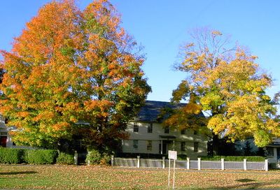
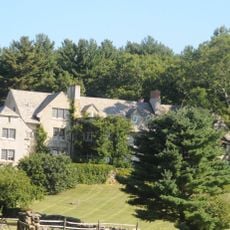
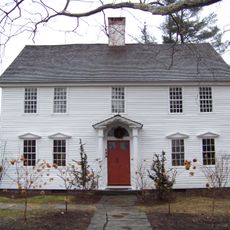
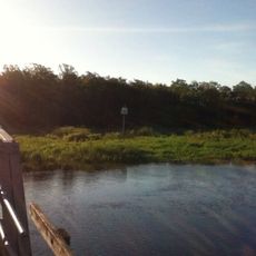
Litchfield is a town in the Northwest Hills region of Connecticut with varied terrain that includes forests, open farmland, and rolling hills. The settlement spreads across a substantial area where traditional homes and historic buildings sit scattered among the natural landscape.

History

The town was established in 1719 after colonists acquired land from the Tunxis Indians and later became important during the American Revolution. It served as a supply and administrative center for military operations throughout the war.

Culture

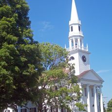
The town takes its name from an English settlement and maintains the typical layout of a rural New England community, where residents still gather around a central green and local institutions.

Practical

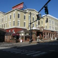
You can reach the town by car or bus, with U.S. Route 202 serving as the main connection to other areas. Local bus services through the Northwestern Connecticut Transit District are available for visitors without a car.

Did you know?

In 1784 Judge Tapping Reeve founded the first law school in the United States here, which attracted future vice presidents and other national leaders to study law. The institution shaped legal education for generations across the country.

Inception
1719
Elevation above the sea
331 m
GPS coordinates
41.74722,-73.18972
Latest update
December 12, 2025 12:06

AroundUs brings together thousands of curated places, local tips, and hidden gems, enriched daily by 60,000 contributors worldwide. Discover all places nearby (Northwest Hills Planning Region).

Around this place
Rye House
United States of America

Rye House

8 km
Warner Theatre
United States of America

Warner Theatre

8.3 km
Stillman House
United States of America

Stillman House

783 m
Mount Tom State Park
United States of America

Mount Tom State Park

9.6 km
Garbage Museum
United States of America

Garbage Museum

7.7 km
Topsmead
United States of America

Topsmead

2.5 km
Milton Center Historic District
United States of America

Milton Center Historic District

7.3 km
James Alldis House
United States of America

James Alldis House

8.4 km
Oliver Wolcott House
United States of America

Oliver Wolcott House

462 m
White Memorial Foundation
United States of America

White Memorial Foundation

3.8 km
Litchfield Historic District
United States of America

Litchfield Historic District

39 m
United States of America

Sunnybrook State Park

11.4 km
First Congregational Church of Litchfield
United States of America

First Congregational Church of Litchfield

140 m
Downtown Torrington Historic District
United States of America

Downtown Torrington Historic District

8.3 km
Humaston Brook State Park
United States of America

Humaston Brook State Park

8.5 km
Warrenton Woolen Mill
United States of America

Warrenton Woolen Mill

9.6 km
West Goshen Historic District
United States of America

West Goshen Historic District

10.2 km
Trinity Church
United States of America

Trinity Church

7 km
Water Street Historic District
United States of America

Water Street Historic District

8.1 km
Villa Friuli
United States of America

Villa Friuli

7.9 km
Fyler-Hotchkiss Estate
United States of America

Fyler-Hotchkiss Estate

8.6 km
Henry B. Bissell House
United States of America

Henry B. Bissell House

4 km
Migeon Avenue Historic District
United States of America

Migeon Avenue Historic District

8.4 km
Jason Skinner House
United States of America

Jason Skinner House

10.1 km
Litchfield–South Roads Historic District
United States of America

Litchfield–South Roads Historic District

11 km
David Welch House
United States of America

David Welch House

6.9 km
Town Hall and District School No. 6
United States of America

Town Hall and District School No. 6

7.3 km
Mount Tom Tower
United States of America

Mount Tom Tower

9.2 km
Show the full map
« Litchfield - Colonial town in Northwest Hills, Connecticut, United States » is provided by Around Us (aroundus.com). Images and texts are derived from Wikimedia project under a Creative Commons license. You are allowed to copy, distribute, and modify copies of this page, under the conditions set by the license, as long as this note is clearly visible.

Discover hidden gems everywhere you go!

From secret cafés to breathtaking viewpoints, skip the crowded tourist spots and find places that match your style. Our app makes it easy with voice search, smart filtering, route optimization, and insider tips from travelers worldwide. Download now for the complete mobile experience.

Around Us App Screenshot

A unique approach to discovering new places

Le Figaro

All the places worth exploring

France Info

A tailor-made excursion in just a few clicks

20 Minutes

Around Us
Travel Guide & Maps
Download

Send to your phone

QR Code
1

Open the camera app on your mobile.

2

Point at the QR code with your camera. A notification will appear.

3

Tap the notification to open the link.