Chest opened
+${chestReward.xp} XP
Explorer
NOUVEAU ×${chestReward.collectible.quantity}
tapez pour fermer
Chest locked

Open chests in the app

Around Us is built for your phone — chests unlock when you walk, explore and capture nearby places.

Enable Location

We need your location to show you interesting places around you

Discover nearby places

Find interesting locations and hidden gems around you

Precise directions

Get accurate directions and distances to places

Your location is never shared with other users. It's only used when you tap the location button.

Tishomingo

Log in to your account

Start exploring — it's free

Trusted by 72,888 travelers worldwide

Continue with Google
Continue with Apple
or

We will send you a code to connect

By continuing, you accept our Terms and Conditions and our Privacy Policy

Check your inbox

We've sent a pincode in your inbox. Please enter the code below.

Discussion Reviews 1 Photos
11.9k Popularity

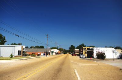
Tishomingo, County seat in Johnston County, Oklahoma, United States

Tishomingo is the county seat of Johnston County in Oklahoma and serves as a small administrative center. The town is notably home to Murray State College, which has a significant presence there and anchors community life.

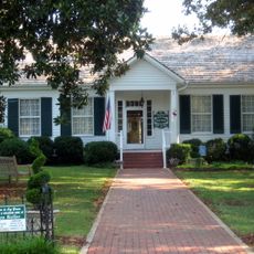
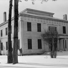
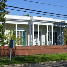
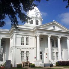
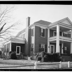
Tishomingo served as the capital of the Chickasaw Nation from 1856 until Oklahoma became a state in 1907. A distinctive red granite building from 1897 marks this earlier period when the town was a seat of political power.

Murray State College creates an educational and social hub where students engage with the community through events and programs throughout the year. The institution shapes how the town functions and draws people together regularly for gatherings and activities.

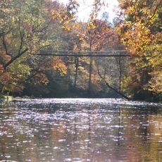
U.S. Route 377 connects Tishomingo to nearby towns, making it simple to reach and easy to explore the surrounding area. The location helps visitors move around smoothly and access neighboring communities without difficulty.

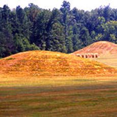
The town cemetery, dating back to 1832, holds the graves of two former Oklahoma governors in its grounds. This burial site preserves state political history that many visitors pass by without noticing its significance.

The community of curious travelers

AroundUs brings together thousands of curated places, local tips, and hidden gems, enriched daily by 60,000 contributors worldwide.

Start exploring
GPS coordinates
34.63676,-88.23171
Latest update
December 7, 2025 20:47
Around this place
Woodall Mountain
United States of America

Woodall Mountain

16.8 km
Pickwick Lake
United States of America

Pickwick Lake

45.1 km
Ivy Green
United States of America

Ivy Green

49.4 km
Natchez Trace Trail
United States of America

Natchez Trace Trail

13.6 km
Tishomingo State Park
United States of America

Tishomingo State Park

5.2 km
Pickwick Landing State Park
United States of America

Pickwick Landing State Park

46.6 km
Pharr Mounds
United States of America

Pharr Mounds

25.4 km
Barton Hall
United States of America

Barton Hall

24.6 km
Bay Springs Lake
United States of America

Bay Springs Lake

10.6 km
Siege and Battle of Corinth Sites
United States of America

Siege and Battle of Corinth Sites

44 km
Jamie Whitten Lock and Dam
United States of America

Jamie Whitten Lock and Dam

15.3 km
Cane Creek Canyon Nature Preserve
United States of America

Cane Creek Canyon Nature Preserve

40 km
Riverton Lock
United States of America

Riverton Lock

32.7 km
Veranda House
United States of America

Veranda House

42.6 km
Overton Farm
United States of America

Overton Farm

37.6 km
Fulton Lock
United States of America

Fulton Lock

45.8 km
Midtown Corinth Historic District
United States of America

Midtown Corinth Historic District

42.4 km
G. V. Montgomery Lock
United States of America

G. V. Montgomery Lock

22.9 km
Church of Our Saviour
United States of America

Church of Our Saviour

19.9 km
Colbert County Courthouse Square Historic District
United States of America

Colbert County Courthouse Square Historic District

49.5 km
Felix Grundy Norman House
United States of America

Felix Grundy Norman House

49.5 km
Downtown Corinth Historic District
United States of America

Downtown Corinth Historic District

42.3 km
Downtown Booneville Historic District
United States of America

Downtown Booneville Historic District

30.4 km
John and Archibald Christian House
United States of America

John and Archibald Christian House

49.2 km
Mulberry Creek
United States of America

Mulberry Creek

34.6 km
Alabama Music Hall of Fame
United States of America

Alabama Music Hall of Fame

48.9 km
Red Bay Water Park
United States of America

Red Bay Water Park

22.6 km
Tammy Wynette Legacy Center
United States of America

Tammy Wynette Legacy Center

44.8 km
Show the full map
Reviews
Share your experience

No review yet

Discussions
Start a discussion...

No discussion yet

« Tishomingo - County seat in Johnston County, Oklahoma, United States » is provided by Around Us (aroundus.com). Images and texts are derived from Wikimedia project under a Creative Commons license. You are allowed to copy, distribute, and modify copies of this page, under the conditions set by the license, as long as this note is clearly visible.

Discover hidden gems everywhere you go!

From secret cafés to breathtaking viewpoints, skip the crowded tourist spots and find places that match your style. Our app makes it easy with voice search, smart filtering, route optimization, and insider tips from travelers worldwide. Download now for the complete mobile experience.

Around Us App Screenshot

A unique approach to discovering new places

Le Figaro

All the places worth exploring

France Info

A tailor-made excursion in just a few clicks

20 Minutes

Around Us
Travel Guide & Maps
Download

Send to your phone

QR Code
1

Open the camera app on your mobile.

2

Point at the QR code with your camera. A notification will appear.

3

Tap the notification to open the link.