Enable Location

We need your location to show you interesting places around you

Discover nearby places

Find interesting locations and hidden gems around you

Precise directions

Get accurate directions and distances to places

Your location is never shared with other users. It's only used when you tap the location button.

Monett

Log in to your account

Start exploring — it's free

Trusted by 68,295 travelers worldwide

Continue with Google
Continue with Apple
or

We will send you a code to connect

By continuing, you accept our Terms and Conditions and our Privacy Policy

Check your inbox

We've sent a pincode in your inbox. Please enter the code below.

Discussion Reviews 2 Photos
19.8k Popularity

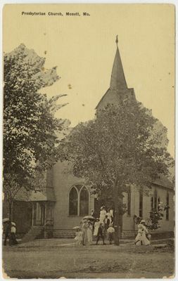
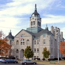
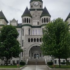
Monett, city in Barry and Lawrence counties, Missouri, United States

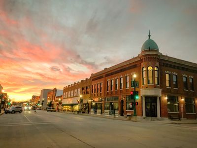
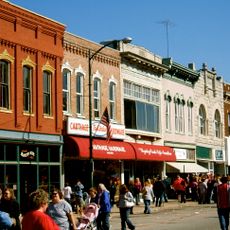
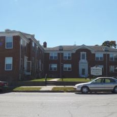
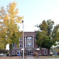
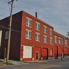
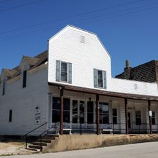
Monett is a city in southern Missouri that developed around railroad infrastructure and now contains both historic and renovated areas. The downtown features old brick buildings and has received new sidewalks and lighting in recent years to improve walking and biking conditions.

Monett was established in the 1880s when the railroad arrived and drove economic growth in the region. Throughout the 20th century, industries such as aircraft manufacturing and later major factory operations brought sustained development to the town.

The name Monett reflects its railroad roots, and the community keeps this heritage visible throughout town. Residents celebrate the strawberry farming tradition with seasonal markets and festivals that draw visitors each spring.

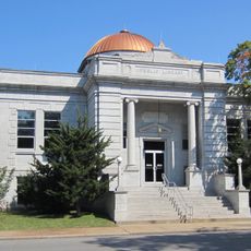
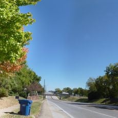
The city has a walkable downtown core with shops, restaurants, and a library within easy reach on foot. Spring and fall are the best times to visit, as summers can be quite warm and less comfortable for exploring on foot.

A mechanic named Logan McKee flew one of the early aircraft for the public in 1911, drawing attention from neighboring states. This moment shows how the town experimented with new technology long before flying became commonplace.

The community of curious travelers

AroundUs brings together thousands of curated places, local tips, and hidden gems, enriched daily by 60,000 contributors worldwide.

Start exploring
Location
Location
Inception
1870
Elevation above the sea
413 m
GPS coordinates
36.92360,-93.92220
Latest update
February 16, 2026 22:20
Around this place
Roaring River State Park
United States of America

Roaring River State Park

38.3 km
George Washington Carver National Monument
United States of America

George Washington Carver National Monument

39.2 km
Blue Springs Heritage Center
United States of America

Blue Springs Heritage Center

51.8 km
66 Drive-In
United States of America

66 Drive-In

48.5 km
Y-Bridge
United States of America

Y-Bridge

43.1 km
United States of America

Jolly Mill

13.6 km
Big Sugar Creek State Park
United States of America

Big Sugar Creek State Park

47.2 km
United States of America

First Battle of Newtonia Historic District

23.9 km
Battle of Carthage State Historic Site
United States of America

Battle of Carthage State Historic Site

43.4 km
Powell Bridge
United States of America

Powell Bridge

41.3 km
Lewis Shaw Coleman House
United States of America

Lewis Shaw Coleman House

19 km
Lawrence County Courthouse
United States of America

Lawrence County Courthouse

22 km
Carthage Courthouse Square Historic District
United States of America

Carthage Courthouse Square Historic District

44.5 km
Second Baptist Church
United States of America

Second Baptist Church

40.6 km
Elijah Teague Anderson House
United States of America

Elijah Teague Anderson House

45.2 km
Colonial Apartments
United States of America

Colonial Apartments

44.7 km
Stone County Courthouse
United States of America

Stone County Courthouse

42.7 km
Phelps Country Estate
United States of America

Phelps Country Estate

45.8 km
Carthage South Historic District
United States of America

Carthage South Historic District

44 km
Neosho Wholesale Grocery Company
United States of America

Neosho Wholesale Grocery Company

40 km
Cassill Place Historic District
United States of America

Cassill Place Historic District

45.4 km
Lentz-Carter Merchandise Store
United States of America

Lentz-Carter Merchandise Store

30.2 km
Battle of Carthage Civil War Museum
United States of America

Battle of Carthage Civil War Museum

44.6 km
Island Green Golf Club
United States of America

Island Green Golf Club

42.5 km
Deer Leap Trail
United States of America

Deer Leap Trail

37.9 km
Jasper County Courthouse
United States of America

Jasper County Courthouse

44.7 km
Golden Pioneer Museum
United States of America

Golden Pioneer Museum

52.1 km
Wilson's Creek National Battlefield Visitor Center
United States of America

Wilson's Creek National Battlefield Visitor Center

49.5 km
Show the full map
Reviews
Share your experience

No review yet

Discussions
Start a discussion...

No discussion yet

« Monett - city in Barry and Lawrence counties, Missouri, United States » is provided by Around Us (aroundus.com). Images and texts are derived from Wikimedia project under a Creative Commons license. You are allowed to copy, distribute, and modify copies of this page, under the conditions set by the license, as long as this note is clearly visible.

Discover hidden gems everywhere you go!

From secret cafés to breathtaking viewpoints, skip the crowded tourist spots and find places that match your style. Our app makes it easy with voice search, smart filtering, route optimization, and insider tips from travelers worldwide. Download now for the complete mobile experience.

Around Us App Screenshot

A unique approach to discovering new places

Le Figaro

All the places worth exploring

France Info

A tailor-made excursion in just a few clicks

20 Minutes

Around Us
Travel Guide & Maps
Download

Send to your phone

QR Code
1

Open the camera app on your mobile.

2

Point at the QR code with your camera. A notification will appear.

3

Tap the notification to open the link.