Chestnut Hill

Log in to your account

AroundUs is a community-driven map of interesting places, built by curious explorers like you. It grows with every review, story, and photo you share.
Connect to save your favorite spots, contribute locations, and create personalized routes.
Continue with Google
Continue with Apple
Continue with X
Continue with Facebook
Continue with email
By continuing, you accept our Terms and Conditions and our Privacy Policy
Create an account
Add to collection
Map
Suggest a change
Share

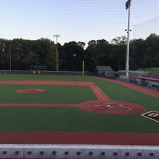
Chestnut Hill, Residential neighborhood in Boston and Norfolk County, US

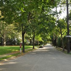
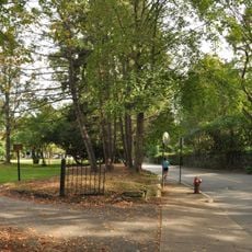
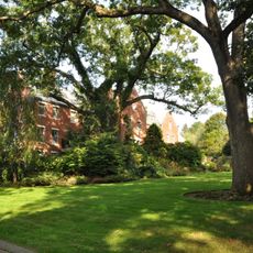
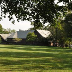
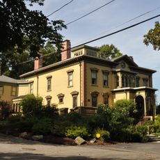
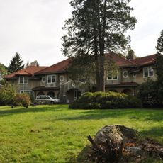
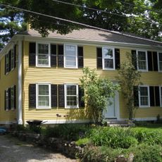
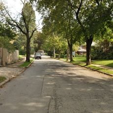
Chestnut Hill is a residential area stretching across parts of Boston, Newton, and Brookline, with borders often defined by the 02467 ZIP code. The landscape rises in gentle hills, where wide streets run past large properties, while more compact sections sit lower in the valley.

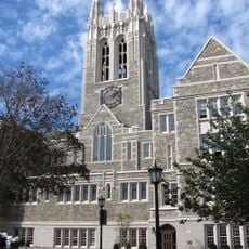
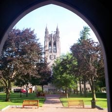
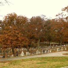
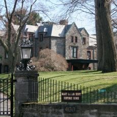
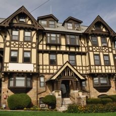
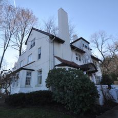
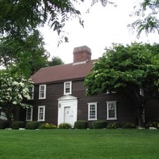
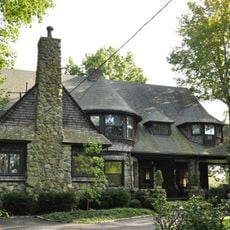
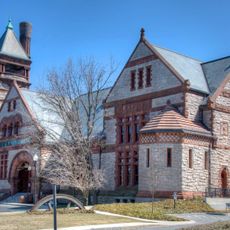
By the late 19th century, wealthy families from Boston bought fields and orchards once worked by farmers and built large country houses on the land. The area became a favored retreat on the edge of the city, later made more accessible by trolley lines and college campuses.

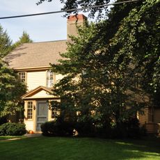
The name comes from the chestnut groves that once covered these hills and helped early settlers recognize the area. Today, homes stand in a mix of styles, from wooden shingle houses to Victorian fronts, giving the neighborhood a quiet and polished character.

Several Green Line stops bring visitors to downtown, while walking through the hills and quiet tree-lined side streets is the easiest way to explore. Shops and cafes gather along Hammond Street and around Cleveland Circle, where a larger square with restaurants opens up.

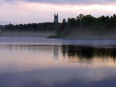
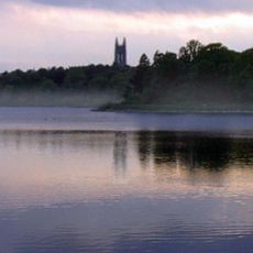
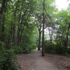
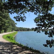
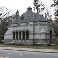
The Chestnut Hill Reservoir, a 135-acre (55 ha) water basin designed by Frederick Law Olmsted in 1870, now sits as a protected wetland in the middle of the residential area. On the southern edge, Hammond Pond Reservation stretches out with a smaller pond and forest trails just minutes from the shops.

Location: Newton

Location: Boston

Location: Brookline

Shares border with: Boston

GPS coordinates: 42.33056,-71.16611

Latest update: December 13, 2025 18:55

Photos
Around this place
United States of America

Alumni Stadium

495 m
Chestnut Hill Reservoir
United States of America

Chestnut Hill Reservoir

805 m
Gasson Hall
United States of America

Gasson Hall

668 m
Boston College Main Campus Historic District
United States of America

Boston College Main Campus Historic District

901 m
Hammond Pond Reservation
United States of America

Hammond Pond Reservation

1.1 km
Eddie Pellagrini Diamond at John Shea Field
United States of America

Eddie Pellagrini Diamond at John Shea Field

485 m
Chestnut Hill Reservation
United States of America

Chestnut Hill Reservation

805 m
Harrington Athletics Village
United States of America

Harrington Athletics Village

482 m
Evergreen Cemetery
United States of America

Evergreen Cemetery

912 m
Dupee Estate-Mary Baker Eddy Home
United States of America

Dupee Estate-Mary Baker Eddy Home

850 m
Hammond Pond Parkway
United States of America

Hammond Pond Parkway

1.2 km
The Chestnut Hill
United States of America

The Chestnut Hill

1.1 km
Reginald A. Fessenden House
United States of America

Reginald A. Fessenden House

1.2 km
Chestnut Hill Historic District
United States of America

Chestnut Hill Historic District

732 m
Chestnut Hill Reservoir Historic District
United States of America

Chestnut Hill Reservoir Historic District

805 m
Old Chestnut Hill Historic District
United States of America

Old Chestnut Hill Historic District

159 m
Hammond House
United States of America

Hammond House

666 m
Paine Estate
United States of America

Paine Estate

1.3 km
House at 41 Middlesex Road
United States of America

House at 41 Middlesex Road

560 m
Roughwood
United States of America

Roughwood

1.3 km
House at 107 Waban Hill Road
United States of America

House at 107 Waban Hill Road

1.2 km
House at 152 Suffolk Road
United States of America

House at 152 Suffolk Road

569 m
Ephraim Ward House
United States of America

Ephraim Ward House

1.3 km
Metropolitan Waterworks Museum
United States of America

Metropolitan Waterworks Museum

870 m
Leavitt-Riedler Pumping Engine
United States of America

Leavitt-Riedler Pumping Engine

880 m
McMullen Museum of Art, Boston College
United States of America

McMullen Museum of Art, Boston College

1.2 km
Kingsbury House
United States of America

Kingsbury House

472 m
Monadnock Road Historic District
United States of America

Monadnock Road Historic District

1.2 km
Show the full map
Reviews

Visited this place? Tap the stars to rate it and share your experience / photos with the community! Try now! You can cancel it anytime.

« Chestnut Hill - Residential neighborhood in Boston and Norfolk County, US » is provided by Around Us (aroundus.com). Images and texts are derived from Wikimedia project under a Creative Commons license. You are allowed to copy, distribute, and modify copies of this page, under the conditions set by the license, as long as this note is clearly visible.

Discover hidden gems everywhere you go!

From secret cafés to breathtaking viewpoints, skip the crowded tourist spots and find places that match your style. Our app makes it easy with voice search, smart filtering, route optimization, and insider tips from travelers worldwide. Download now for the complete mobile experience.

Around Us App Screenshot

A unique approach to discovering new places

Le Figaro

All the places worth exploring

France Info

A tailor-made excursion in just a few clicks

20 Minutes