Enable Location

We need your location to show you interesting places around you

Discover nearby places

Find interesting locations and hidden gems around you

Precise directions

Get accurate directions and distances to places

Your location is never shared with other users. It's only used when you tap the location button.

Ashland

Log in to your account

Start exploring — it's free

Trusted by 64,385 travelers worldwide

Continue with Google
Continue with Apple
or

We will send you a code to connect

By continuing, you accept our Terms and Conditions and our Privacy Policy

Check your inbox

We've sent a pincode in your inbox. Please enter the code below.

Discussion Reviews 1 Photos
17.6k Popularity

Ashland, borough in northwestern Schuylkill county in the U.S. state of Pennsylvania

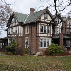
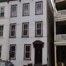
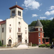
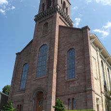
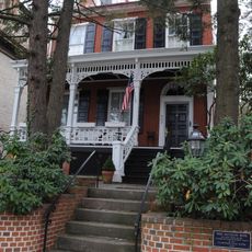
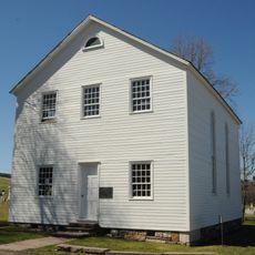
Ashland is a borough in Pennsylvania located across parts of Schuylkill and Columbia counties. The town features quiet streets and old buildings mostly from the 1800s, surrounded by steep hills and forests.

The town was founded around 1820 and grew through coal mining as workers came to the region. In 1857, it was officially incorporated as a borough with its own local government.

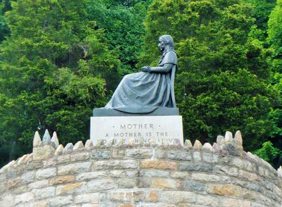
The name Ashland comes from Henry Clay's estate in Kentucky, linking the town to broader American history. Visitors can see this connection reflected in the old buildings and the memorial that honors mothers and family bonds.

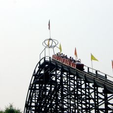
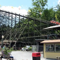
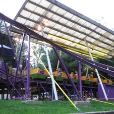
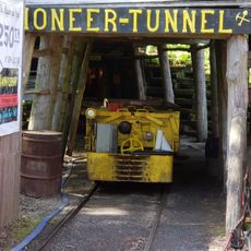
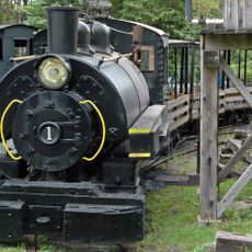
Visitors can explore Pioneer Tunnel, where mine cars descend into old coal mines and a steam train is also available for rides. The town is easily reached via Pennsylvania Route 54 and Route 61, making access and navigation straightforward.

The Mothers' Memorial statue was built during the Great Depression and depicts a woman holding a child as a symbol of care and family. Located at the corner of Route 54 and Route 61, this rare monument specifically honors mothers and their role in the community.

The community of curious travelers

AroundUs brings together thousands of curated places, local tips, and hidden gems, enriched daily by 60,000 contributors worldwide.

Start exploring
Location
Inception
1820
Part of
Coal Region
GPS coordinates
40.78139,-76.34417
Latest update
February 17, 2026 00:40
Around this place
Knoebels Amusement Resort
United States of America

Knoebels Amusement Resort

17.3 km
Phoenix
United States of America

Phoenix

17.4 km
Flying Turns
United States of America

Flying Turns

17.3 km
Impulse
United States of America

Impulse

17.2 km
Twister
United States of America

Twister

17.2 km
Locust Lake State Park
United States of America

Locust Lake State Park

17.1 km
Assumption of the Blessed Virgin Mary Ukrainian Catholic Church
United States of America

Assumption of the Blessed Virgin Mary Ukrainian Catholic Church

3.1 km
Frank D. Yuengling Mansion
United States of America

Frank D. Yuengling Mansion

16.2 km
John O'Hara House
United States of America

John O'Hara House

16.4 km
High Speed Thrill Coaster
United States of America

High Speed Thrill Coaster

17.3 km
Mary Queen of Peace Catholic Church Pottsville, Pennsylvania
United States of America

Mary Queen of Peace Catholic Church Pottsville, Pennsylvania

15.7 km
St. John the Baptist Church
United States of America

St. John the Baptist Church

16.5 km
Burd Patterson House
United States of America

Burd Patterson House

16.4 km
Wagner Covered Bridge No. 19
United States of America

Wagner Covered Bridge No. 19

12.6 km
Pottsville Downtown Historic District
United States of America

Pottsville Downtown Historic District

16.7 km
St. Paul's Union Church and Cemetery
United States of America

St. Paul's Union Church and Cemetery

14.2 km
Lake Glory
United States of America

Lake Glory

16.8 km
Davis Covered Bridge
United States of America

Davis Covered Bridge

16.5 km
Kreigbaum Covered Bridge
United States of America

Kreigbaum Covered Bridge

15.6 km
Richards Covered Bridge
United States of America

Richards Covered Bridge

16.8 km
Johnson Covered Bridge No. 28
United States of America

Johnson Covered Bridge No. 28

15.9 km
Furnace Covered Bridge No. 11
United States of America

Furnace Covered Bridge No. 11

17 km
Snyder Covered Bridge No. 17
United States of America

Snyder Covered Bridge No. 17

14 km
Kozmo's Kurves
United States of America

Kozmo's Kurves

17.3 km
Pioneer Tunnel Coal Mine
United States of America

Pioneer Tunnel Coal Mine

788 m
Big Mine Run Geyser
United States of America

Big Mine Run Geyser

2.2 km
Lawrence L. Knoebel Covered Bridge
United States of America

Lawrence L. Knoebel Covered Bridge

17.3 km
Pioneer Tunnel Coal Mine & Steam Train
United States of America

Pioneer Tunnel Coal Mine & Steam Train

799 m
Show the full map
Reviews
Share your experience

No review yet

Discussions
Start a discussion...

No discussion yet

« Ashland - borough in northwestern Schuylkill county in the U.S. state of Pennsylvania » is provided by Around Us (aroundus.com). Images and texts are derived from Wikimedia project under a Creative Commons license. You are allowed to copy, distribute, and modify copies of this page, under the conditions set by the license, as long as this note is clearly visible.

Discover hidden gems everywhere you go!

From secret cafés to breathtaking viewpoints, skip the crowded tourist spots and find places that match your style. Our app makes it easy with voice search, smart filtering, route optimization, and insider tips from travelers worldwide. Download now for the complete mobile experience.

Around Us App Screenshot

A unique approach to discovering new places

Le Figaro

All the places worth exploring

France Info

A tailor-made excursion in just a few clicks

20 Minutes

Around Us
Travel Guide & Maps
Download

Send to your phone

QR Code
1

Open the camera app on your mobile.

2

Point at the QR code with your camera. A notification will appear.

3

Tap the notification to open the link.