Oyster Creek Nuclear Generating Station

Log in to your account

AroundUs is a community-driven map of interesting places, built by curious explorers like you. It grows with every review, story, and photo you share.
Connect to save your favorite spots, contribute locations, and create personalized routes.
Continue with Google
Continue with Apple
Continue with X
Continue with Facebook
Continue with email
By continuing, you accept our Terms and Conditions and our Privacy Policy
Create an account

Oyster Creek Nuclear Generating Station

Add to collection
Map
Suggest a change
Share

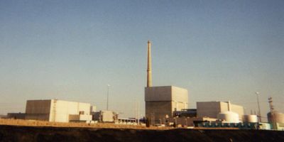
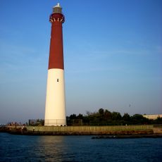
Oyster Creek Nuclear Generating Station, Decommissioned nuclear power plant in Forked River, New Jersey, United States

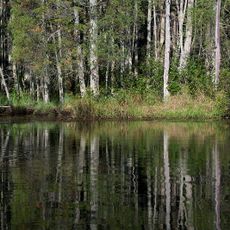
Oyster Creek Nuclear Generating Station is a decommissioned facility spread across roughly 800 acres beside a waterway in New Jersey. The complex featured a single boiling water reactor designed to generate 636 megawatts of electricity for the region.

The facility received its operating permit in 1969, making it the first commercial nuclear station in the United States to reach this milestone. Operations ceased in 2018, ending nearly five decades of power generation for the region.

The site takes its name from the nearby creek and represents a shift in how communities view energy production and environmental responsibility. Local residents and visitors now see the landscape as reflecting changing attitudes toward nuclear technology over the decades.

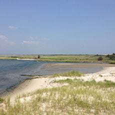
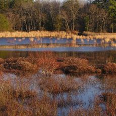
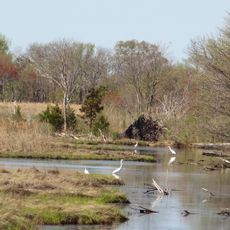
The property sits in a transitional zone between waterway and dry land, so visitors should prepare for damp conditions and marshland. Access is available, but it's wise to check current visiting arrangements beforehand since the site undergoes ongoing remediation work.

During Hurricane Sandy in 2012, the site experienced severe storm surge flooding yet its structures remained undamaged despite the extreme conditions. This resilience became a notable point of interest for engineers and climate researchers studying the site.

Location: New Jersey

Website: http://exeloncorp.com/PowerPlants/oystercreek/Pages/profile.aspx

GPS coordinates: 39.81470,-74.20500

Latest update: December 19, 2025 23:16

Photos
Nuclear power plants: history of atomic energy, major accidents, and geopolitics

This collection brings together nuclear power plants that have shaped the history of civilian nuclear energy. Some experienced accidents that changed the world’s view of nuclear energy. Chernobyl in Ukraine remains a symbol of the 1986 disaster, while Fukushima in Japan showed the risks of natural...

Around this place
Star Jet
United States of America

Star Jet

18.4 km
Barnegat Lighthouse
United States of America

Barnegat Lighthouse

10.1 km
Casino Pier
United States of America

Casino Pier

18.4 km
Island Beach State Park
United States of America

Island Beach State Park

14.6 km
Hangar No. 1, Lakehurst Naval Air Station
United States of America

Hangar No. 1, Lakehurst Naval Air Station

25.7 km
Jet Star
United States of America

Jet Star

18.4 km
Hydrus
United States of America

Hydrus

18.2 km
Double Trouble State Park
United States of America

Double Trouble State Park

9.4 km
Cattus Island Park
United States of America

Cattus Island Park

19.1 km
Manahawkin Bay Bridge
United States of America

Manahawkin Bay Bridge

17 km
Thomas A. Mathis and J. Stanley Tunney Bridges
United States of America

Thomas A. Mathis and J. Stanley Tunney Bridges

16.9 km
Barnegat Lighthouse State Park
United States of America

Barnegat Lighthouse State Park

10.1 km
Cathedral of the Air
United States of America

Cathedral of the Air

24.3 km
Popcorn Park Zoo
United States of America

Popcorn Park Zoo

14.9 km
United States of America

Shore Region

18.1 km
Penn State Forest
United States of America

Penn State Forest

23.2 km
Manahawkin Baptist Church
United States of America

Manahawkin Baptist Church

13.7 km
Ocean County Courthouse
United States of America

Ocean County Courthouse

15.4 km
Manahawkin Bottomland Hardwood Forest
United States of America

Manahawkin Bottomland Hardwood Forest

14.4 km
Barnegat Light Public School
United States of America

Barnegat Light Public School

10.5 km
Mary Etta Cox House
United States of America

Mary Etta Cox House

7 km
U.S. Life Saving Station No. 14
United States of America

U.S. Life Saving Station No. 14

17.5 km
Breakwater Beach
United States of America

Breakwater Beach

18.2 km
Insectropolis
United States of America

Insectropolis

22.3 km
Shore Beach
United States of America

Shore Beach

6.6 km
Harvey Cedars Bay Beach
United States of America

Harvey Cedars Bay Beach

13.6 km
Island Heights Historic District
United States of America

Island Heights Historic District

14.9 km
Beach Haven West Bay Beach
United States of America

Beach Haven West Bay Beach

16.8 km
Show the full map
Reviews

Visited this place? Tap the stars to rate it and share your experience / photos with the community! Try now! You can cancel it anytime.

« Oyster Creek Nuclear Generating Station - Decommissioned nuclear power plant in Forked River, New Jersey, United States » is provided by Around Us (aroundus.com). Images and texts are derived from Wikimedia project under a Creative Commons license. You are allowed to copy, distribute, and modify copies of this page, under the conditions set by the license, as long as this note is clearly visible.

Discover hidden gems everywhere you go!

From secret cafés to breathtaking viewpoints, skip the crowded tourist spots and find places that match your style. Our app makes it easy with voice search, smart filtering, route optimization, and insider tips from travelers worldwide. Download now for the complete mobile experience.

Around Us App Screenshot

A unique approach to discovering new places

Le Figaro

All the places worth exploring

France Info

A tailor-made excursion in just a few clicks

20 Minutes