Chest opened
+${chestReward.xp} XP
Explorer
NOUVEAU ×${chestReward.collectible.quantity}
tapez pour fermer
Chest locked

Open chests in the app

Around Us is built for your phone — chests unlock when you walk, explore and capture nearby places.

Enable Location

We need your location to show you interesting places around you

Discover nearby places

Find interesting locations and hidden gems around you

Precise directions

Get accurate directions and distances to places

Your location is never shared with other users. It's only used when you tap the location button.

Wounded Knee Creek

Log in to your account

Start exploring — it's free

Trusted by 72,894 travelers worldwide

Continue with Google
Continue with Apple
or

We will send you a code to connect

By continuing, you accept our Terms and Conditions and our Privacy Policy

Check your inbox

We've sent a pincode in your inbox. Please enter the code below.

Wounded Knee Creek
Discussion Reviews 1 Photos
20.3k Popularity

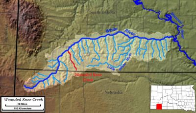
Wounded Knee Creek, Stream in Pine Ridge Indian Reservation, South Dakota, US

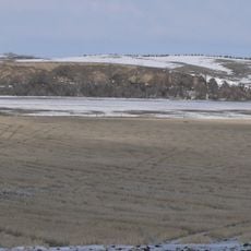
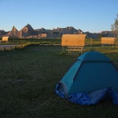
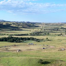
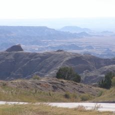
Wounded Knee Creek is a stream flowing through the Pine Ridge Indian Reservation in South Dakota. It extends for about 100 miles, moving northwest from Nebraska and eventually joining the White River in the region south of Badlands National Park.

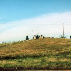
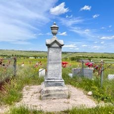
The creek was the site of a tragic event on December 29, 1890, when U.S. Army troops killed over 150 Lakota people during an attempt to confiscate weapons. This incident marks one of the darkest chapters in the history of relations between the United States and Native Americans.

The Lakota people call this waterway Čhaŋkpé Ópi Wakpála, a name rooted in their own language and history. It flows through land that remains central to the daily life and identity of the reservation communities who live along its banks.

The stream flows through settlements on the reservation and serves as a key water source for local communities. Visiting the area requires respect for the sacred land and its significance to the people who live there.

The creek's name traces back to an earlier injury a warrior sustained, reflecting a deep historical connection between the landscape and the people who inhabited it. This connection keeps the place alive in Lakota oral history and collective memory.

The community of curious travelers

AroundUs brings together thousands of curated places, local tips, and hidden gems, enriched daily by 60,000 contributors worldwide.

Start exploring
Location
GPS coordinates
43.43640,-102.54500
Latest update
December 7, 2025 10:06
Around this place
Wall Drug
United States of America

Wall Drug

66.6 km
Minuteman Missile National Historic Site
United States of America

Minuteman Missile National Historic Site

63.2 km
Wounded Knee National Historic Landmark
United States of America

Wounded Knee National Historic Landmark

35.8 km
Angostura Reservoir
United States of America

Angostura Reservoir

73.4 km
Bordeaux Trading Post
United States of America

Bordeaux Trading Post

74.8 km
Camp Sheridan
United States of America

Camp Sheridan

67 km
Badlands Observatory
United States of America

Badlands Observatory

70.1 km
Angostura Dam
United States of America

Angostura Dam

72.8 km
Prairie Homestead
United States of America

Prairie Homestead

65.6 km
Wasta Rest Stop Tipis
United States of America

Wasta Rest Stop Tipis

70.3 km
Governor Leslie Jensen House
United States of America

Governor Leslie Jensen House

74.8 km
Hermosa Masonic Lodge
United States of America

Hermosa Masonic Lodge

68.9 km
Inland Theater
United States of America

Inland Theater

71.7 km
Quinn Methodist Church
United States of America

Quinn Methodist Church

70.1 km
Miller Hall
United States of America

Miller Hall

73.7 km
Lee and Gottliebe Fritz House
United States of America

Lee and Gottliebe Fritz House

75.6 km
Wounded Knee cemetery
United States of America

Wounded Knee cemetery

35.8 km
Museum of the Fur Trade
United States of America

Museum of the Fur Trade

75 km
Ben Reifel Visitor Center
United States of America

Ben Reifel Visitor Center

59.8 km
Pioneer Museum
United States of America

Pioneer Museum

75.3 km
Wasta Rest Stop Tip–Eastbound
United States of America

Wasta Rest Stop Tip–Eastbound

70.3 km
Minuteman Missile National Historic Site Visitor Center
United States of America

Minuteman Missile National Historic Site Visitor Center

68.9 km
Wasta Rest Stop Tipi–Westbound
United States of America

Wasta Rest Stop Tipi–Westbound

70.5 km
Cedar Pass Campground
United States of America

Cedar Pass Campground

58.9 km
Sage Creek Campground
United States of America

Sage Creek Campground

52 km
Ancient Hunters Overlook
United States of America

Ancient Hunters Overlook

54.3 km
Yellow Mounds Overlook
United States of America

Yellow Mounds Overlook

53.4 km
Saddle Pass Trailhead
United States of America

Saddle Pass Trailhead

58.3 km
Show the full map
Reviews
Share your experience

No review yet

Discussions
Start a discussion...

No discussion yet

« Wounded Knee Creek - Stream in Pine Ridge Indian Reservation, South Dakota, US » is provided by Around Us (aroundus.com). Images and texts are derived from Wikimedia project under a Creative Commons license. You are allowed to copy, distribute, and modify copies of this page, under the conditions set by the license, as long as this note is clearly visible.

Discover hidden gems everywhere you go!

From secret cafés to breathtaking viewpoints, skip the crowded tourist spots and find places that match your style. Our app makes it easy with voice search, smart filtering, route optimization, and insider tips from travelers worldwide. Download now for the complete mobile experience.

Around Us App Screenshot

A unique approach to discovering new places

Le Figaro

All the places worth exploring

France Info

A tailor-made excursion in just a few clicks

20 Minutes

Around Us
Travel Guide & Maps
Download

Send to your phone

QR Code
1

Open the camera app on your mobile.

2

Point at the QR code with your camera. A notification will appear.

3

Tap the notification to open the link.